16 May 2011
MODIS Reveals Major Sources of Sediment
Posted by John Freeland
It’s mud season in the Midwest and the MODerate Imaging Spectroradiometer
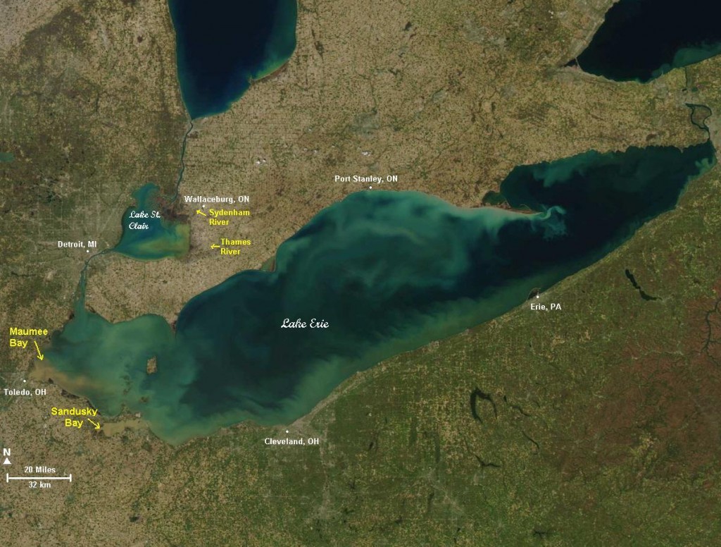
(MODIS) 250m true color band beautifully displays the tell-tale sediment plumes entering western Lake Erie (left). Updates of Great Lakes MODIS imagery are available here
MODIS is a multi-band imaging instrument mounted on two Earth-orbiting satellites, the Terra, and the Aqua, both part of the NASA-led international Earth Observing System. Between the two of them, the entire Earth is imaged every one or two days. Originally intended to observe aerosols, MODIS does a good job identifying where “earth” flows into water.
Two big rivers entering western Lake Erie are the Maumee and the Sandusky, both of which drain clayey soils that support row crops, especially corn. Their brown sediment plumes carrying heavy loads of spring runoff and sediment are shown entering the the southwest corner of the lake. Lake Erie is shallow and wind-swept. Some of the lake turbidity may be due to re-suspension of bottom sediments.
In Canada, the Sydenham and Thames Rivers flow through major agricultural lands and dump sediment into Lake St. Clair, upstream of Lake Erie.
Of major concern from a water quality standpoint are the nutrients and agricultural chemicals adsorbed onto the clay particles carried to the lake and suspended in the water column. Phosphorous overload is responsible for nutrient enrichment (eutrophication), nuisance algal blooms, and a persistent oxygen-deprived dead zone in Lake Erie.
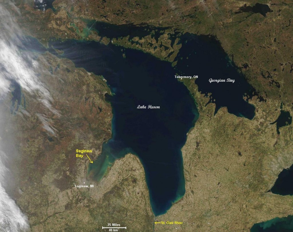
The MODIS image of Lake Huron (right) from the same day, however, shows a much different scenario. Aside from a brown sediment plume entering Saginaw Bay at the mouth of the Saginaw River, the lake is almost completely clear. The differences between Lake Erie and Lake Huron watersheds are many but soil composition, forest cover, degree of urbanization and agricultural land use are major contrasting factors.


 John Freeland earned a PhD in Soil Science (Pedology) at North Dakota State University and is a consultant working in the private sector. He has published soils research and taught at the high school and college levels. John is interested in wetlands, soil genesis, science communication, the intersection of art and science, and soil-water-landscape processes. John lives near the Ohio-Michigan border and plays bass in multiple music projects.
We just retweeted about this article, because we have ocean color data and soon a new Water Quality data portal in our Giovanni data analysis system, http://giovanni.gsfc.nasa.gov. Thanks for the GREAT article about Great Lakes sediments!
Jim:
Thanks for the re-tweet and all the great work you’re doing at NASA!
Depth has a good bit to do with the Erie map. The dark blue areas are also the deepest parts of lake Erie. .
Right, but the Maumee and Sandusky Rivers deliver a lot of sediment, especially this time of year. It will be interesting to look at images from later in the growing season when the ground cover is grown up.
I was out canoeing yesterday. The water was up into the timber in many places, the water back feeding into the main stream was as black as coal from the rotting leaf litter, the streams were coffee brown from the fields being open for planting. Little eddies and patterns that stayed apart for many yards down the river.
You’ve penned an apt and eloquent description of a river during spring flood.
The surface waters of Lake Erie were colored a bright turquoise on May 4 probably by elevated levels of calcium carbonate sediment.. Lake Erie generally has a lot of calcium carbonate in it because the floor of the lake is limestone. During most of the year the calcium carbonate remains dissolved in the cold water but as the lake warms up the solubility of calcium carbonate is lowered.