
18 February 2011
Friday fold: Jefferson River Canyon
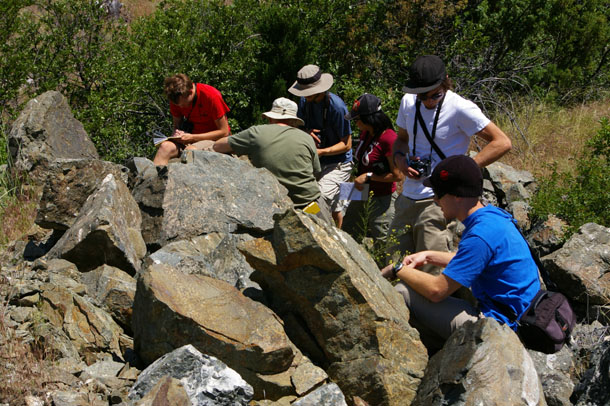
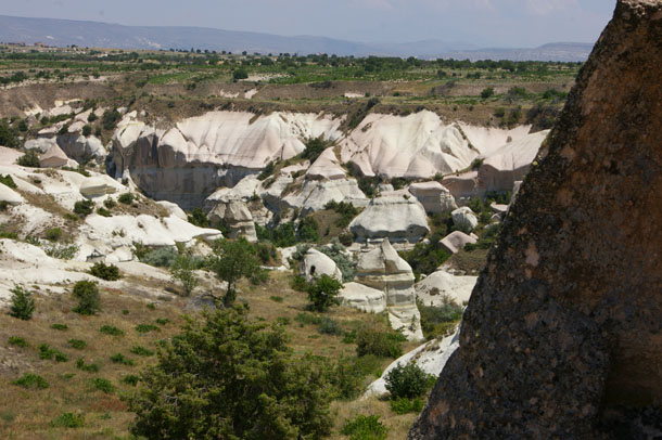
Here’s your Friday fold, straight from the canyon of the Jefferson River, near Cardwell, Montana. Perspective is to the south. East is on the left; west is on the right.
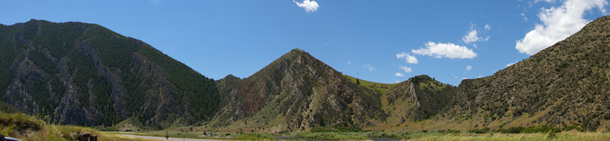
This is right next to the outcrops of LaHood Conglomerate that I mentioned earlier this week. My Rockies course co-instructor Pete Berquist and I bring the students here for several reasons, including the conglomerate, nearby Lewis & Clark Caverns State Park, and the great view to the south of folded Paleozoic and Mesozoic strata. We sketch the scene together, as seen here…
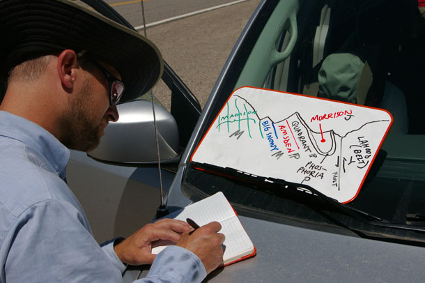
…And then the students are given a topographic map to mentally match up with the lateral view and the schematic sketch on the whiteboard. They are tasked with sketching their interpretation of the geology onto the map. This interpretation serves as the construction of a hypothesis, which could then be field-checked in person.
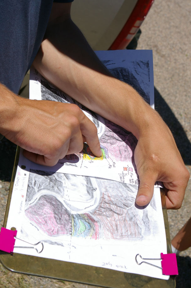
For our purposes on this day, the second “real” day in the field for the course, it’s enough to have the students make the mental conversion between “landscape as viewed from ground level” and the topo map’s “bird’s eye” perspective, along with attendant perspectives on rock deformation, stratigraphy, and differential weathering. They will engage in “real” mapping later.
Anyhow, here’s an annotated view of the scene:
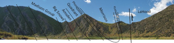
Most of the view is taken up by a large overturned syncline, with an axial plane that dips steeply to the west. At the far left are the Mississippian-aged Madison Group limestones, topped with upper Mississippian Big Snowy Group (more limestones), then the Amsden Formation (orange siltstone and sandstone from the Pennsylvanian), the Quadrant Formation (a Pennsylvanian quartz sandstone), the Permian phosphatic Phosphoria Phormation :), and and youngest of all, the Morrison Formation, which is Jurassic. In the area of the Jefferson River Canyon, the strata are tightly folded around the Morrison. Finally, at the far right of the view, we see the abrupt appearance of the LaHood Conglomerate, part of the Mesoproterozoic Belt Supergroup. The contact here is a thrust fault.
The skyline is etched out according to the different susceptibilities to weathering of the exposed strata. The LaHood and Madison exposures are relatively sturdy fare in this arid climate, and we see that the Amsden and Morrison are relatively weak. The Phosphoria and top of the Big Snowy hold up the “peaklets” on the ridge, which make for convenient landmarks on the topographic map.
I miss Montana. I’m looking forward to spending some time out there this summer, and introducing a new crop of students to scenes like this one under the big sky.
Happy Friday!
16 February 2011
Outcrops of the LaHood Conglomerate
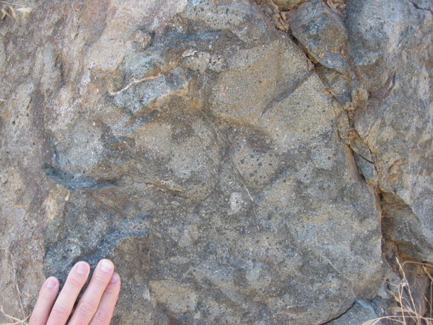
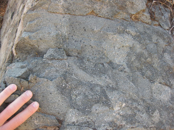
Remember the LaHood Conglomerate?
Here’s a few field photos of my Rockies class visiting it last July:
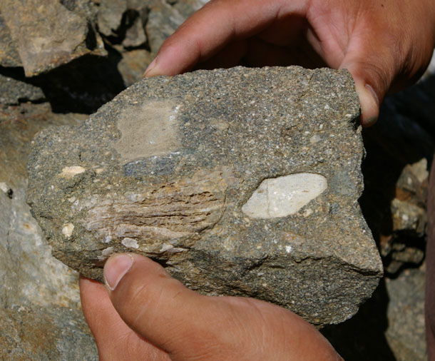
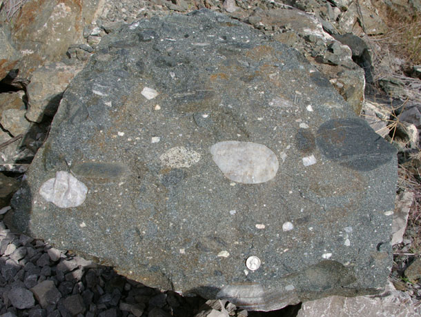
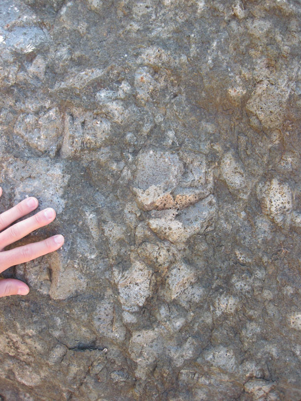
Amphibolite clast:
Marble clast:
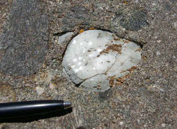
I love how well-rounded these clasts can be — like eggs.
When these grains were loose cobbles, tumbling down into the Belt Sea, the Earth was only 3 to 3.5 billion years old. The rivers which carried them downhill flowed past a landscape devoid of plants and animals. Since then, they have been locked away underground, fused to their neighbors, and only recently brought to the surface and exposed for the eyes of curious hominids like us. What a wild journey…
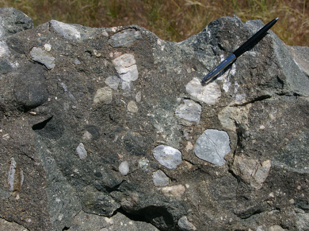
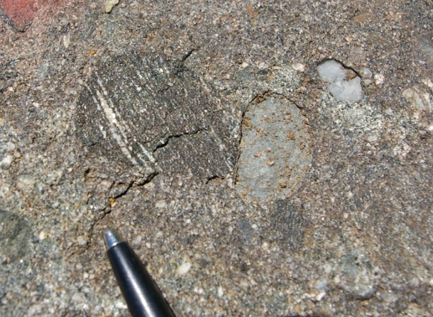
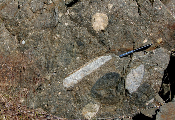
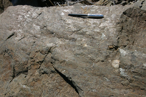
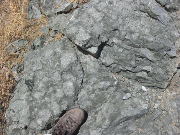
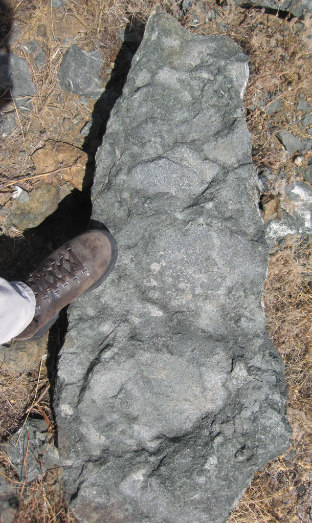
A few shear bands cut across the LaHood in the outcrops on the north side of the Jefferson River Canyon, and slickensides are visible:
Nice place to check out a cool geologic unit.
15 February 2011
Capadoccia 7
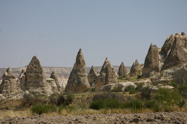
And now, for the final half of my final day in Capadoccia, Turkey…
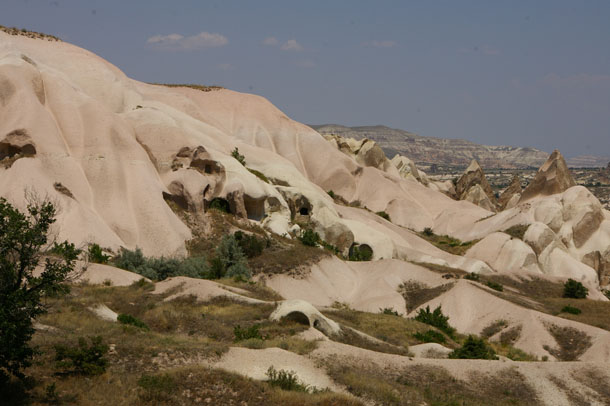
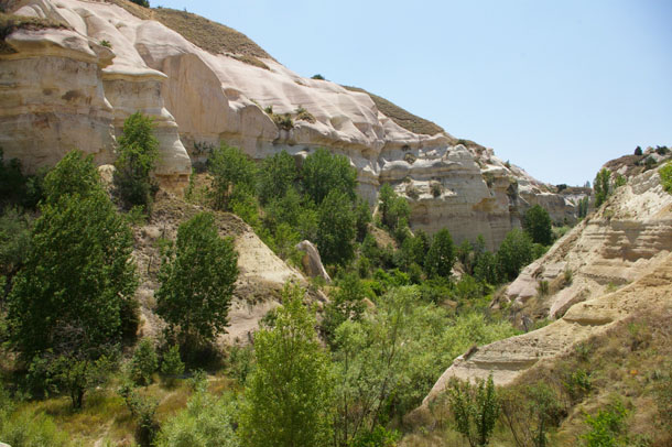
We continued hiking along up the scenic valley that I mentioned a few days ago, checking out the lovely scene in the lovely weather…
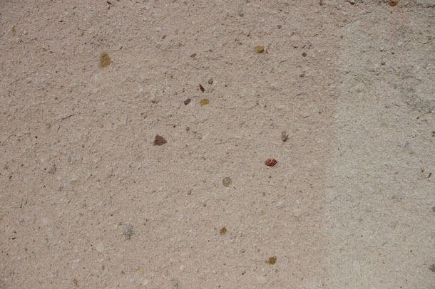
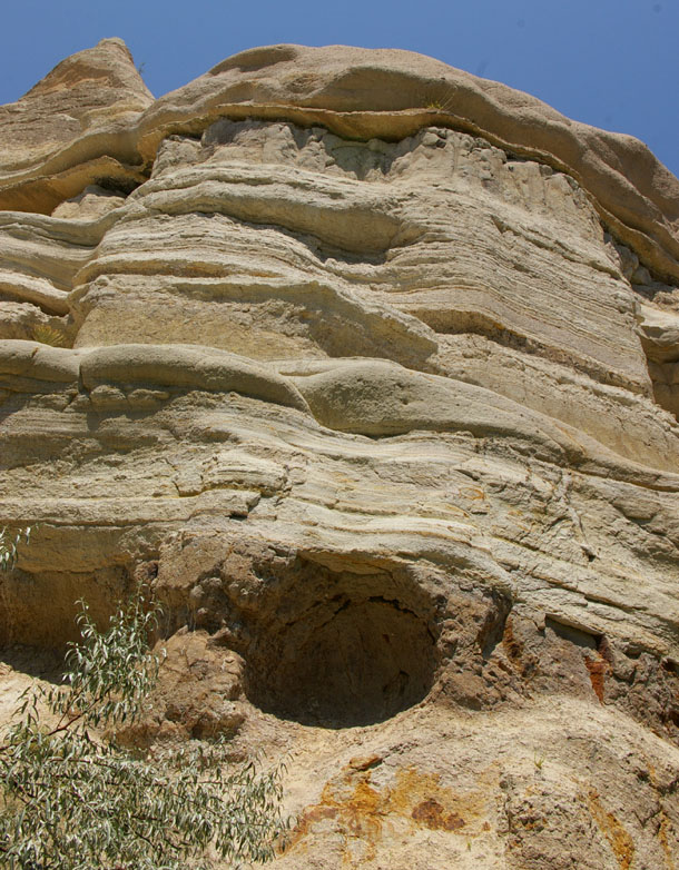
The valley floor was reasonably wet and vegetated, but the higher slopes were eroding at a rate too quick for vegetation to get established. Here’s an exposure of the tuff there, bearing kandy-kolored lithic fragments. A Turkish 1-lira coin (about the same size as a U.S. quarter) lies near the center to provide a sense of scale:
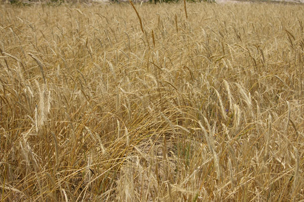
Here’s a wheat field along the valley bottom:
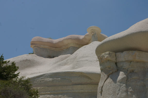
Looking up at a nice example of differential weathering: the uppermost pinkish layer of tuff appears to be… (wait for it) …tougher than the lower, more white-colored layers of tuff. I liked the way it weathered out here into this duckbill-like aerial peninsula:
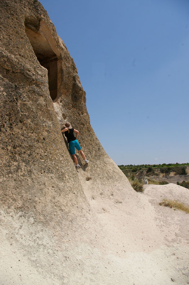
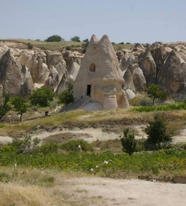
The highlight of the hike came near the end, as we climbed up out of the valley and onto the dissected plateau. We saw one tall hoodoo with a hole near the top, and we wondered, “Are there paintings up in that one?” As we got closer, we saw that there were steps notched into the side of the tower…
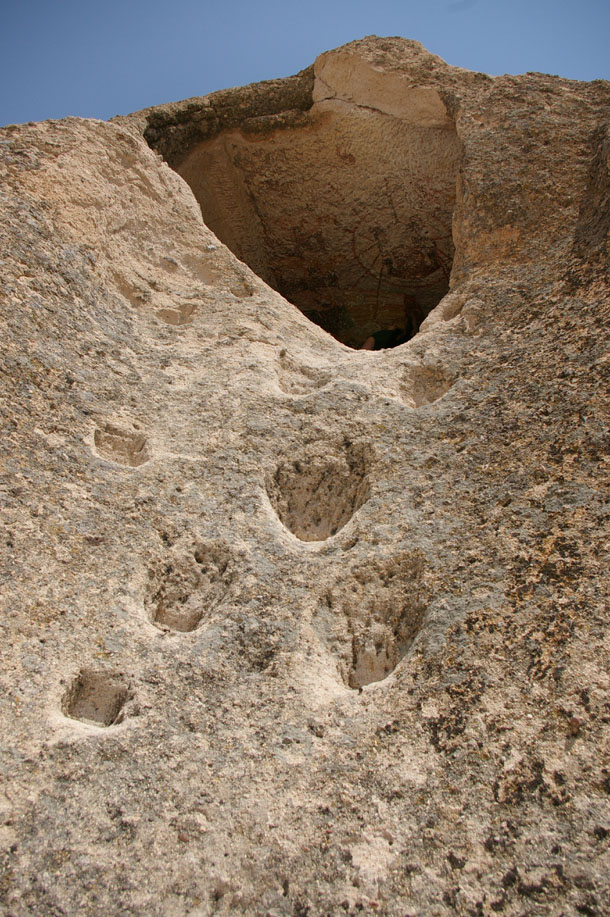
…So we climbed up:
We got inside, to a nice shady nook, with a lovely view out over the dry landscape:
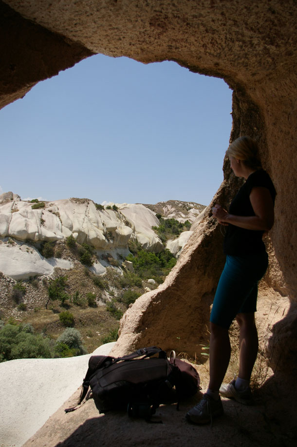
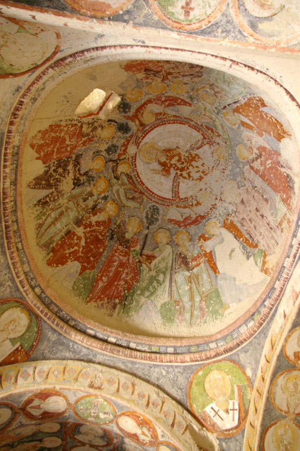
And sure enough, there were Christian paintings from the Byzantine era all over the inside. They were defaced, and therefore of lower quality than the ones we had seen in the “museum” earlier in the day, but because we discovered these ones on our own, they seemed that much cooler to us.
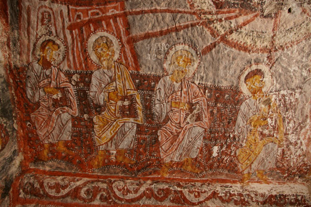
We relished that experience — it reminded me quite intensely of an experience I had once in Joshua Tree National Park, in southern California, where on a hot day, I looked around for some shade and saw a little overhanging pocket on the side of one of the granite domes in the Wonderland of Rocks, and I climbed up into it and found native American pictographs on the wall — art providing tangible evidence of someone else, another human being, hanging out in that same protective space and marking their territory with paint. Joshua Tree and Capadoccia — different arid regions, with different tribes practicing different religions (possibly at different times too, though conceivably they could have been painted on the same day). It’s a special sort of connection between me in the present, and them in the ancient past — an experience of shared humanity.
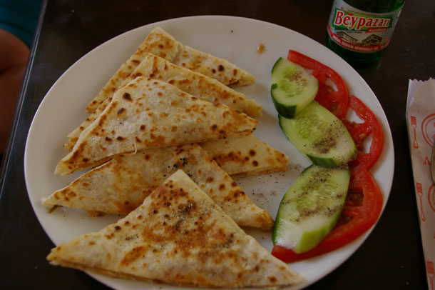
Lily and I rested awhile in this ancient, desecrated church, taking in its silence and its mix of the vulgar and the sublime. When we had cooled down and rested, we returned to the village of Göreme, where we got a quesadilla-like snack:
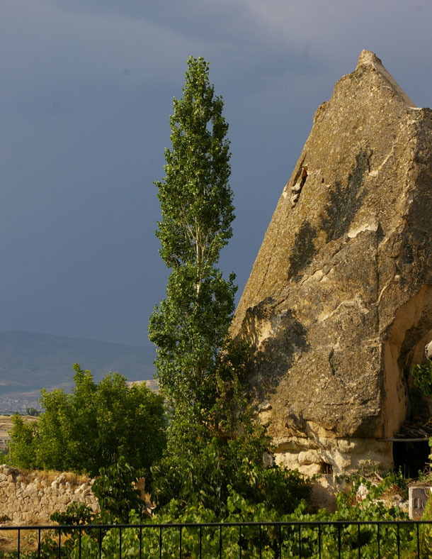
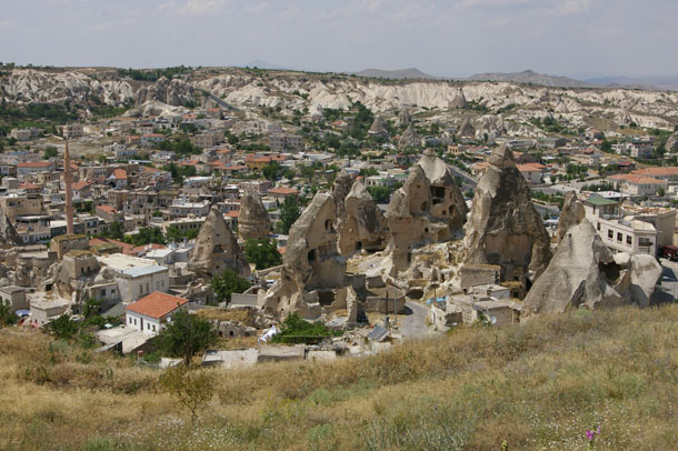
Late in the day, the sun sank to the west, and we took a last look around Göreme.
And then we got on a bus, and rode back to İstanbul.
Fare thee well, Capadoccia.
14 February 2011
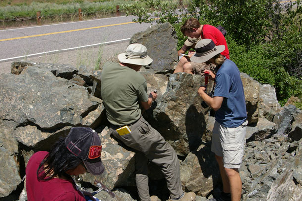
Volcanic breccia in Sierra foothills?
A year and a half ago, on my way back to Modesto from Yosemite, I pulled over at the side of the road and found a piece of urbanite full of whoppers. But that curiosity wasn’t what caught my eye and made me pull over in the first place. Instead, what I noticed was this:
It appears to be some kind of volcanic breccia, based on the relatively angular clasts and the presence of vesicles (amygdules). I reckon it could be a survivor of the extrusions of the Sierra Nevada magmatic arc when it was actively erupting in the late Mesozoic. The frozen roots of those volcanoes are today exposed as the granitic plutons of the Sierra Nevada batholith.
But at some point, those volcanoes were burping lava out onto the surface, and potentially triggering lahars and ashflows and those extrusive rocks may be preserved in a few low-lying places were erosion hasn’t yet dispatched them. Is this one?
Here’s the exact location of the outcrop, on the west side of the road. I defer to the local geologist for insights…
Dolostone ♥s shale
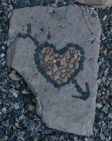
Originally posted in September 2010 as part of this missive on the Champlain Thrust Fault.
Happy Valentine’s Day!
12 February 2011
Capadoccia 6
I’ve got two more batches of Capadoccia photos for you. Sorry if you feel bored with this continuing series — but I think it was not only my favorite part of Turkey (and geomorphologically interesting) but photogenic too…
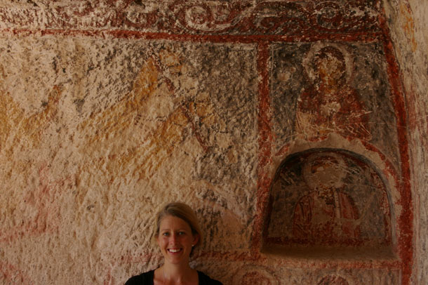
So on our final day in Capadoccia, Lily and I took a hike up another valley.
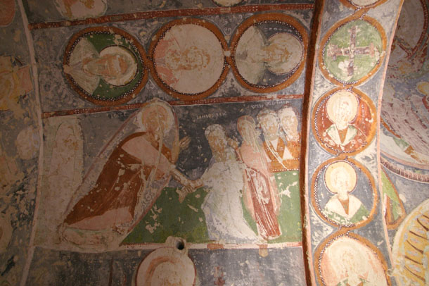
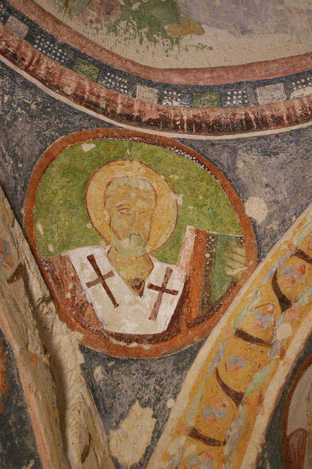
We stopped along the way at this hoodoo church which has been preserved (i.e. the interior paintings have been prevented from vandalism). It was outside this museum that I noticed the flagstones full of trace fossils.
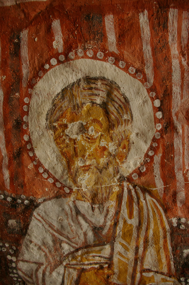
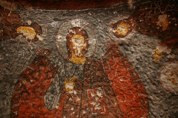
Wild-looking, eh? Like a Smurf house. This whole “fairy tower” was hollowed out during Byzantine times, and equipped as a Christian church. On the inside, it is decorated with religious paintings, reflecting the local theological preferences of the time.
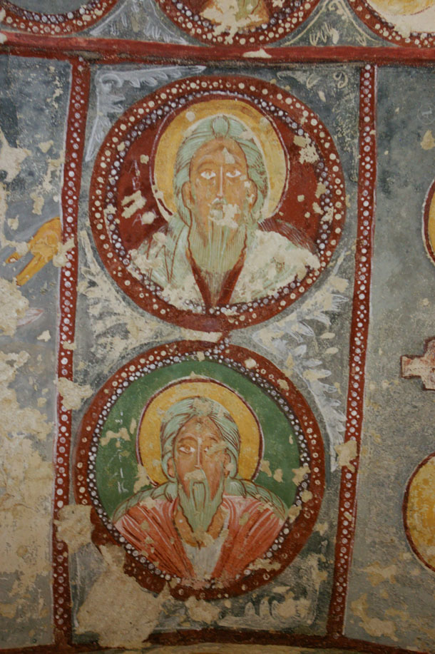
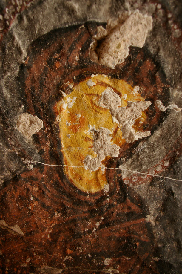
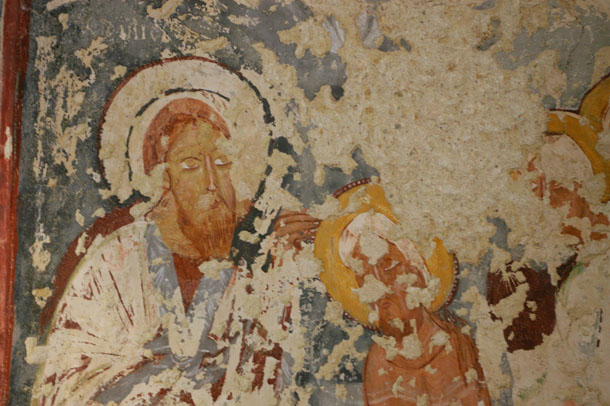
Chapels and churches (and even some “cathedrals”) like this were common in Byzantine Capadoccia, but when Islam moved into the region, the vast majority were defaced, as Islam has a prohibition about depicting “living beings,” especially in sacred places. In most every Capadoccian chapel I visited, the faces of the saints and gods depicted were pecked apart, the paint layers blasted away (presumably with a rock), revealing the tuff beneath. This is one of the only “whole-faced” depictions of Jesus that I saw in the region:
After our churchly sojurn, we continued up the valley…
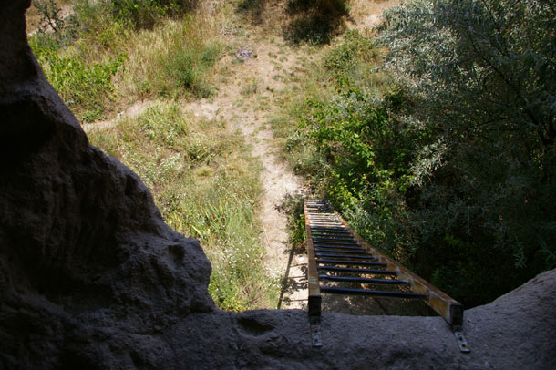
At one point, we saw a ladder leading up to a habitation about 20 feet (~6 m) above the valley floor, and climbed up to check it out.
The path led through another one of the stream-tunneled “underpasses” that I mentioned a few days ago, but this one had collapsed.
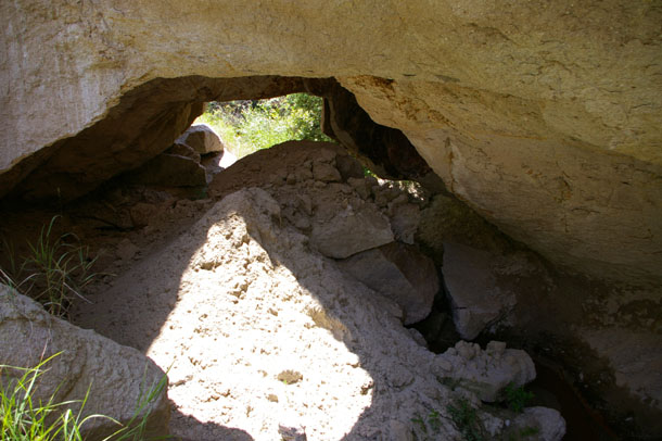
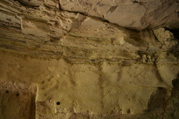
We found a way around the outside. Inside another, we could see thin fine-grained laminae near the upper part of the cut (lens cap at lower left for scale):
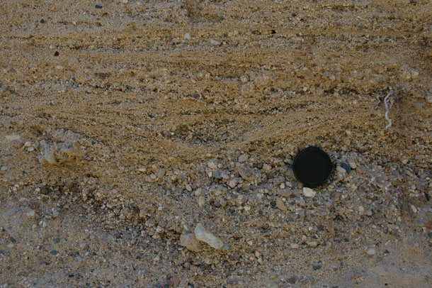
And elsewhere, very coarse-grained, clast supported deposits bearing cross-bedding. Must have been a stream here, though smaller than that gravel channel I pointed out earlier.
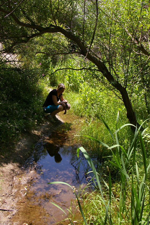
Again, a place where the path and the stream intersected — a surprisingly common vegetated oasis:
The further we hiked, the higher up we got, granting us some fine views back over the valley through which we had hiked:
Our thrilling conclusion comes tomorrow, when I reveal what we discovered up yonder canyon… Stay tuned.
11 February 2011
Friday fold: Difficult Run fun
Last Sunday morning, Lily and I met up with some students of mine (past and present) for a hike down Difficult Run in Virginia. This defile leads down from Georgetown Pike near McLean, Virginia towards a confluence with the Potomac across from the south end of the Billy Goat Trail, and just upstream from Black Pond (on the property of Madeira School). The trail was icier than we had anticipated, and Difficult Run was “up,” making it dangerous to get too close to the water, so we didn’t. But we had an enjoyable hike regardless, and spotted some new folds in the migmatitic schist and gneiss exposed there. Check them out:
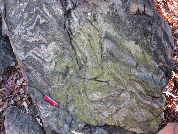
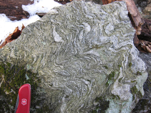
Here’s a bonus for you — schist chips in migmatite:

Migmatite is a rock that falls on the border between “metamorphic” and “igneous” — basically, it’s a metamorphic rock that got heated up so much it began to melt, but didn’t finish the job. The minerals with the lowest melting points (quartz, potassium feldspar, muscovite) melted out as “granite” flavored magma. After the rock was heated up enough to express out this liquid felsic distillation, squeezed-dry sheets of unmelted mica-rich schist were wafting in the magmatic breeze, and boudinaged. Torn asunder, these liberated schist chips could begin to act as mechanically independent particles. They could get tumbled along in the magmatic currents, and even imbricated against their neighbors. Later, when the granitic magma around them crystallized, they were locked in these illicit positions for the next half a billion years…
Happy Friday; enjoy your weekend. Here’s hoping spring comes sooner rather than later. I could use more hikes like this, and less time sheltering inside with only the blog for company…
10 February 2011
Mystery spikes
Mystery mineral from Mount Washington, New Hampshire: radiating needles of something black…
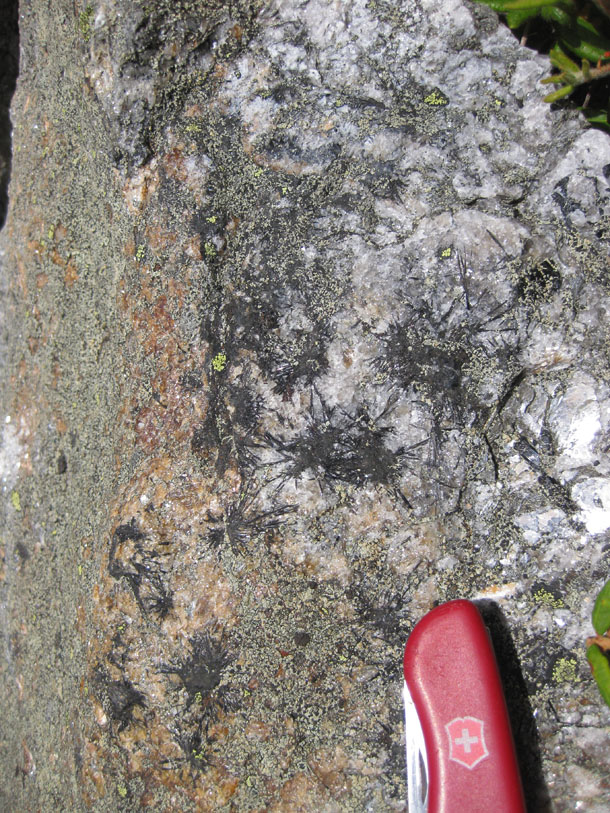
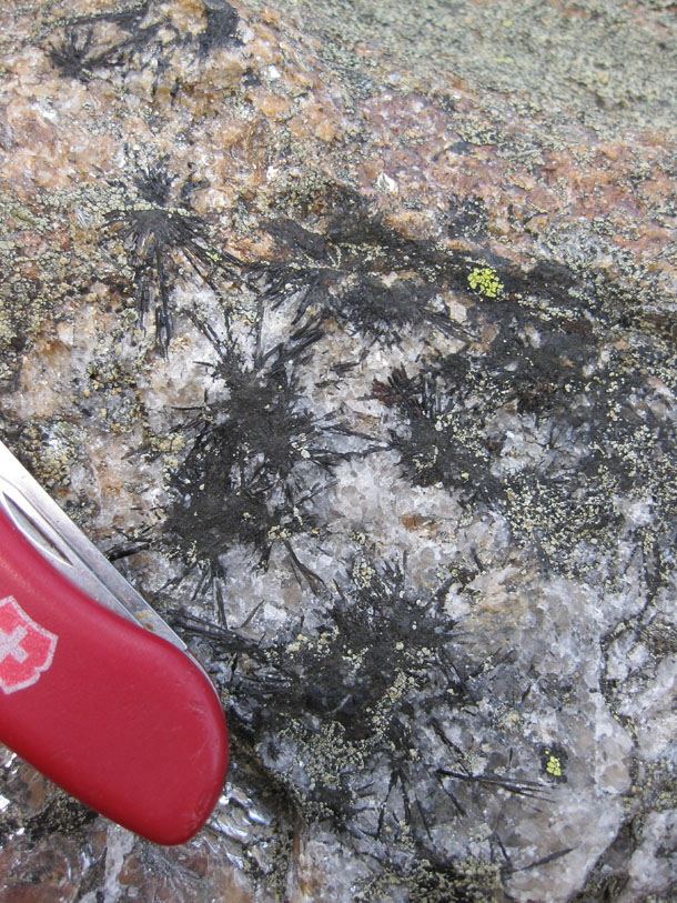
I’d venture “tourmaline”… but you tell me.
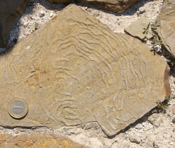
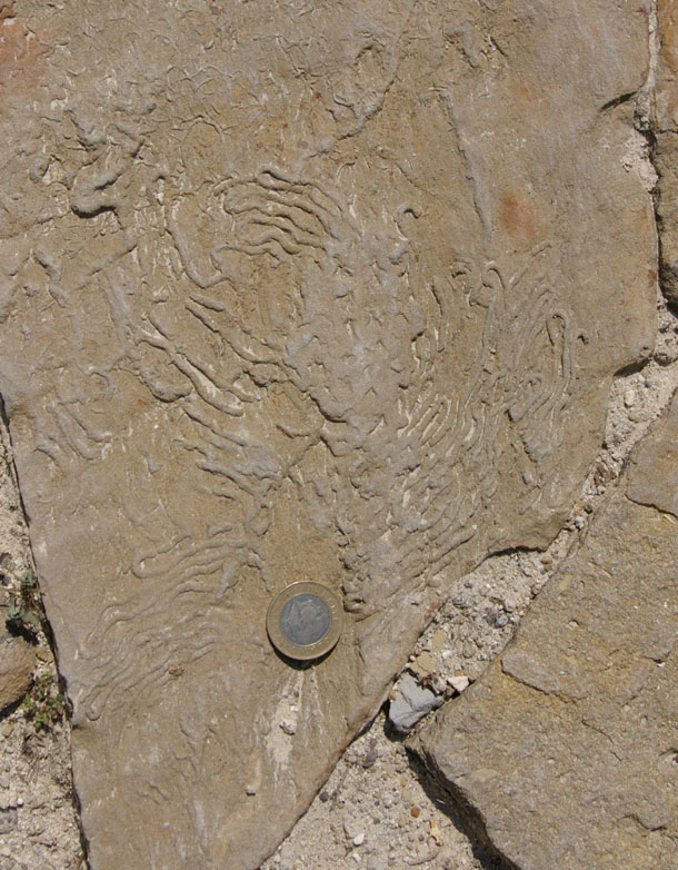
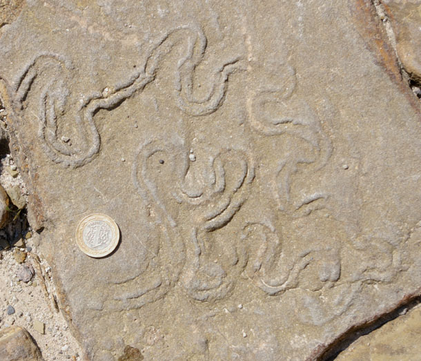
Treasure trove of traces
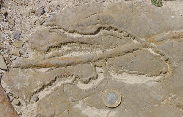
Here’s an amazing sight that caught me unawares in Capadoccia — some paving stones outside a small “museum” (preserved Byzantine hoodoo church) that were chock full of some AMAZING trace fossils. Sense of scale is provided by a Turkish 1-lira coin, about the same size as a U.S. quarter. Check out the variety, size, and preservation quality of these gorgeous things:
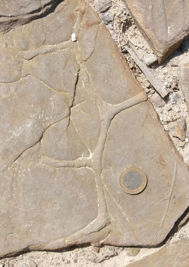
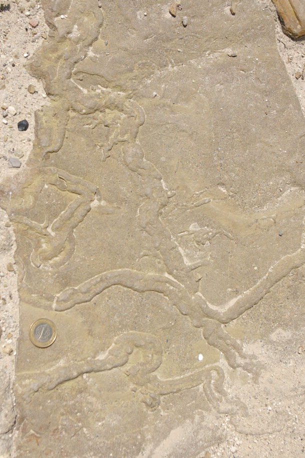
These are “negatives” — molds of depressions that were formed as a new layer (ultimately tougher) of sand was deposited on top of what was probably originally mud. So where the original features were trough-like, we now see raised ridges. They have been inverted, and our “view” is looking “up” as far as deposition was concerned.
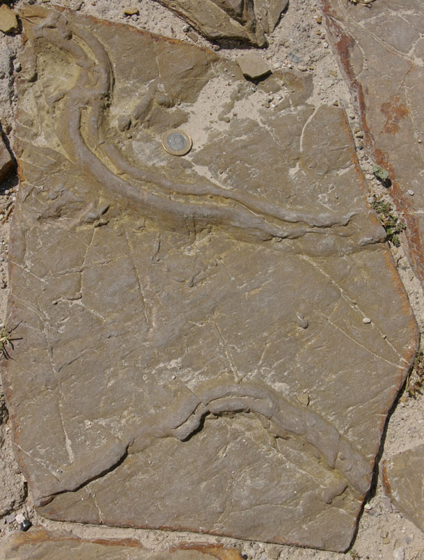
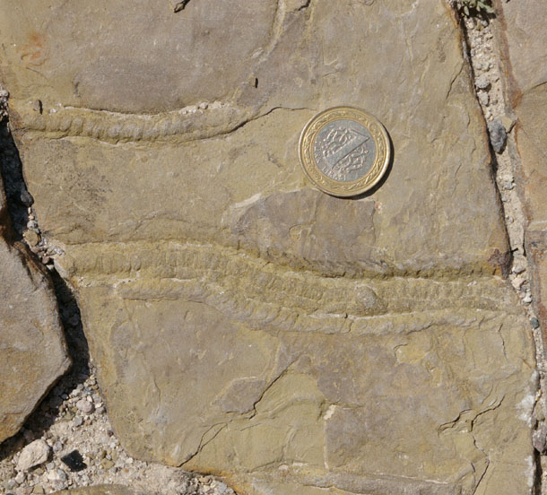
Also some ripple marks (inverted: this is a “bottom up” view like the traces above):
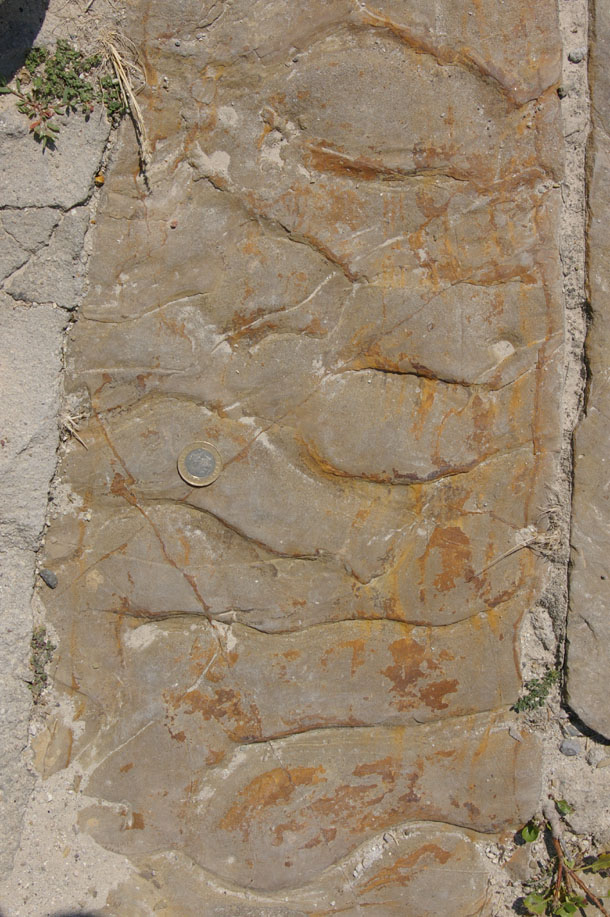
Current would have been flowing from the bottom of the photo towards the top, as the asymmetry of these ripples has the steep side facing “up” before the inverted “mold” was formed. Assuming you’re sitting upright right now as you read this, if you had been lying on the seafloor (?) when these strata were deposited, the current would have been flowing up your nostrils.
Ewwww.
7 February 2011
Geologist scam
I just got an e-mail which screams “scam!”
Apologies for having to reach out to you like this, but I made a quick trip to the UK and had my bag stolen from me with my passport and credit cards in it. The embassy has cooperated by issuing a temporary passport, I just have to pay for a ticket and settle
Hotel bills.To be honest,i don’t have money with me,I’ve made contact with my bank but the best they could do was to send me a new card in the mail which will take 2-4 working days to arrive here.i was thinking of asking you to lend me some quick funds that i can give back as soon as i am out of here,i really need to make a last minute flight.
I can furnish you with info on how you will get me the money. You can reach me via hotel’s desk phone, the number is, +44 1224 722381.
Thanks,
[redacted]
I have removed the name of the “sender” because I don’t think it’s really the sender. The name given was of a geologist from a Florida university and I suspect it was copied wholesale off of his website. The source address was not the university e-mail, but a gmail account.
It appears to be a new(?) flavor of scam where the scammer pretends to be a geologist and reaches out to another geologist for money. The tip off for me? I’ve never met or heard of this particular geologist before. Professional courtesy is one thing, but this scammer’s approach is apparently shot-gun like, trying to find a professional connection by getting at least one email through to someone who knows the geologist whose identity has been stolen.
I trust most geologists are savvy enough to sniff out the fake — but just in case, I figured I should post a note here. Anyone else getting emails like this one?
 Callan Bentley is Associate Professor of Geology at Piedmont Virginia Community College in Charlottesville, Virginia. He is a Fellow of the Geological Society of America. For his work on this blog, the National Association of Geoscience Teachers recognized him with the James Shea Award. He has also won the Outstanding Faculty Award from the State Council on Higher Education in Virginia, and the Biggs Award for Excellence in Geoscience Teaching from the Geoscience Education Division of the Geological Society of America. In previous years, Callan served as a contributing editor at EARTH magazine, President of the Geological Society of Washington and President the Geo2YC division of NAGT.