
11 January 2022
Pau Branco: another significant mining-related landslide in Brazil
Posted by Dave Petley
Pau Branco: another significant mining-related landslide in Brazil
On Saturday 8 January 2022 another significant mining-related landslide occurred in Brazil. On this occasion the site was the Pau Branco iron ore mine, which is located on the western side of Quadrilátero Ferrífero region. The mine is reportedly owned by the French company Vallourec. Mining operations at the site have been suspended by the regulator.
The Brazilian website Observatório da Mineração has a report on the landslide, in Portuguese. It includes this image of the failure:-
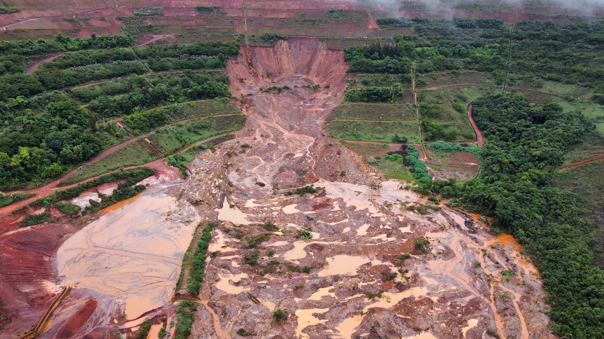
The 8 January 2022 landslide at the Pau Branco mine in Brazil. Image via Observatório da Mineração, collected by Bruno Costalonga Ferrete.
.
The location appears to be -20.145, -43.968. This is Google Earth image of the location, from a similar perspective as above:-
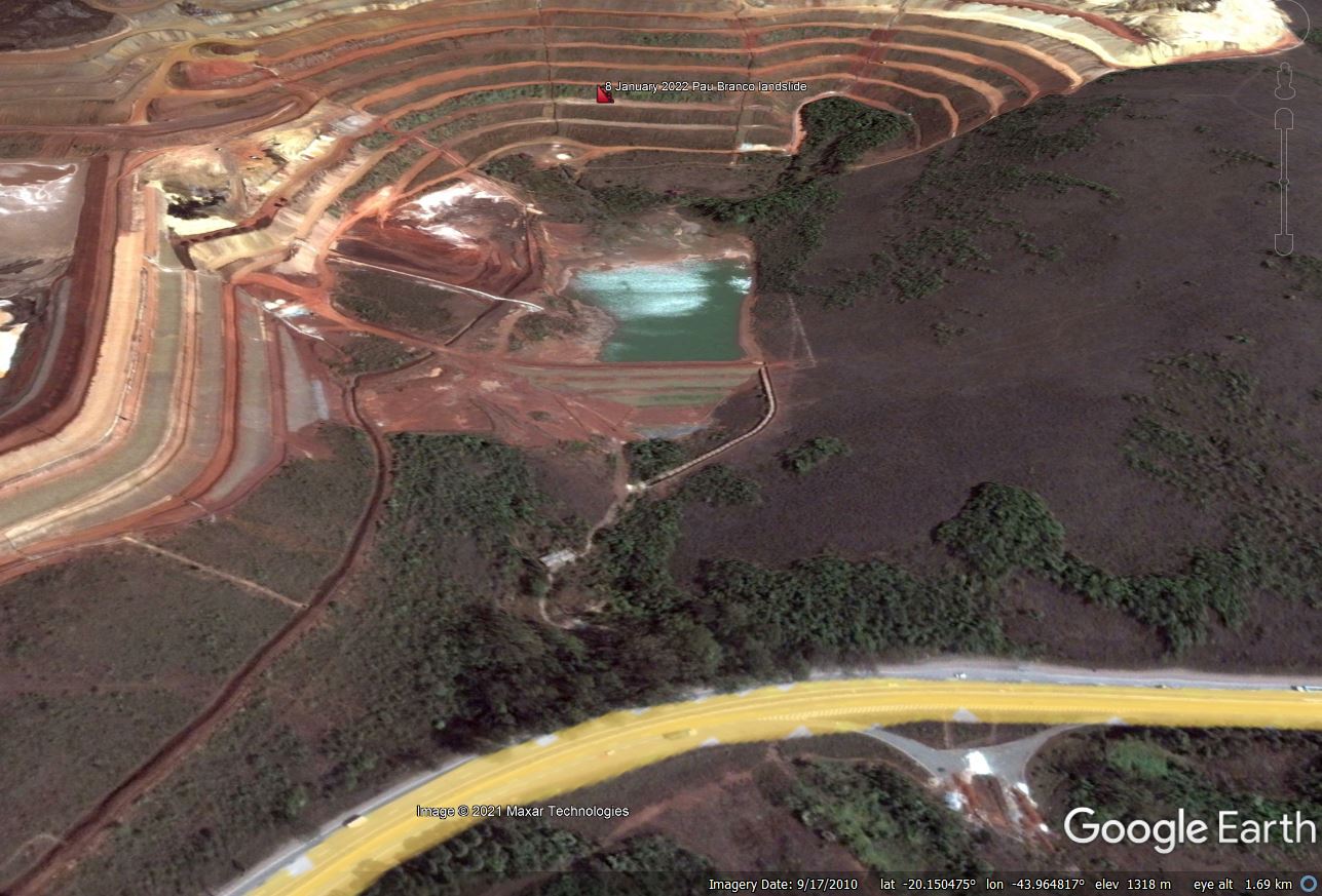
Google Earth image of the site of the 8 January 2022 landslide at Pau Branco.
.
It appears that a benched slope has failed. The mechanism is unclear but a rotational landslide looks likely. It appears that the mass has fluidised to become a flow. The image below suggests that this then overtopped a water retention lagoon, but fortunately the dam did not fail. The landslide then impacted the major road at the foot of the slope.
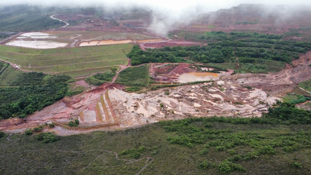
The flowpath of the 8 January 2022 landslide at the Pau Branco mine in Brazil. Image via Observatório da Mineração, by Bruno Costalonga Ferrete.
.
A report on the Observatório da Mineração website indicates that the retention structure, which is not a tailings dam, was upgraded last year. The failure itself has occurred in a benched slope above the lagoon. It appears to me that this slope consisted of mine waste dumped onto the natural slope – Google Earth images suggest that the slope was created between 2006 and 2010 – but this needs confirmation. I would imagine that this slope was created to increase the volume of mine waste that could be dumped upslope in the main waste storage site. The Google Earth image below shows the configuration:-
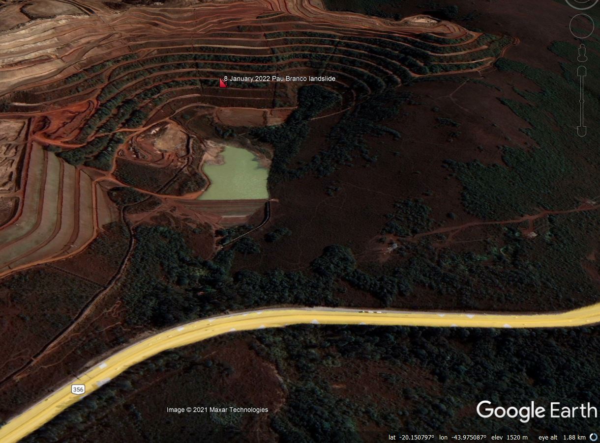
Google Earth image of the configuration of the site of the 8 January 2022 landslide at Pau Branco.
.
So overall I this that this was probably a rotational landslide that fluidised into a flow, with the failure occurring in benched mine waste. But I would welcome views from others via the comments.
Once again, this event will ask questions about the stability of mine waste in Brazil (and beyond). It also continues to drive concerns about the capability of mining companies to ensure that slopes are stable and that regulators are able to ensure that appropriate methods are being used. It feels likely that we will see another major mine waste failure this year, despite some efforts to improve mine waste management practices.
 Dave Petley is the Vice-Chancellor of the University of Hull in the United Kingdom. His blog provides commentary and analysis of landslide events occurring worldwide, including the landslides themselves, latest research, and conferences and meetings.