
5 May 2020
The Sardoba dam failure: flood routing
Posted by Dave Petley
The Sardoba dam failure: flood routing
After my blog post yesterday about the 1 May 2020 Sardoba dam failure in Uzbekistan, several people have asked about the flood routing between the breach and the large inundated area that I showed in my post. The Planet Labs imagery shows this clearly, and it is quite an interesting story.
We can start with the area around the dam – the Planet Labs image below shows the breach in the lower left and the now partially drained reservoir:-
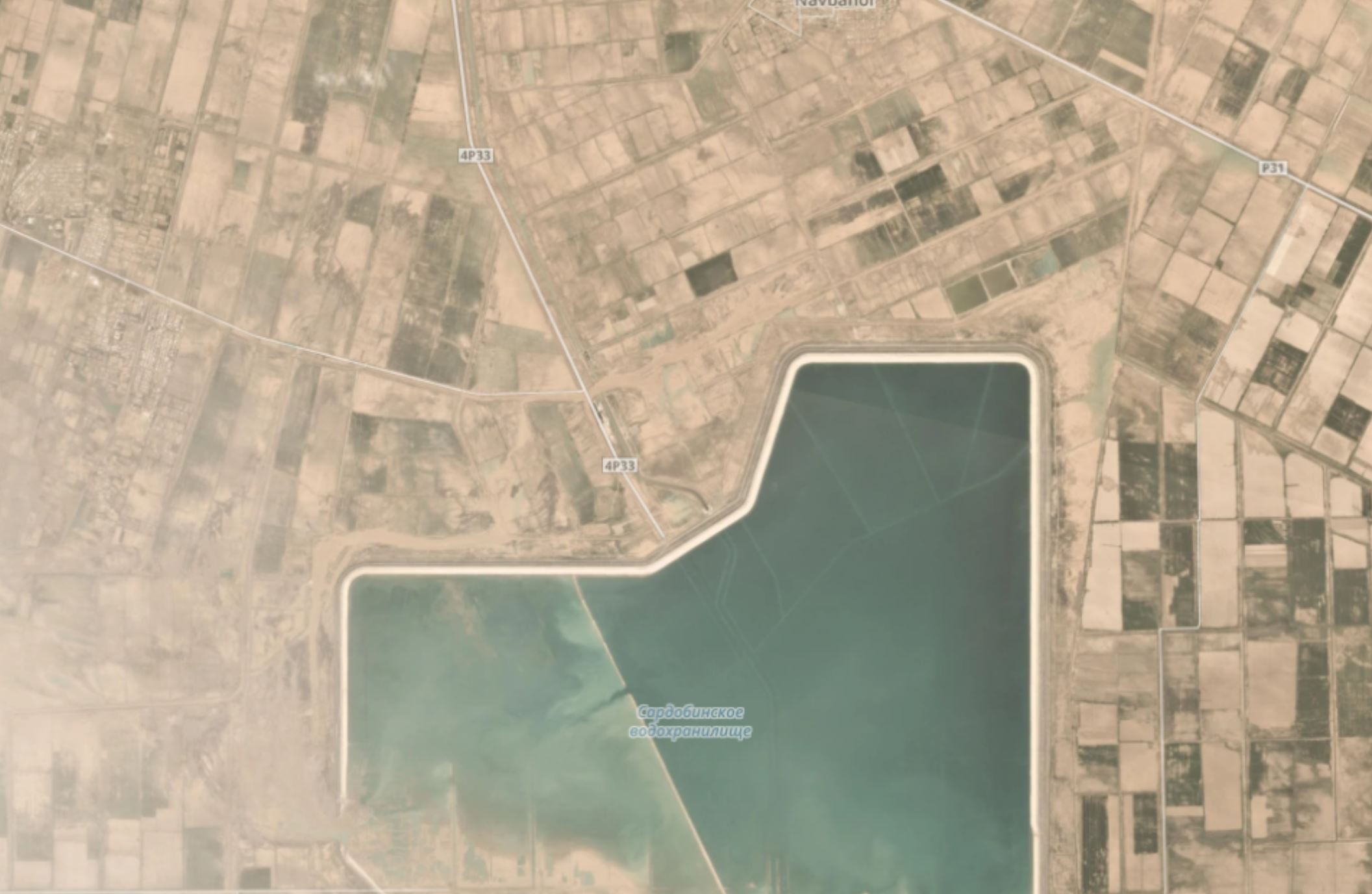
Flood routing from the Sardoba Dam failure in action. Planet Labs PlanetScope image captured on 3 May 2020. Copyright Planet Labs, used with permission.
.
Scouring immediately downstream of the breach is clear, and there is a distinct channel that follows the wall of the dam, initially towards the north and then towards the east. This is shown in more detail below:-
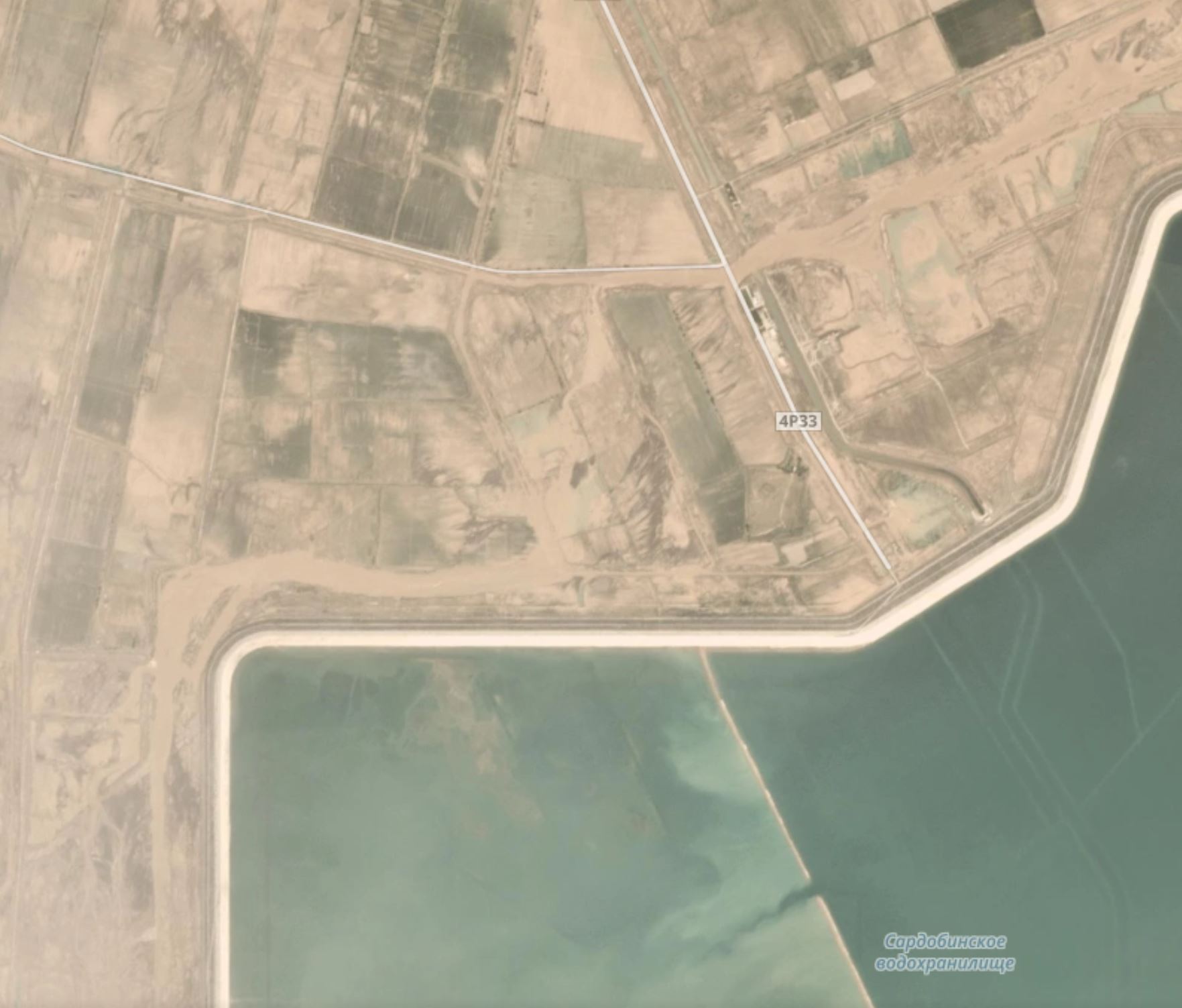
Flood routing from the Sardoba Dam failure in action. Planet Labs PlanetScope image captured on 3 May 2020. Copyright Planet Labs, used with permission.
.
There is also evidence from the images that the water inundated a much larger area in the vicinity of the dam, and on 3 May 2020 there was still some evidence of minor flooding. From there, the water spread across a broad area rather then being channelised, as the image below illustrates:-
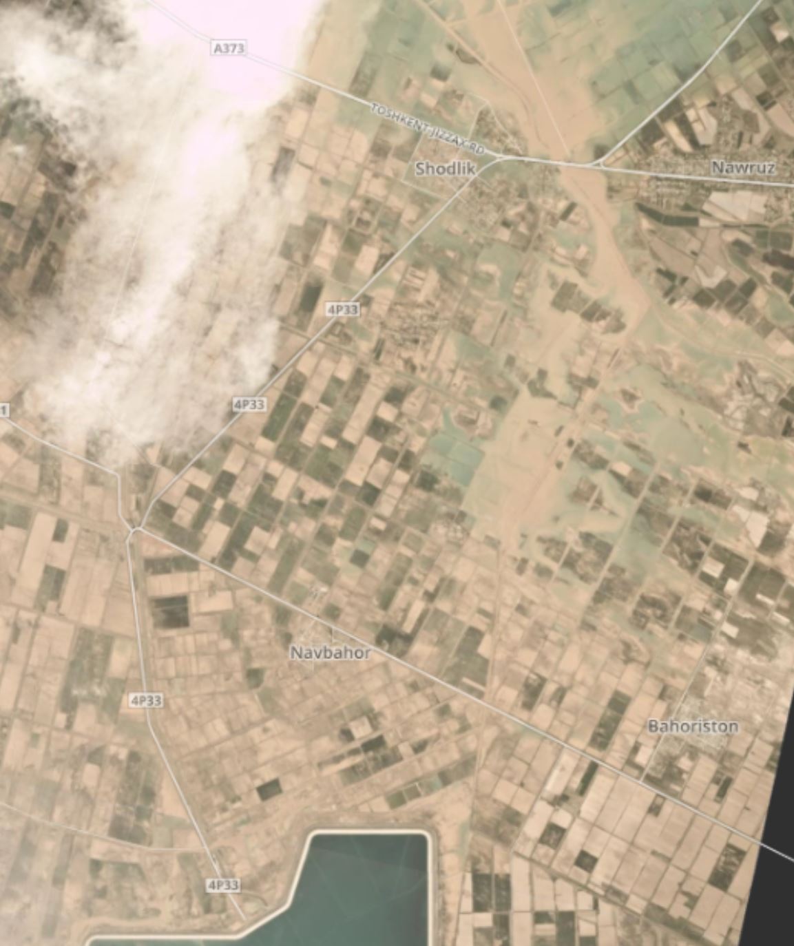
Flood routing from the Sardoba Dam failure in action. Planet Labs PlanetScope image captured on 3 May 2020. Copyright Planet Labs, used with permission.
.
In this image there is extensive damage to the fields (and presumably to the villages) across a wide area. Towards the northeast there are areas that remain submerged, and at the top of the image the flow has channelised once more as the water moved into the extensively ponded area that I showed yesterday. The imagery collected on 4 May 2020 shows that this area remains deeply flooded.
Thus the Planet Labs satellite imagery demonstrates that the Sardoba dam failure has caused flood damage over a broad area of this part of Uzbekistan.
.
On reflection 1: EGU General Assembly Day 2
Today is day 2 of the EGU2020 virtual meeting. This is the list of the landslide sessions on Day 2 – it is a busy landslide day:-
NH3.5 Debris flows: advances on mechanics, monitoring, modelling and risk management
Displays Chat Tue, 05 May, 14:00–18:00
NH3.1 Large slope instabilities: characterisation, dating, triggering, monitoring and modelling
.
On reflection 2: recent landslides
Uganda and Kenya continue to be battered by heavy rain and resultant floods and landslides, whilst a landslide in New York State has left houses teetering on the edge of disaster. In China, the early part of the rainy season is just getting under way.
Reference
Planet Team (2020). Planet Application Program Interface: In Space for Life on Earth. San Francisco, CA. https://www.planet.com/
 Dave Petley is the Vice-Chancellor of the University of Hull in the United Kingdom. His blog provides commentary and analysis of landslide events occurring worldwide, including the landslides themselves, latest research, and conferences and meetings.
Thank You, Dave for looking into it!
Now it is more or less clear to me what has happened.
Water from the breach found its way into the major irrigation canal flowing to the north and then flooded the irrigation areas in the north and north-east. Waters released deliberately through the dam gates to lower Sardoba reservoir level also were released into the same main canal and reinforced the flood…
It is amazing that on May 4 we still see flooded area in the north as big as it looked two days ago … Kazakh experts claim flooding covered 2.6 thousand square kilometers, from those 720 square kilometers in Kazakhstan ( https://www.inform.kz/ru/snimki-iz-kosmosa-pokazali-masshtaby-podtopleniy-v-maktaaral-skom-rayone_a3645924 ). About 100 000 people were evacuated by early morning of May 4.
It is very interesting how this works out in the end given transboundary nature of damages. Given extensive hydroengineering plans in Central Asian countries, let us hope that this tragic event will cause development of proper agreements on dam safety and compensation of damages.