
12 March 2020
Salkantay: Planet Labs imagery of the upper portions of the flow
Posted by Dave Petley
Salkantay: Planet Labs imagery of the upper portions of the flow
Capturing imagery of the source area of the ice/rock avalanche and subsequent debris flow at Salkantay in Peru is extremely difficult. This is an area that is heavily affected by cloud cover, especially in the upper portions of the catchment. Earlier this week I was able to post some images of the track of the debris flow that had been captured by Planet Labs using their PlanetScope constellation, but the upper part of the landslide was not captured. On 10 March 2020 a further pass by one of the satellites has captured the upper portion of the landslide, even though the actual source remains frustratingly obscured.
This is an image of the area around the source, captured before the landslide on 24 October 2019 by Planet Labs:-
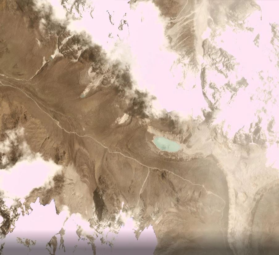
Planet Labs imagery of the upper portions of the of the Salkantay landslide, prior to failure. Planet Labs PlanetScope image captured on 24 October 2019. Copyright Planet Labs, used with permission.
.
This is the Planet Labs image of the same area, captured on 10 March 2020:-
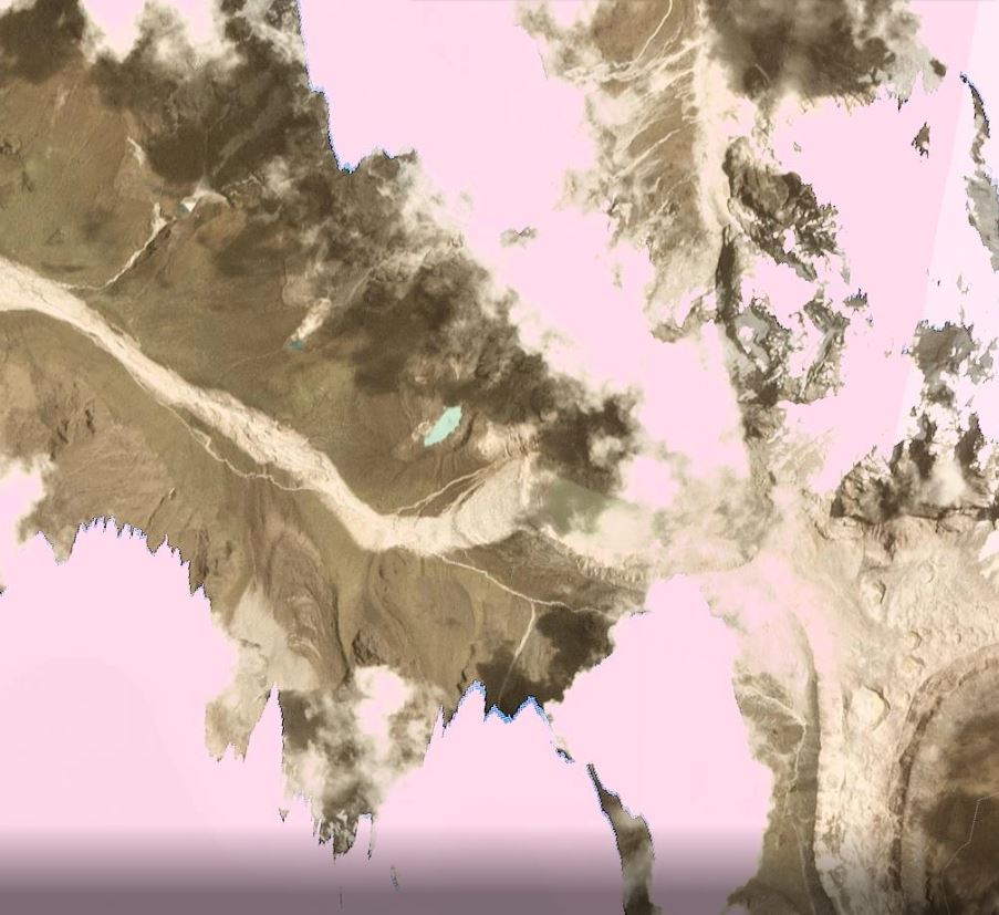
Planet Labs imagery of the upper portions of the of the Salkantay landslide, after failure. Planet Labs PlanetScope image captured on 10 March 2020. Copyright Planet Labs, used with permission.
.
Unfortunately the imagery does not really provide much additional information about the landslide source, although it can be seen that the lateral extent of the collapse was quite limited in extent on the mountainside. The landslide mass has travelled into the lake basin and has then emerged on the west side. Interestingly, there is still water in the lake, suggesting that it was not displaced or that the lake has refilled after the landslide. This is quite surprising – I would welcome views on how this has happened.
The track of the landslide is clear. Directly below the lake the landslide has eroded the vegetation but does not appear to have generated a great deal of scour. Further down the track there appears to be considerable scour, and on the west side of the image the landslide track has become wider. This is probably controlled by the pre-failure topography.
Reference and acknowledgement
Planet Team (2020). Planet Application Program Interface: In Space for Life on Earth. San Francisco, CA. https://www.planet.com/
 Dave Petley is the Vice-Chancellor of the University of Hull in the United Kingdom. His blog provides commentary and analysis of landslide events occurring worldwide, including the landslides themselves, latest research, and conferences and meetings.
“Interestingly, there is still water in the lake, suggesting that it was not displaced or that the lake has refilled after the landslide. This is quite surprising – I would welcome views on how this has happened.”
Options that come to mind:
(a) Source material (at least part) remains in the bottom of the lake (displaced water volume by it is what triggered further material be entrained downstream of the lake).
(b) Less likely, but if some source material was ice/snow, might have been melted & incorporated to lake water volume?