14 January 2020
The Hope Slide in Canada: new images released by BC Highways
Posted by Dave Petley
The Hope Slide in Canada: new images released by BC Highways
Early on 9 January 1965 a very large landslide occurred in the Nicolum Valley in the Cascade Mountain Range in British Columbia in Canada. Now termed the Hope Slide, the landslide involved the collapse of Johnson Peak, generating a 47 million cubic metre landslide that buried BC Highway 3, killing four motorists.
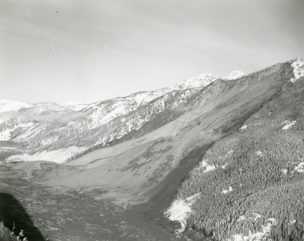
Last week, BC Highways released onto their blog an archive of images taken in the immediate aftermath of the landslide, together with a blog commentary. There is also a nice article on the CBC website about the image set. This is an overview of the landslide from the archive:-

Overview of the Hope Slide from the BC Highways archive. Image from the BC Highways archive.
.
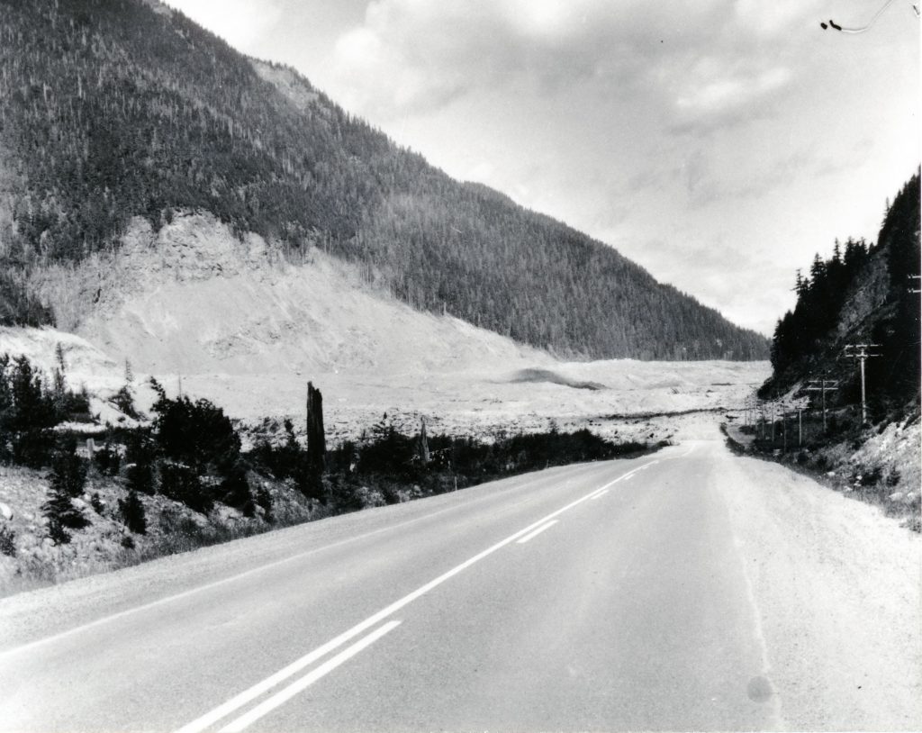
The image below shows the opposite side of the valley. The landslide has clearly run up the valley wall, stripping the topsoil and the trees from the slope, demonstrating that this was a high velocity flow.

Super-elevation at the downslope end of the Hope landslide in Canada. Image from the BC Highways archive.
.
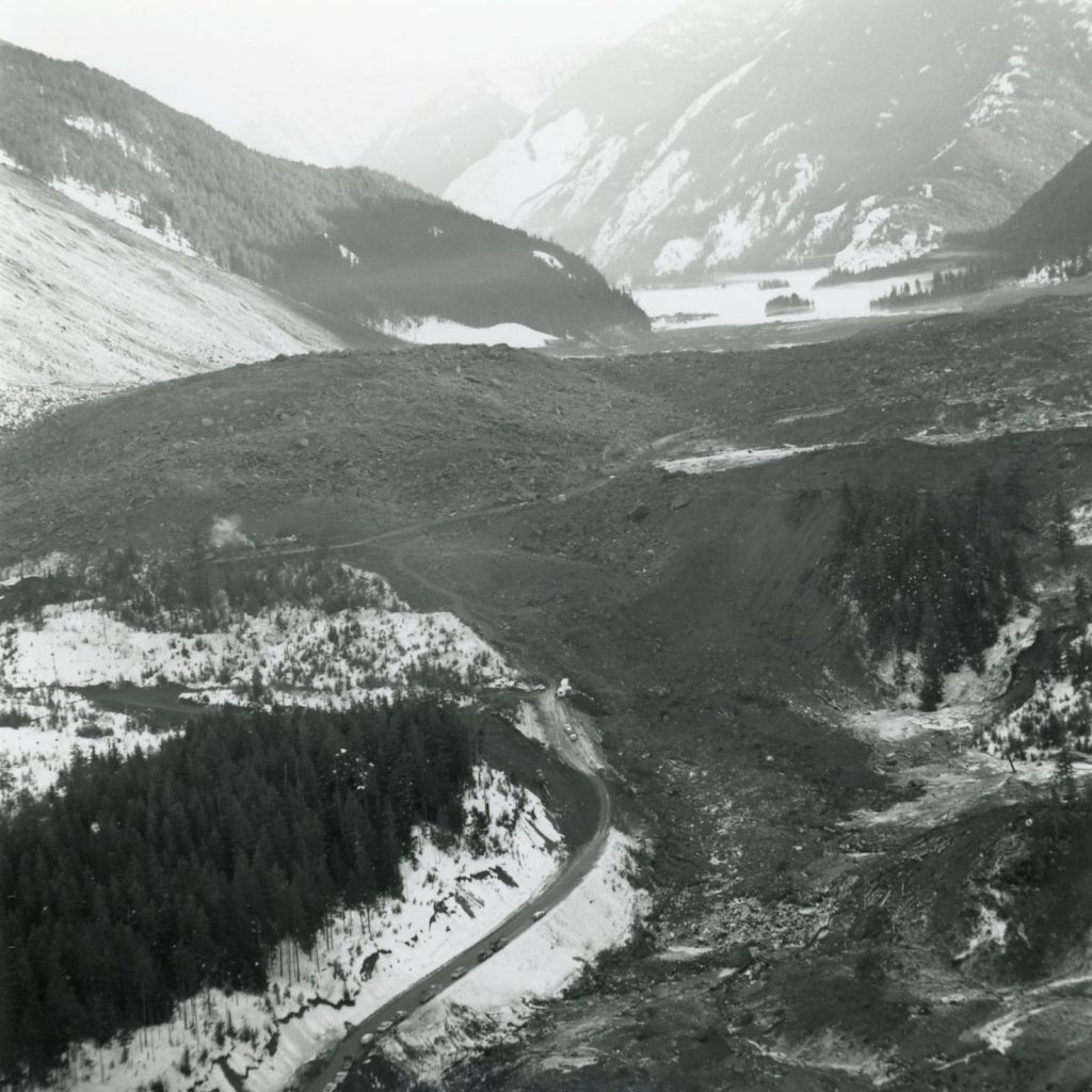
The image below shows the aftermath of the landslide, with the extensive debris deposit across BC Highway 3. Clearly this presented the highways agency with a substantial challenge in terms of reopening the road. Perhaps surprisingly, a temporary road was opened in just three weeks.

The debris field from the Hope landslide. Image from the BC Highways archive.
.
There is a good Wikipedia page about the Hope Slide, including a section on the causes and the trigger of the failure. The underlying causes were pre-existing tectonic structures (faults and shear zones), which chronically weakened the slope, ultimately providing a detachment surface. The trigger is less clear – whilst two small earthquakes were recorded in the area, it is unlikely that these were sufficient to initiate collapse. It seems likely therefore that this was a progressive failure.


 Dave Petley is the Vice-Chancellor of the University of Hull in the United Kingdom. His blog provides commentary and analysis of landslide events occurring worldwide, including the landslides themselves, latest research, and conferences and meetings.