25 November 2019
Savona: a landslide-induced bridge collapse in Italy
Posted by Dave Petley
Savona: a landslide-induced bridge collapse in Italy
Over the weekend extremely heavy rainfall affected a wide swathe of Europe, most notably in France and Italy. The Italian region of Liguria has suffered from multiple landslides, the most dramatic of which occurred on an elevated section of the A6 motorway on the road between Savona and Turin. There are severe rainfall alerts in Emilia Romagna (red); in Abruzzo, Calabria, Piedmont, Veneto, Marche, Lombardy and Puglia (orange); and in Val d’Aosta, Trentino, Alto Adige, Campania, Molise, Basilicata, Umbria, Sicily and Sardinia (yellow).
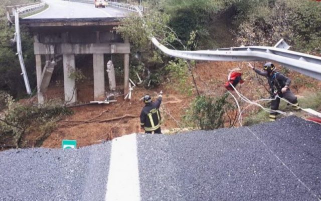
The event near to Savona was serious – it was fortunate that there was no loss of life given the impact:-

The aftermath of the landslide on the A6 near to Savona in Italy. Image via Il Fatto Quotidiano.
.

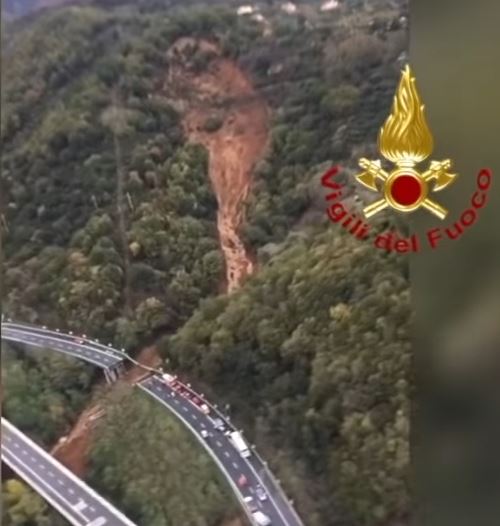
The aftermath of the landslide on the A6 near to Savona in Italy. Image via Youtube.
.
On first inspection this appears to be a slip in soil and regolith in a steep topographic depression or bowl. The released debris appears to have transitioned to become a channelised debris flow that has exceeded the capacity of the channel below the road.
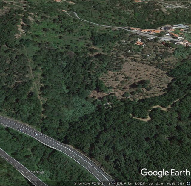
The Savona landslide occurred close to Madonna del Monte at 44.295, 8.434. The topographic depression from which the landslide originated can be clearly seen:-

The location of the landslide on the A6 near to Savona in Italy, as shown on Google Earth
.
In essence this event will be down to inappropriate design of the channel below the road. It highlights the difficulty of designing structures that are able to handle the very short lived, high discharge events that occur when chanellised debris flows evolve from slope failures. As usual, I highlight the video from the 2008 Lantau events in Hong Kong to illustrate the dramatic and devastating effects of these landslides.


 Dave Petley is the Vice-Chancellor of the University of Hull in the United Kingdom. His blog provides commentary and analysis of landslide events occurring worldwide, including the landslides themselves, latest research, and conferences and meetings.
Is it an optical illusion, or is there a clear kink in road where subsequently failed ??
FWIW, long ago, I remember reading of a seasonal alpine rail route that kept losing the same bridges to Winter / thaw snow and rock avalanches. They tried wider spans, they tried stronger trestles, they tried shelters, they just kept losing those bridges. So, they replaced them with a ‘folding’ design, ‘draw-bridges’ whose track & trestles lifted clear every Autumn…
Not an option on A6, of course…
😉
The mudwave on the remaining columns isn’t that high. Makes me wonder if there was a center support structure that was taken out by the debris flow.
You can search for the little town, Madonna del Monte, Savona on Google Earth.
There you can see the intact bridge.
I think the causes were a undersized foundation due the little catchment area of the torrent and that on one side the abutment was undermined and settled down over critical point to disrupt the static stability of the bridge.
Historic landslide on a map
https://mobile.twitter.com/antonyaolarsson/status/1182219867522551808
Is it fixed already? Does anybody have some info?