
29 December 2018
First visual satellite images of Anak Krakatau show the enormous extent of the landslide
Posted by Dave Petley
First visual satellite images of Anak Krakatau show the enormous extent of the landslide
The ESA Sentinel-2 satellite today captured the first visible band imagery of the Anak Krakatau landslide scar. This is the image, from Sentinel Hub:-
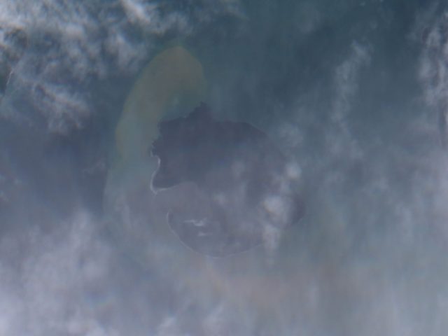
ESA Sentinel-2 True Colour image of Anak Krakatau collected on 29th December 2018.
.
For reference, this is an image also collected by Sentinel-2, of the island before the landslide:-
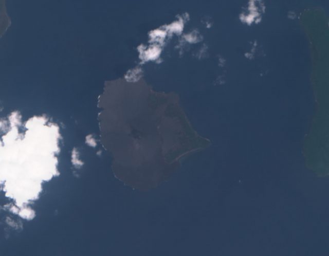
ESA Sentinel-2 True Colour image of Anak Krakatau collected on 1st November 2018.
.
I have tried to improve the Sentinel-2 image to bring out the main features:-
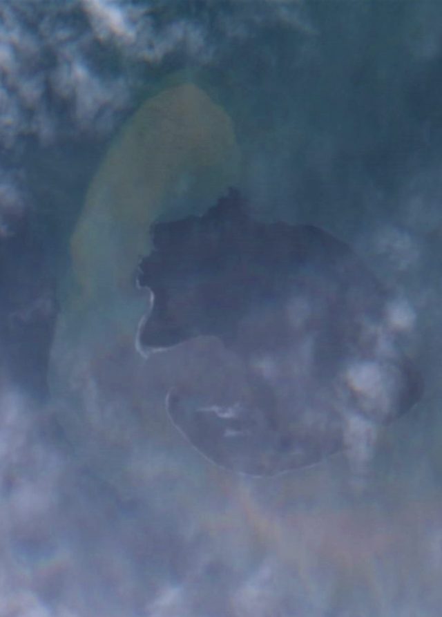
ESA Sentinel-2 True Colour image of Anak Krakatau collected on 29th December 2018.
.
So, there appears to be a huge scar on the west side of the island. This is consistent with the reported deformation from the radar images, as analysed by PVMBG and reported by the BBC. They report that the landslide had a volume of 150-170 million cubic metres, which is a huge landslide. Note that most of the slide was a terrestrial (i.e. above water) slide, not the underwater event that was initially reported. A very substantial proportion of the volcanic cone is missing, including all of the higher elements. PVMBG report that the come elevation has decreased from 338 metres to about 100 metres. Around the southwest part of the island there appears to be an extensive shallow marine deposit – is this landslide material, perhaps moved by the currents, or ash fall from the volcanic eruptions? Or both of course.
It seems likely that this failure was a single large event, although it might have had several phases in short succession. The seismic data, once properly analysed should help with the interpretation of the failure sequence. A key question will be whether INSAR data could have detected precursory deformation of this flank prior to the main landslide event?
 Dave Petley is the Vice-Chancellor of the University of Hull in the United Kingdom. His blog provides commentary and analysis of landslide events occurring worldwide, including the landslides themselves, latest research, and conferences and meetings.
I posed this same question on LinkedIn… I am not sure how to move the Flag from looking at things afterward to before .. especially for these high-risk targets. If they can task the satellites to get the data afterward … why not before? We are smart enough ….
To our Indonesian friends .. given this experience.. placing terrestrial radar at or near these sites … up to 4-5 km away — or closer … could definitely save lives. We would have seen in the data the swelling of the mountain and structures …if we can detect diurnal and heat-induced deformation in the granites of Yosemite, down to .004 inches.. we can for sure see half a mountainside in its growth and pre-failure state !!