10 February 2017
Oroville Dam: extraordinary erosion, and a crisis, on the spillway
Posted by Dave Petley
Oroville Dam: extraordinary erosion, and a crisis, on the spillway
The Oroville Dam in California is the tallest dam in the USA. with a height of 230 m, this is an earthfill embankment dam built between 1961 and 1968 for the purposes of water supply, hydroelectric power generation and flood control. After years of drought, California is suffering a series of huge rainstorms – so-called atmospheric rivers – that have rapidly raised the water level in the dam. To allow flood control, the dam has been undergoing controlled discharges of water through the spillway. This structure can be clearly seen to the left of the dam in the Google Earth image below:
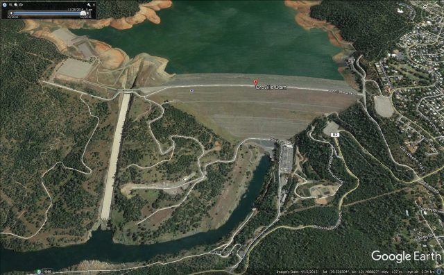
Google Earth imagery of the Oroville Dam in California before the current crisis
.
On Tuesday, after such a release water, major damage was noted on the spillway, apparently caused by the failure of the concrete base and then erosion of the underlying substrate. The California Department of Water Resources tweeted this image of the damage on 8th February:
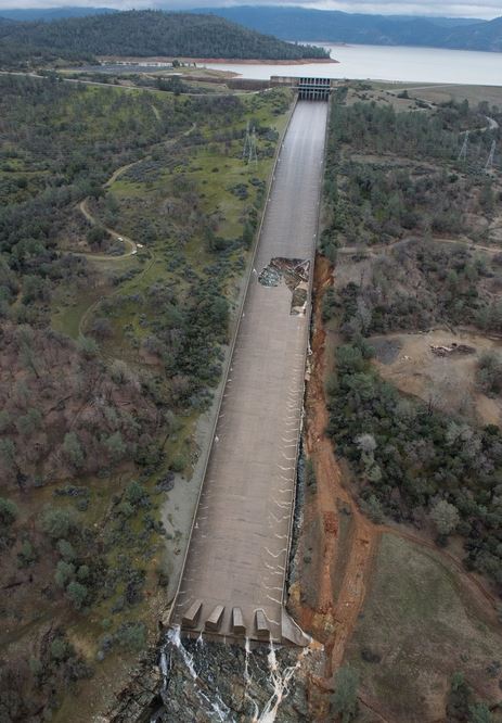
Spillway damage at the Oroville Dam, via California Department of Water Resources
Over the next few days further discharges of water have been undertaken to test the spillway and to control the water level in the lake. The CaDWR tweeted this image of one such test earlier today:
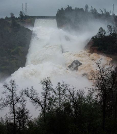
Damage to the Oroville Dam spillway during a water flow test on 9th February, via CaDWR
.
Unsurprisingly, the condition of the spillway has dramatically deteriorated:
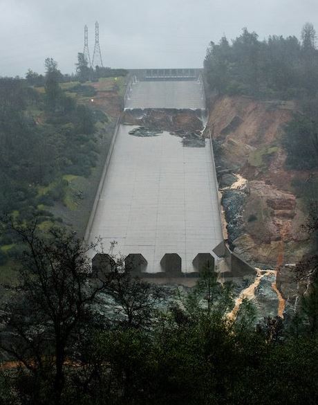
Damage to the Oroville Dam spillway on 9th February, via CaDWR
.
So now the Department of Water Resources are left in a bind. KQED is providing excellent coverage of this event, with an update yesterday as follows:-
With the spillway mostly out of commission since major releases were curtailed, Lake Oroville has been rising at the rate of about half a foot [about 15 cm] an hour since midday Tuesday. Its level has increased 30 feet [about 10 m] since then, with the reservoir’s surface now 20 feet [6 m] below an emergency spillway.
The emergency spillway, which would release water down a steep slope adjacent to the spillway, has never been used in the dam’s half-century of operation. DWR officials and others say water flowing down the slope will likely result in a large volume of debris being dumped into the Feather River, which flows through the city of Oroville on its way to the Sacramento Valley.
That’s one reason dam managers are willing to risk the destruction of the concrete spillway, calculating that would be preferable to the unknowns involved in an uncontrolled emergency spillover.
“It’s going to be rocks, trees, mud — liquid concrete — going down that river,” retired DWR engineer Jerry Antonetti told Sacramento’s KCRA as he watched the spillway Wednesday night. “I’d open ‘er up, sacrifice the bottom of that thing — it’s going to go in the river — clean it out next year and build a new spillway.”
The emergency spillway can be seen to the left of the main structure in the image below:
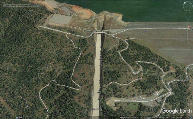
Google Earth image showing the main spillway and the emergency spillway at Oroville Dam.
.
It is not difficult to anticipate the damage that the use of this structure will cause. Fortunately the integrity of the Oroville Dam itself is not in question, but managing the spillway and associated damage is a massive challenge.


 Dave Petley is the Vice-Chancellor of the University of Hull in the United Kingdom. His blog provides commentary and analysis of landslide events occurring worldwide, including the landslides themselves, latest research, and conferences and meetings.
In my county in California–the second smallest county in the state after the City of San Francisco–there are nearly 40 road closures due to landslides, slip outs, washouts, culvert failures, and sinkholes (with more closed from downed power lines).
I can’t even imagine what kind of land movement they are having in the burn scars of the massive fires they had last summer south of us in Big Sur.