
19 June 2014
The Devdoraki landslide: a new set of high quality images
Posted by Dave Petley
The Devdoraki Landslide
The Devdoraki landslide was a large event in the Dariali Valley in Georgia that blocked the main road between Russia and Georgia a month ago. I featured some images of the landslide at the time, but (via Jorg Hanisch), I have been provided with a new set of very high quality photographs of the landslide. These images were collected by Georgy Gotsiridze of the Consulting Center “GeoGraphic”, Tbilisi, Georgia, who has made them available for free use. They are remarkable.
This is the source zone of the Devdoraki landslide:
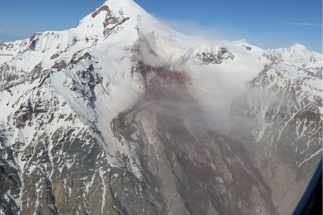
Image copyright of Georgy Gotsiridze, used with permission
..
Note the failure appears to have started as a rock mass failure on a very steep, ice-covered slope. This then appears to have entrained a very large volume of material as it loved down the steep slope. The dynamics are complex though – on the left side of the flow as seen from the camera the slide has spilled over a rock spur to create a second slide. Down-slope this merges again with the main slide, as shown in this image:
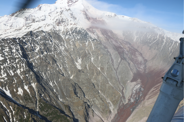
Image copyright of Georgy Gotsiridze, used with permission
..
The most dramatic aspect of this image through is the extraordinary super-elevation of the slide when it reached the foot of the steepest slope and then needed to turn 90 degrees to follow the valley. Super-elevation is the term used when the slide travels up a slope, typically because of a sharp turn. On the right side of the image this super-elevation is very clear. This indicates that the landslide was travelling very fast at this point. The super-elevation is better illustrated in this image, showing the entire upper portion of the landslide:
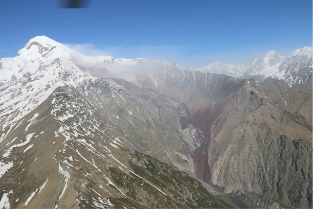
Image copyright of Georgy Gotsiridze, used with permission
..
Interestingly, from this point onwards the character of the slide appears to have changed markedly, I assume from a rock avalanche to a rapid debris flow. This is an image of the track of the landslide in the lower reaches:
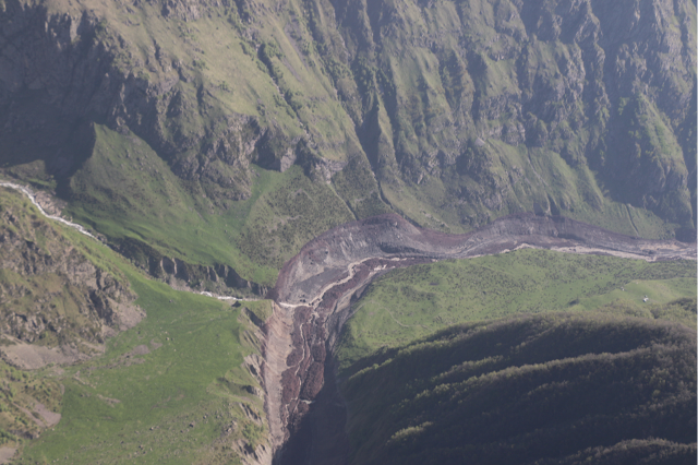
Image copyright of Georgy Gotsiridze, used with permission
..
There is some evidence of super-elevation on the outside of the bend, but to nothing like the extent upslope. The flow appears to have been strongly channelized in this portion. This is supported by this image of the slide, taken from a lower angle:
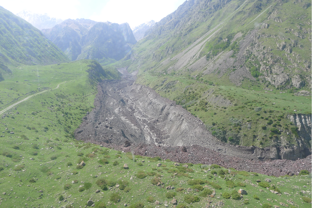
Image copyright of Georgy Gotsiridze, used with permission
..
Finally, this is the landslide deposit at the point that it entered the main channel and stopped:
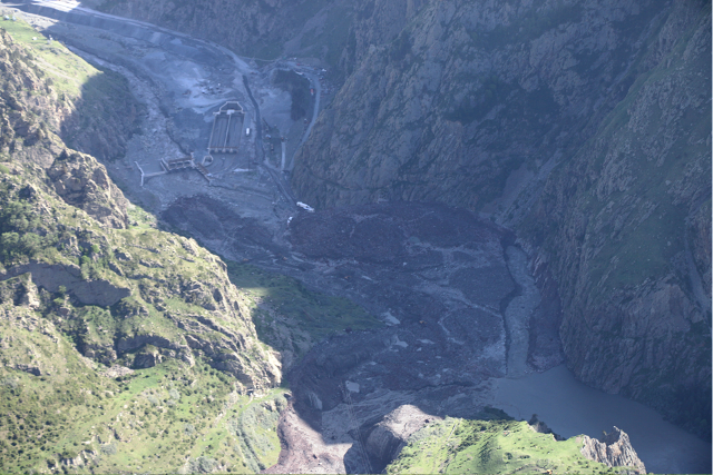
Image copyright of Georgy Gotsiridze, used with permission
..
The diversion channel, which flowed into a tunnel, is clearly evident. The landslide does not seem to have traveled far, or to have spread dramatically, once it entered the main channel. There is little evidence of super-elevation as well. This supports the hypothesis that the movement rate was notably lower than for the initial stages.
This is a very unusual and interesting landslide – I hope that it will be analyzed and written up in detail.
 Dave Petley is the Vice-Chancellor of the University of Hull in the United Kingdom. His blog provides commentary and analysis of landslide events occurring worldwide, including the landslides themselves, latest research, and conferences and meetings.