
4 June 2011
The Springhill Landslide in Utah – community action at its best
Posted by Dave Petley
The Springhill neighbourhood of Salt Lake City in Utah is a smart, modern residential area. The Google Earth below shows the location – the grid reference of lat: 41.814; long: -111.878 should allow you to find the place for yourself on Google Earth:
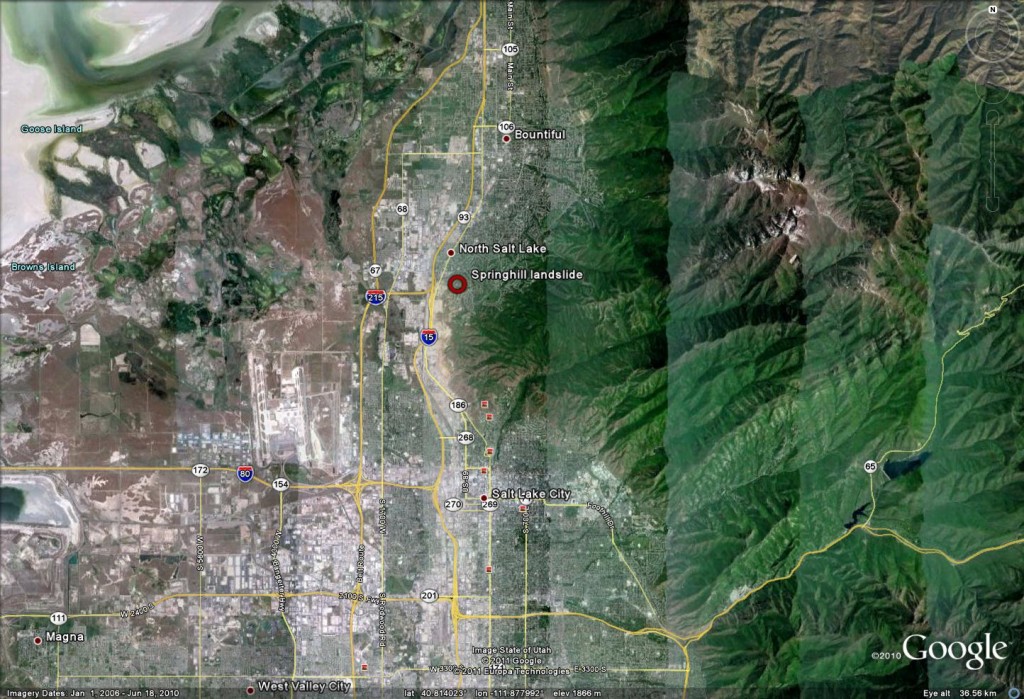
At first sight the 2010 Google Earth image does not suggest that there are any major problems with the area that that is the subject of this post, though there are: some morphological features that would make one want to take a second look:
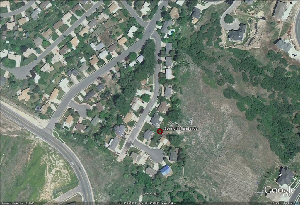
An intial closer, perspective look still makes it difficult to see much of a problem, but note the rather ominous light shaped linear feature just to the left of the blue roofed house at the top of the image, and the abrupt break in slope above and to the left of this. Hmmmm!:
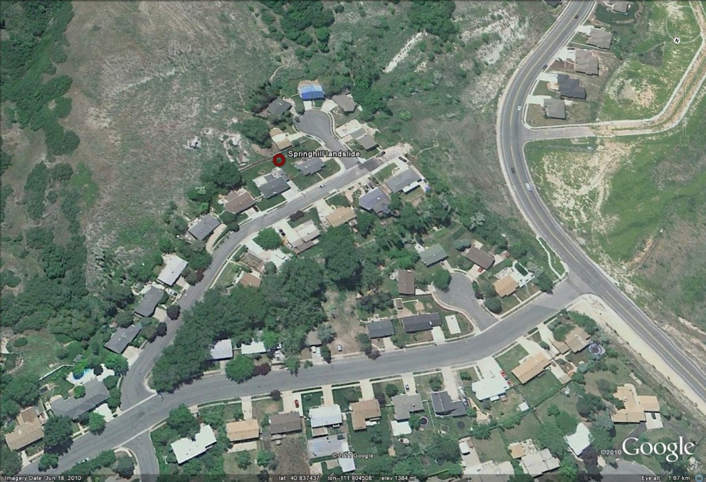
Before we look at that potential crack, lets take a look at the road. I have now rotated the image so that the view is from the northwest. The road is now starting to look a little worrying because the pavement has clearly been repaired and the alignment of the margins of the highway appears to be distorted:
Let’s now take a look at the road togetrher with the possible crack that we identified earlier, and also that break in slope:
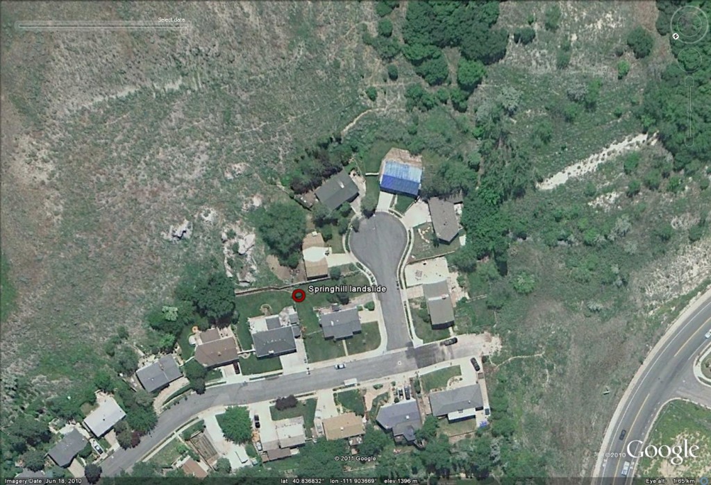
This is starting to look a little worrying in that the possible crack appears to be upslope of the deformed road. Let’s compare this view with one from 2006:
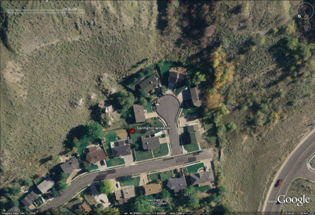
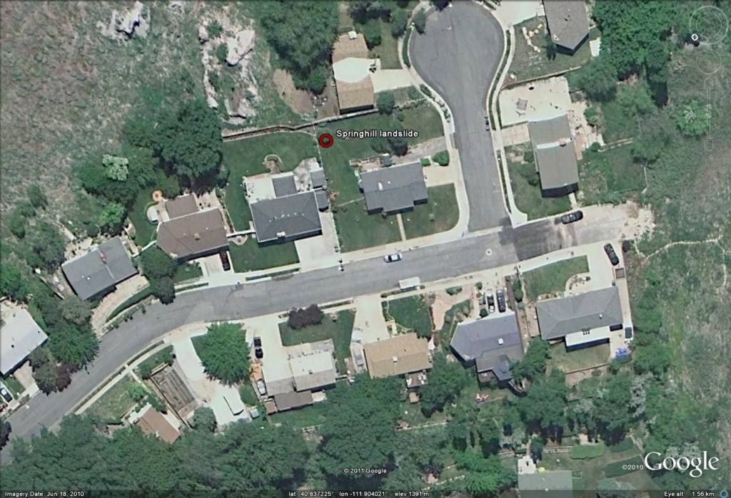
The road is clearly less distorted, though has been patched at each end and, more importantly, there is no sign of the feature that could be a crack.
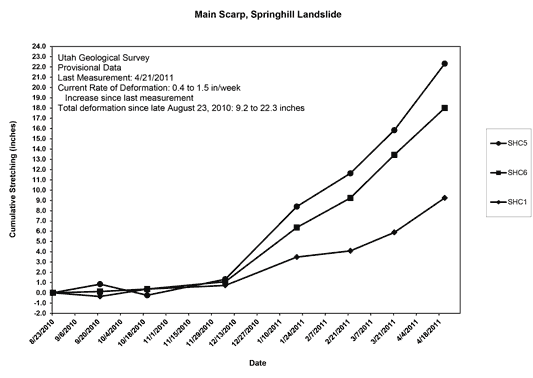
This area is the Spinghill Landslide, a slow-moving but destructive slide that is affecting this neighbourhood. Movement was first observed in the 1990s and has continued thereafter. Unfortunately at present the rate of movement is being recorded at as much as 1.5 inches (c.40 mm) per week. The impact on the properties is inevitably very serious. The Utah Geological Survey are monitoring the landslide and have a good technical update report online. Perhaps most interesting is a map of the measured movement as per GPS instruments – here the units of movement are inches, where 1 inch = 25.4 mm. Note this is just the movement since June 2010:
http://geology.utah.gov/utahgeo/hazards/landslide/springhill/images/springhill-aeriallg.jpg
And secondly, a graph of displacement against time:
http://geology.utah.gov/utahgeo/hazards/landslide/springhill/update.htm
Note that the movement rate has notably accelerated in the last few months. A news report from yesterday suggests that high rates of movement are still being recorded, and that the area is now being considered as being potentially uninhabitable. There is a quite excellent community blog with some very nice media reports about the landslide at http://www.projectspringhill.com/. This does a fine job of providing insight into the very human cost of such a landslide. The video below shows the demolition of the house with the blue roof:
http://www.youtube.com/watch?v=aTpVqRoSdl0
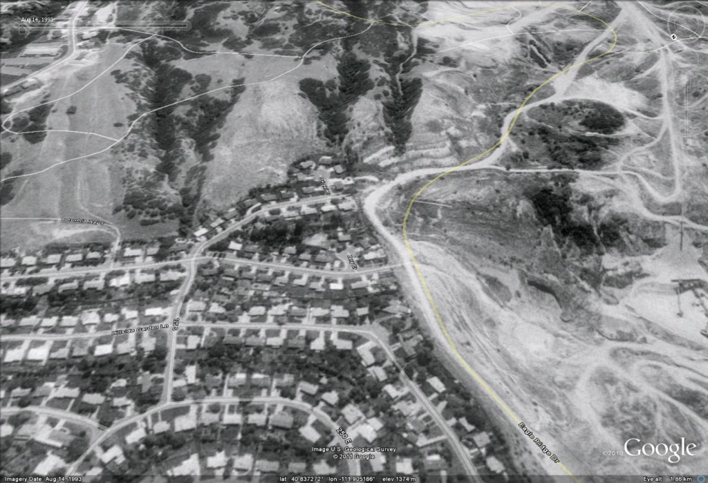
There can be little doubt that this event is a slow motion tragedy for those people living in the area. Finally, this Google Earth image is dated 1993; I have provided a perspective view. Whilst it wuld be impossible for a non-specialist to identify this site as being hazardous from a slope stbility perspective, to me there are enough morphological features present to hint at potential problems. I wonder why this site was not identified as being potentially problematic before subdivision?
 Dave Petley is the Vice-Chancellor of the University of Hull in the United Kingdom. His blog provides commentary and analysis of landslide events occurring worldwide, including the landslides themselves, latest research, and conferences and meetings.
it is an old landslide and your last comment it is correct
“Whilst it wuld be impossible for a non-specialist to identify this site as being hazardous from a slope stbility perspective, to me there are enough morphological features present to hint at potential problems. I wonder why this site was not identified as being potentially problematic before subdivision?”
the dangerous surface is bigger than the one interestd actually
“I wonder why this site was not identified as being potentially problematic before subdivision?”
Part of the reason probably has to do with culture. Utah is one of our most conservative states. There’s “freedom to fail” and “buyer beware.”
The cost of a thorough environmental risk study would likely be considered an unreasonable burden on the developer. New development is usually an important revenue source for the community.