
26 May 2011
Snake River landslide – update and images
Posted by Dave Petley
Thanks to reader Brandi for much of the information in this post.
The removal of the debris left by the landslide in the Snake River canyon in Wyoming is now well underway, with plans to reopen the highway tomorrow. Reports suggest that the landslide has left a 10 metre wide, >2 metre deep trench in the roadway, which will require a temporary repair.
Meanwhile, there are two good sets of images of the landslide online. First, Pinedale online news has a nice article about the slide, including the following picture, which shows rather nicely the volume of material on the road. Note the mature tree, displaced but standing upright on the slide mass:
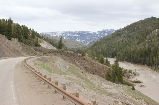
From: http://www.pinedaleonline.com/news/2011/05/Roadblock.htm
Meanwhile, the Wyoming Geological Survey has a very comprehensive gallery of images of the landslide. Finally, David Bell also has a gallery of pictures of the landslide.
Finally, Brandi also kindly provided some information about the landslide:
This slide is located in a ~48 km section of highway, where four of the largest slides on Wyoming highways have occurred previously: the Elbow, Blue Trail, Wolf Mountain, and Deer Creek slides. The slides typically occur in a lower Cretaceous lithology called the Bear River Formation, composed of interbedded siltstones, porcellanites, bentonites, sands, and very thin limestones. The shales and siltstones of the Bear River are overlain by sandstones of the Aspen and Frontier Formations.
A key factor in the landslides here involves numerous anticlinal and synclinal folds throughout Snake River Canyon, exposing the Bear River multiple times.
Record levels of rain and snow pack exist in the area – up to 229% of average stream flow conditions for the month for Yellowstone and 149% of average for stream flow on the Snake, and precipitation at +214% of average for the month at the nearest data station. (Source: NRCS Snotel May ’11 report)
 Dave Petley is the Vice-Chancellor of the University of Hull in the United Kingdom. His blog provides commentary and analysis of landslide events occurring worldwide, including the landslides themselves, latest research, and conferences and meetings.
Thank you Brandi !
Great reporting !! Lots of detail and data, and the big picture too ! I learned a lot. That’s why I love this Blog site !
A time-lapse video of the landslide as it occurred!
http://www.youtube.com/watch?v=u99FnHi5-xA
Thanks Brandi ! I likes This blog very much. There’s enough report and with a large picture too.