
15 May 2011
Images from the Sichuan earthquake zone
Posted by Dave Petley
On Saturday the organisers of the conference in Chengdu to mark the 3rd anniversary of the Sichuan Earthquake kindly organised for us to spend a day in the Wenchuan earthquake area. The main focus was on the debris flows that have plagued this area since the earthquake; unfortunately this is likely to be the case for years to come. With typical bad timing, the SD card on my camera failed, so I was left with photographs from my useless iPhone (surely the most over-rated piece of technology of the modern age!). Nonetheless, I thought I’d post a few images here.
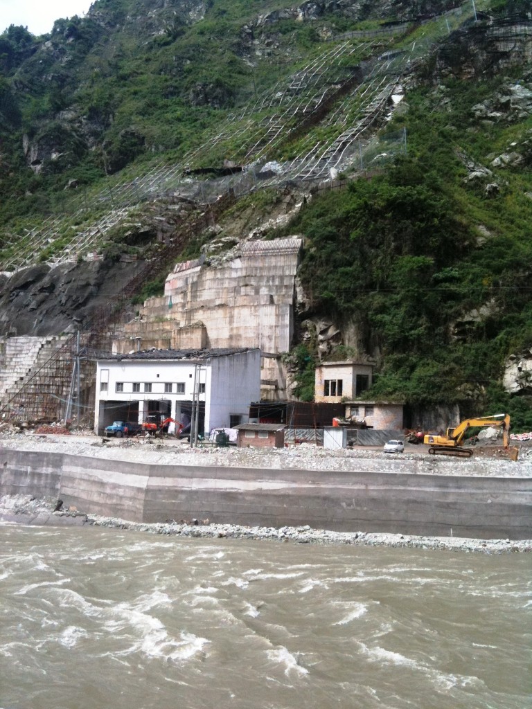
First, in many locations desperate measures are needed to protect infrastructure. Here, an electricity substation is threatened by slope problems, such that extensive works have been needed on the slope. These have included the construction of a retaining wall, dentition, and the construction of a shelter above the building. If you look carefully you will see that tyres have been put on the shelter roof to cushion the impacts from debris:
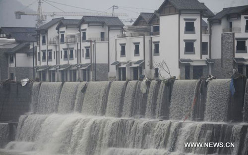
This is the newly constructed town of Yingxiu, replacing the devastated urban area. The scale of the reconstruction is hugely impressive:

However, this area was badly affected by flooding in August 2010, when a landslide blocked the Minjiang River, causing considerable damage to the new town (image from here):
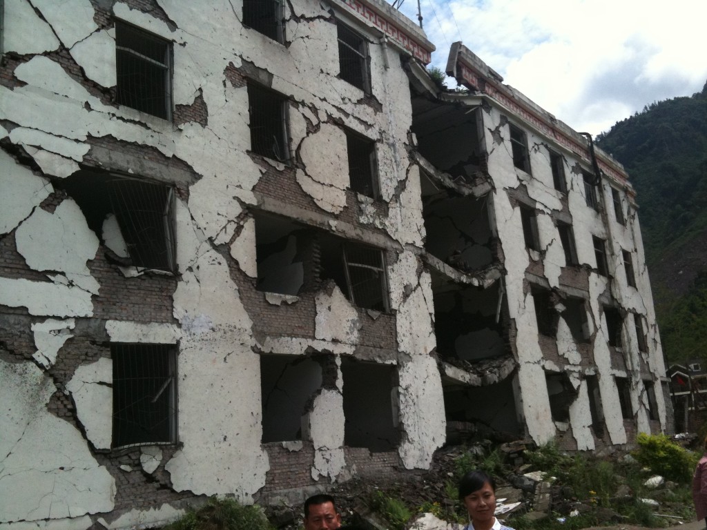
At the moment many of the buildings are empty; it would be interesting to know if worries about flooding are part of the reason. Meanwhile, in the town the Secondary School has been preserved as a monument to the earthquake. The site is very sobering:
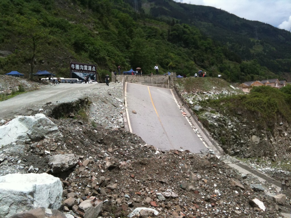
Upstream a section of broken road remains in place, whilst behind the disaster tourism is in full swing, with stalls selling pictures and VCDs of the impacts of the earthquake:
 Dave Petley is the Vice-Chancellor of the University of Hull in the United Kingdom. His blog provides commentary and analysis of landslide events occurring worldwide, including the landslides themselves, latest research, and conferences and meetings.
Tesla made earthquakes in Alaska in 1899 so saith The Lord God. -Biblical Prophet
[…] in the Yingxiu area of Sichuan Province, resulting in severe disruption. This is the area that I visited in May. One of the landslides was captured on video – take a look at the video below – the […]
[…] is the question of where this sediment mobilisation occurred. One leading candidate might be the Wenchuan Earthquake area, where we know that very large quantities of sediment were released from the slopes. Could it be […]
[…] is the question of where this sediment mobilisation occurred. One leading candidate might be the Wenchuan Earthquake area, where we know that very large quantities of sediment were released from the slopes. Could it be […]
[…] is the question of where this sediment mobilisation occurred. One leading candidate might be the Wenchuan Earthquake area, where we know that very large quantities of sediment were released from the slopes. Could it be […]