
2 February 2011
Cyclone Yasi – potential impacts
Posted by Dave Petley
Unfortunately, my bizarre track record for promoting disaster wherever I go is once again coming to fruition. Two days before I fly to Australia, the north-east coast of that country is about to be struck by a category 5 (the strongest type) cyclone, named Cyclone Yasi. The Australian Bureau of Meteorology has a map of the likely landfall zone:

Unfortunately, the impact of this event is likely to be severe. Whilst we tend to think of cyclones (hurricanes) as wind events, the range of impacts is much greater. Generally, such a storm is associated with very rough seas, high winds (including very strong gusts), storm surge and finally intense rainfall. In the southern hemisphere, the most severely affected area is typically just to the left (in the direction of travel) of the eye, where the forward motion of the storm combines with storm generated wind speed to generate extremely high winds and a large storm surge, This is why the forecast of the most-severely affected area has a bulge in that direction.
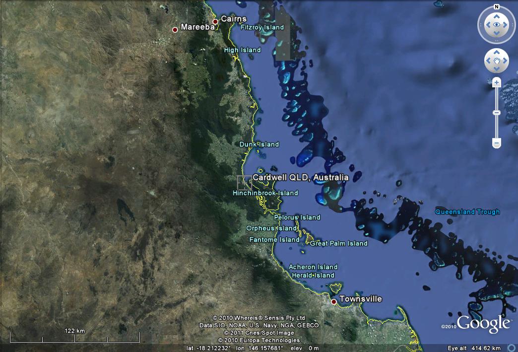
The Google Earth image of the likely landfall area is shown below. This area has a tropical climate of course:
A quick zoom into the area around Innisfail emphasises the vulnerability of the region to a storm of this size. Note the linear features close to the shoreline in the southeast corner of the image. These are I suspect ancient coastlines:
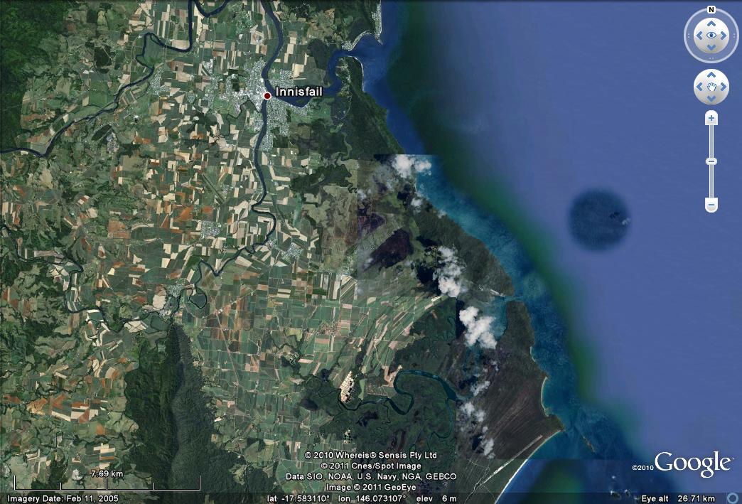
When Cyclone Larry hit Innisfail in 2006, 55% of houses were reported to have been damaged.
 Dave Petley is the Vice-Chancellor of the University of Hull in the United Kingdom. His blog provides commentary and analysis of landslide events occurring worldwide, including the landslides themselves, latest research, and conferences and meetings.
AGU Blogosphere | The Landslide Blog | Cyclone Yasi – potential ……
Here at World Spinner we are debating the same thing……
Coverage of Cyclone Yasi: ABC News 24
http://aqviva.dk/2011/02/coverage-of-cyclone-yasi-abc-news-24/