
6 February 2009
Name the landslide 3
Posted by Dave Petley
Time for a bit of Friday fun, that is Name the Landslide round 3. This one has been set be Peter Weisinger, winner of round 1. The challenge is, as ever, to identify the landslide shown in the Google Earth images below and to provide a brief description, suing the comments below. Do feel free to use the comments section to work towards a team solution.
Peter has very kindly provided two perspectives:
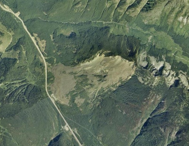
 Over to you…
Dave
 Dave Petley is the Vice-Chancellor of the University of Hull in the United Kingdom. His blog provides commentary and analysis of landslide events occurring worldwide, including the landslides themselves, latest research, and conferences and meetings.
Looks like the Hope Slide, east in Vancouver, BC in the Coast Mountains. Occurred January 6th, 1965 and was triggered by a minor earthquake.http://en.wikipedia.org/wiki/Hope_Slide
There is still some debate as to the earthquake was the trigger or caused by the landslideWeichert, D., Horner, R.B. and Evans, S.G., 1994. Seismic Signature of Landslides: the 1990 Brenda Mine Collapse and the 1965 Hope Rockslides. Bulletin of the Seismological Society of America, 84(5): 1523-1532.
Yes, that’s the “hope”, 49°18’N, 121°14’W. Giant one. And there’s pretty good imagery on GE/panoramio.