13 March 2011
NASA Terra Satellite Shows Tsunami Flooding in Japan
Posted by Dan Satterfield

Sendai was hit by a 10 meter tsunami on Friday. This image, from the NASA Terra satellite, is a true colour image showing the coast around Sendai BEFORE the quake and tsunamis. Click image for full resolution.
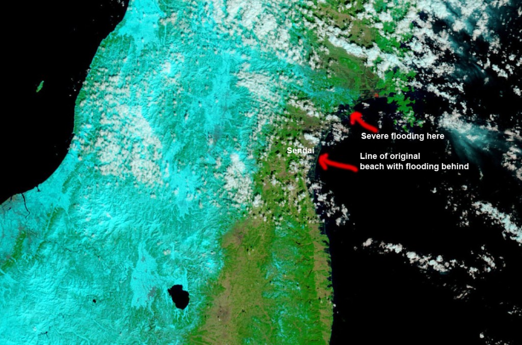
Below is an image after the quake/tsunamis.

Click to see full resolution. A close look shows the original beach outline with water well behind. Even more severe flooding is visible just northward.
Late Saturday, the USGS confirmed that GPS sensors indicate a movement of about 2.4 meters due to the quake. This is a large amount. This quake was on the subduction zone between the Pacific Plate and the North American Plate. The ocean off Japan is on the Pacific plate which is diving under the North American plate.
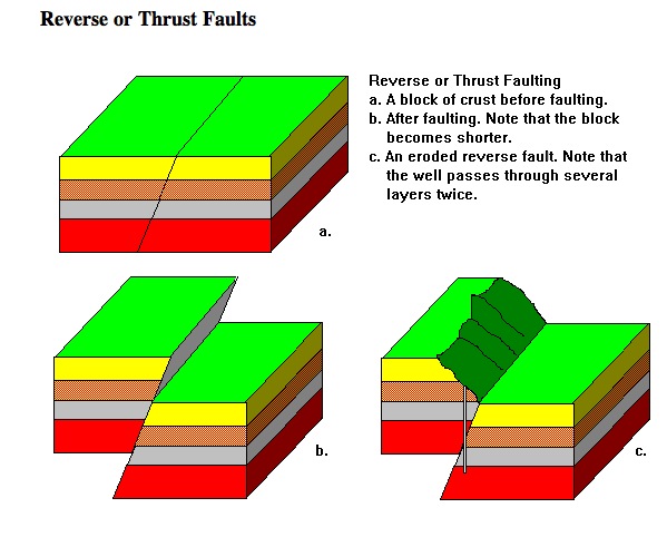
This means the fault rupture was a “thrust” fault. See the image below to see what this looks like in general.

Typical Reverse or thrust fault. From Steven Dutch- Uni. Wisc. Click image to learn more about faults.
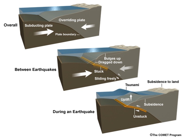
A COMET (Cooperative Online Meteorological Training and continuing Education) module on tsunamis has a graphic that is probably closer to what happened in Japan. Notice the subsidence after the fault moves. If the coast of Japan has indeed dropped, this might explain why the water is still there. It may be there permanently.
I want to be clear that I’m not claiming that the coast has sunk near Sendai, just saying that it’s a possibility. If there are some plate tectonics experts who know more, please email me. It may very well be that the geologists studying the quake just do not know yet. They will though; this will be the most studied quake in history, and the best recorded.
If you want to help the people in Japan and are looking for a really good charity, then I have two suggestions.
Direct Relief International and The International Rescue Committee. Both of these charities use 90% or more of their donations for programs and relief. This is very good, and it puts them at the top of nearly every list of great charities.
Check out the other AGU blogs for more on the quake.


 Dan Satterfield has worked as an on air meteorologist for 32 years in Oklahoma, Florida and Alabama. Forecasting weather is Dan's job, but all of Earth Science is his passion. This journal is where Dan writes about things he has too little time for on air. Dan blogs about peer-reviewed Earth science for Junior High level audiences and up.
Excellent work. Sad for the Japanese.