14 November 2016
First news of landslides from the Kaikoura Earthquake sequence in New Zealand yesterday
Posted by Dave Petley
First news of landslides from the Kaikoura Earthquake sequence in New Zealand yesterday
The large sequence of earthquakes in the northeast of South Island in New Zealand, the first of which was the M=7.5 Kaikoura Earthquake (this may actually have been a pair of events), occurred in a mountainous but sparsely populated area. New Zealand is highly landslide prone at the best of times, so it is unsurprising that there are initial indications that the Hamner earthquake sequence has triggered substantial numbers of landslides.
The first images of these landslides are now starting to appear. The coastal region in the area of Kaikoura, seems to have suffered from a number of large landslides, blocking the state highway and railway line that run down the east coast. These are key lifelines linking the Cook Strait ferries that go from Picton with most of the population of the South Island, including the city of Christchurch:
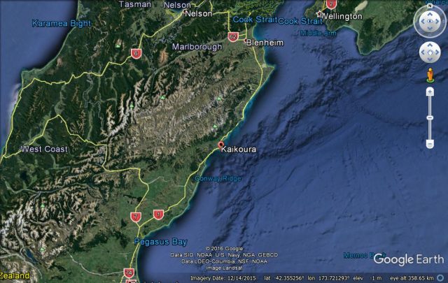
Google Earth image of the northeastern portion of South Island
.
There is an alternative road route, but it is a huge detour and crosses the Southern Alps in a pass. But State Highway 1 is blocked with some substantial landslides, as this image, tweeted by Marlborough Emergency, shows:
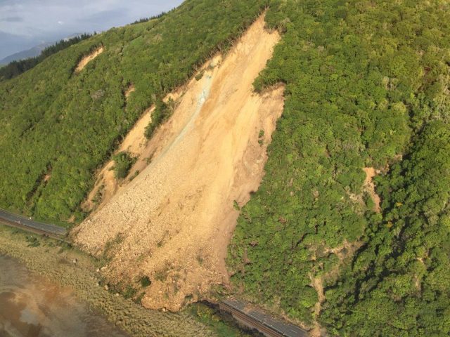
Landslide on State High 1 near to Kaikoura, triggered by the Kaikoura Earthquake, as tweeted by Marlborough Emergency
.
This is by no means the only landslide of this type blocking the coastal road. This image was tweeted by SkyAlert:
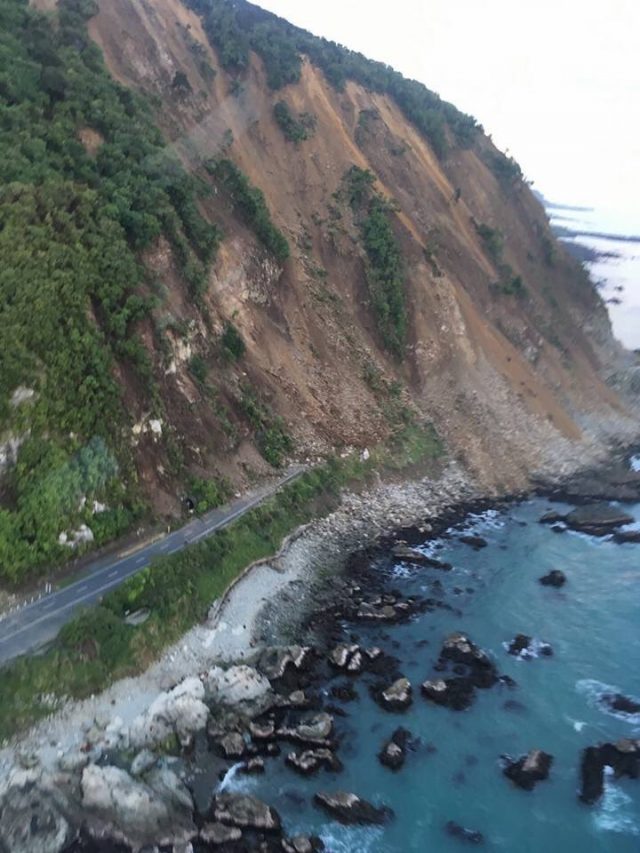
A landslide on SH1 near to Kaikoura triggered by the Kaikoura Earthquake and tweeted by SkyAlert
.
Whilst this landslide has caused remarkable deformation to the railway line:
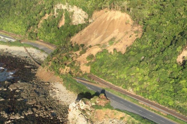
Remarkable railway line deformation in New Zealand, via ABC News
.
I wonder also whether these images are showing vertical uplift of the land surface, based on the shoreline platform.
There also appears to have been substantial landsliding inland. One landslide is reported to have blocked temporarily the Dart River, although water is now flowing once more. This image appears to show the landslide:
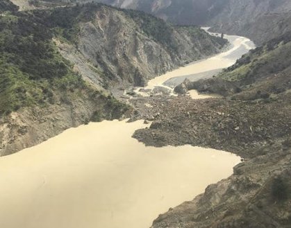
A landslide blocking the Dart Stream in New Zealand, via the NZ Herald
.
There appear to be other landslides in this image as well.
Finally (for now) there are some screenshots or remarkable landslides from footage broadcast by NewsHub. This tweeted image appears to show a very large landslide:
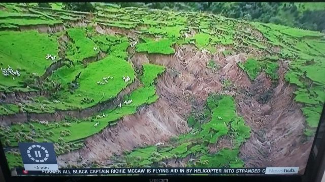
A screenshot of footage of landslides triggered by the Kaikoura earthquake, as tweeted
.
This landslide appears to have left some very bemused cows:
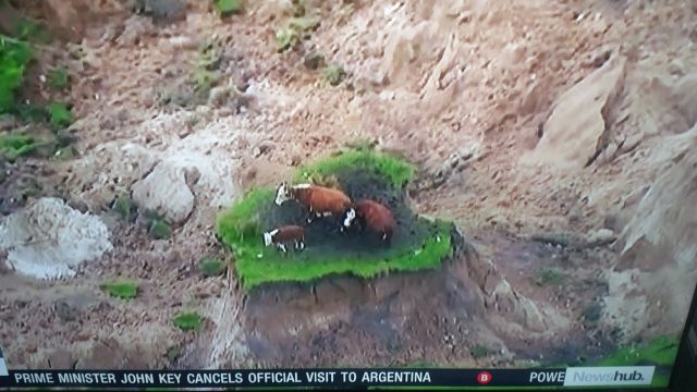
Cows left stranded by a landslide triggered by the Kaikoura earthquake
.
Please post links to further images in the comments below. In the meantime I suspect that the Landslide team at GNS Science are going to be very busy for the next few months.


 Dave Petley is the Vice-Chancellor of the University of Hull in the United Kingdom. His blog provides commentary and analysis of landslide events occurring worldwide, including the landslides themselves, latest research, and conferences and meetings.
Final photo in this tweet.
@lukeappleby: More incredible aerial images from @NZDefenceForce of damage in the Kaikoura area. #eqnz #nzearthquake pic.twitter.com/rhMk1DvCLD
https://twitter.com/lukeappleby/status/798069506006401024
@lou_gordongreen: The whole seabed raised out of the ground #kaikoura #eqnz #earthquakenz pic.twitter.com/CbUVW5YjX2
https://twitter.com/lou_gordongreen/status/798011354548293632
One of the methods of contrast with earthquakes is seismic retrofitting of buildings.
Therefore, old and unsafe buildings should be strengthened by methods such as strengthening with FRP in accordance with ACI 4402R or retrofitted by classical methods such as FEMA 360.