
10 November 2015
The history of the Fundao Dam near Bento Rodriguez
Posted by Dave Petley
The Fundao Dam
It is increasingly clear that the disaster at the Samarco mine that destroyed the town of Bento Rodriguez in Brazil in a mudslide of tailings last week was caused by the failure of one of the upstream structures, the Fundao Dam. Unfortunately as yet I have struggled to track down a decent image of the site of the dam failure. The best I have managed is this YouTube video of the site, which was pointed out in a comment by Caner Zanbak, shot from a helicopter:
.
It is really hard to understand exactly what this imagery shows because the camera never stands back from the site of the former dam. But the images do seem to show near complete destruction of the Fundao Dam itself, and extensive loss of tailings from the pond that it retained. Fortunately the retaining structures to the adjacent ponds appear to be intact. This is approximately the site of the former dam:-
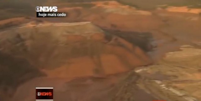
The site of the Fundao Dam from Youtube
.
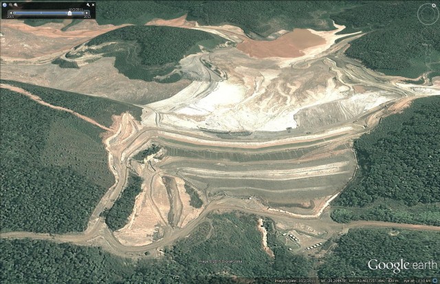
Google Earth has a good sequence of images of the dam site over the last decade. This is the most image of the Fundao Dam, dated August 2013. The video above suggests that considerable work had been undertaken in this area since this image was collected:
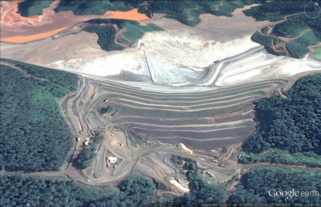
Fundao Dam in August 2013 via Google Earth
.
Back in August 2005 this area was completely undeveloped:
Fundao Dam site in August 2005 via Google Earth
.
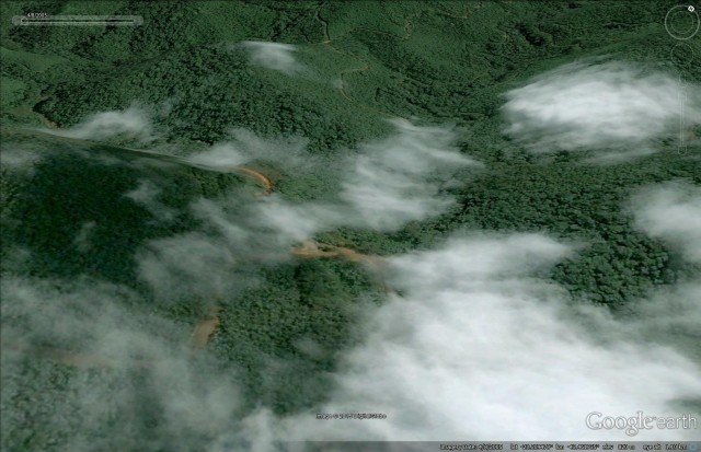
By May 2008 the development of this site was underway. Although partially obscured by cloud the dam was apparently under construction:-
Fundao Dam in may 2008 via Google Earth
.
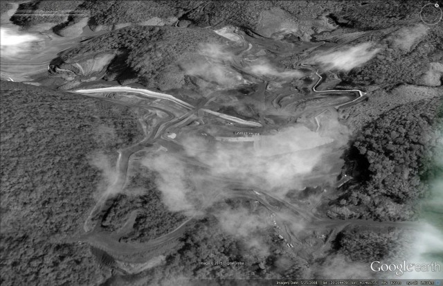
By February 2011 the dam was fully formed, although less high than at present, and a large volume of tailings was stored behind it:-
Fundao Dam in February 2011 via Google Earth
.
None of these images give any hint as to why the Fundao Dam failed so dramatically. There is no obvious sign of instability in the dam itself, nor in the adjacent slopes, as far as I can see. The most recent image does show an increase in the amount of water flowing from beneath the dam, but this is probably not a factor. The dam does not seem to be located on an unstable piece of terrain, although Google Earth is not up to assessing this properly. It is all very mysterious, and we can only hope that the investigation is open and transparent so that lessons can be learnt.
Of interest perhaps this brief report on the website of Reta Engenharia:
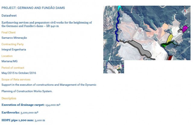
Reta Engenharia website on works on the Fundao Dam
.
But note that the diagram does not seem to show any works on the Fundao Dam itself, and there is nothing that I have seen that indicates that the failure was linked to this project.
 Dave Petley is the Vice-Chancellor of the University of Hull in the United Kingdom. His blog provides commentary and analysis of landslide events occurring worldwide, including the landslides themselves, latest research, and conferences and meetings.
I am still intrigued by what appears to be an episode of rapid debris accumulation followed by more gradual drawdown. That area appears to be a relatively flat alluvial valley with debris depths of tens of meters deep as evidenced by the “bathtub ring” visible around the valley in several of the videos.
Looking at Google earth, one can see what appears to be a narrow water gap eroded into a bedrock ridge appx. 1/2 mile SSE of Bento Rodrigues. All the local rivers pass thru this narrow defile. This may have been what impeded the initial flood of debris, them let it drain away more gradually.