
19 January 2015
A new valley blocking landslide in the Zanskar valley in northern India
Posted by Dave Petley
Zanskar valley landslide
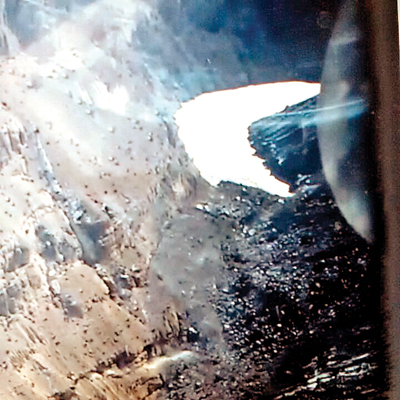
News agencies in India are reporting that a large landslide has blocked the Phuktal River in the Zanskar Valley. The information about this landslide is a little unclear, although most reports suggest that the barrier is about 200 feet (61 m) high. It appears that a helicopter overflight has been undertaken, from which DNA have published this not very high quality, but still interesting, image:
.
If this is indeed the landslide then a large and already frozen lake appears to have started to develop. The landslide itself is indeed substantial. The material on the left side looks to be quite fine-grained.
Presumably at this time of year the rate of flow along the river is comparatively low, but the landslide undoubtedly poses a significant threat. Reports suggest that four villages are being evacuated and that the Chadar Trek, a 150 km ice hike, has been closed. Kashmir Life suggests that the landslide occurred on 31st December and that the lake is now 5 km long.
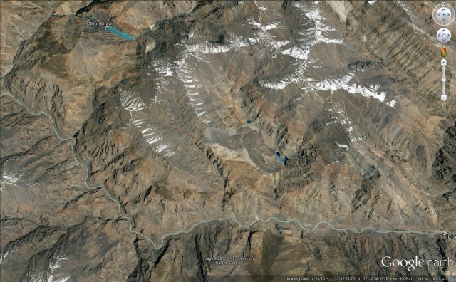
Based on the information that is available in the news reports, this is the most likely stretch of river affected by the landslide:
Google Earth
.
This image suggests that it will be extremely difficult to move sufficient resources to the site to manage the hazard.
 Dave Petley is the Vice-Chancellor of the University of Hull in the United Kingdom. His blog provides commentary and analysis of landslide events occurring worldwide, including the landslides themselves, latest research, and conferences and meetings.