2 August 2011
Images of landslides from the Christchurch earthquakes part 2: evil dancing boulders
Posted by Dave Petley
This is the second of my series of posts on landslide problems from the Christchurch earthquakes. The other sections are here:
Part one: boulder damage to a house
Part three: topographic amplification at the cliff tops
Part four: large-scale cliff collapses
Part five: landslides that involve sliding
This part concentrates on the behaviour of the boulders released from the Port Hills during the shaking.
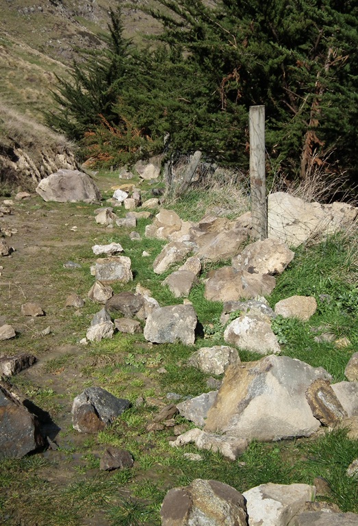
First, the number of boulders released from the slopes is really remarkably large. This track located on the midslope caught a very large number of the smaller rocks:
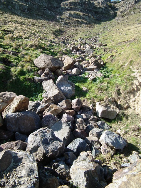
It is interesting to note that as they moved down the slope the boulders became concentrated in the pre-existing channels. I think we would normally have interpreted these rocks as having been moved fluvially (i.e. by water) not through rockfalls:
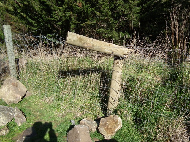
This very substantial wooden fence post has been hit and snapped clean in two by a small boulder. Note the size of the rock at the foot of the post:
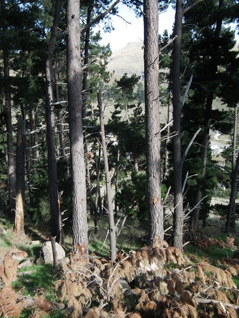
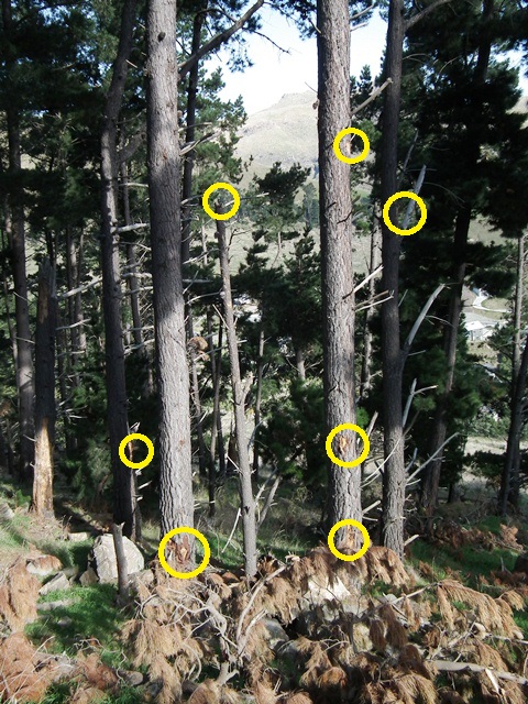
Below the track was a shelter belt – a stand of trees designed to capture rockfalls. Many of the trees were shattered and splintered by the impacts. These two trees show the marks of glancing blows from boulders:
For clarity I have marked on the image below just some of the impact marks. Note in particular the small tree that has been shattered and the height of the impact marks up the other trees. The boulder must have been five metres of more from the ground surface at this point:
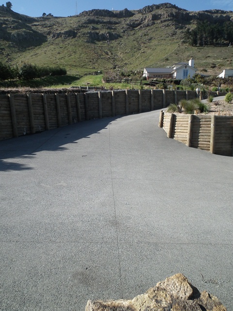
Finally, this illustrates just how far some of the boulders travelled. The rock in the foreground has detached from the slope in the background, crossing fields and roads en route to its final resting place. With care you can see the marks it made as it crossed the driveway, clearly bouncing en route:
More to come later – next up will be some images of a more conventional landslide in a residential area.
The other posts in this series are as follows:
Part one: boulder damage to a house
Part three: topographic amplification at the cliff tops
Part four: large-scale cliff collapses
Part five: landslides that involve sliding


 Dave Petley is the Vice-Chancellor of the University of Hull in the United Kingdom. His blog provides commentary and analysis of landslide events occurring worldwide, including the landslides themselves, latest research, and conferences and meetings.
[…] Part Two […]
[…] Part two: evil dancing rocks […]
[…] Part two: evil dancing rocks […]
[…] Part two: evil dancing rocks […]
Here are two pictures of the same “rock protection fence” taken the day after the February quake. https://www.facebook.com/media/set/?set=a.10150198237749502.373479.600384501
Sorry, this link may work better
https://www.facebook.com/media/set/?set=a.10150198237749502.373479.600384501&l=b4ef85962e&type=1
[…] video taken by a drone of some of the sites. A couple of years ago I visited many of these sites, and I have an old post that presents some of the images that I collected. As a reminder, this is typical of the state of some of the buildings at the top […]
[…] video taken by a drone of some of the sites. A couple of years ago I visited many of these sites, and I have an old post that presents some of the images that I collected. As a reminder, this is typical of the state of some of the buildings at the top […]