
28 March 2009
Images of landslides and other damage from the Sichuan earthquake part 4 – the Mianyuanhe area
Posted by Dave Petley
This is the fourth part of my photographic description of damage caused by the Sichuan earthquake. The other parts are as follows:
Part 1: Beichuan town
Part 2: The Tangjiashan landslide
Part 3: Hanwang town
Part 4 (this part): The Mianyuanhe area
Part 5: The Xingyiu area
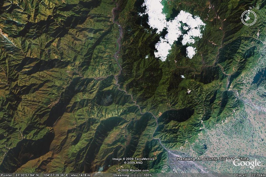
First a location map. The Mianyuanhe area is a fairly large river valley that cuts through the Longmen mountain chain, with its mouth as Hanwang as shown in the Google Earth image (which predates the earthquake) below:
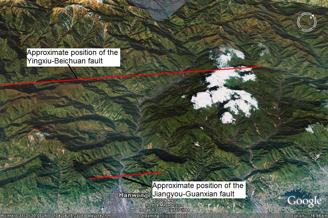
 As you may know, it has been shown that the earthquake was associated with movement on two different thrust faults (and an additional strike-slip fault that sits between the two). The Mianyuanhe shows the surface expression of the two thrust faults. I have annotated a perspective Google Earth view of the Mianyuanhe area to show the approximate position of the two faults below:
 This image also gives an idea of the terrain in this area. The surface features of these two faults is pretty clear. This is the Jiangyou-Guanxian fault (JGF) – the car has tilted as it crosses the crest of the fault scarp:
 The displacement on the Yingyou-Beichuan fault (YBF) is much larger:
 The presence of these two faults has meant that this is an area that has been pretty badly affected by the earthquake, with a large amount of building damage and many, many landslides. It is also an area with some active mines (coal mines I think) – for example, this mine, located just on the hanging wall side of the JGF, has been pretty badly damaged by the earthquake:
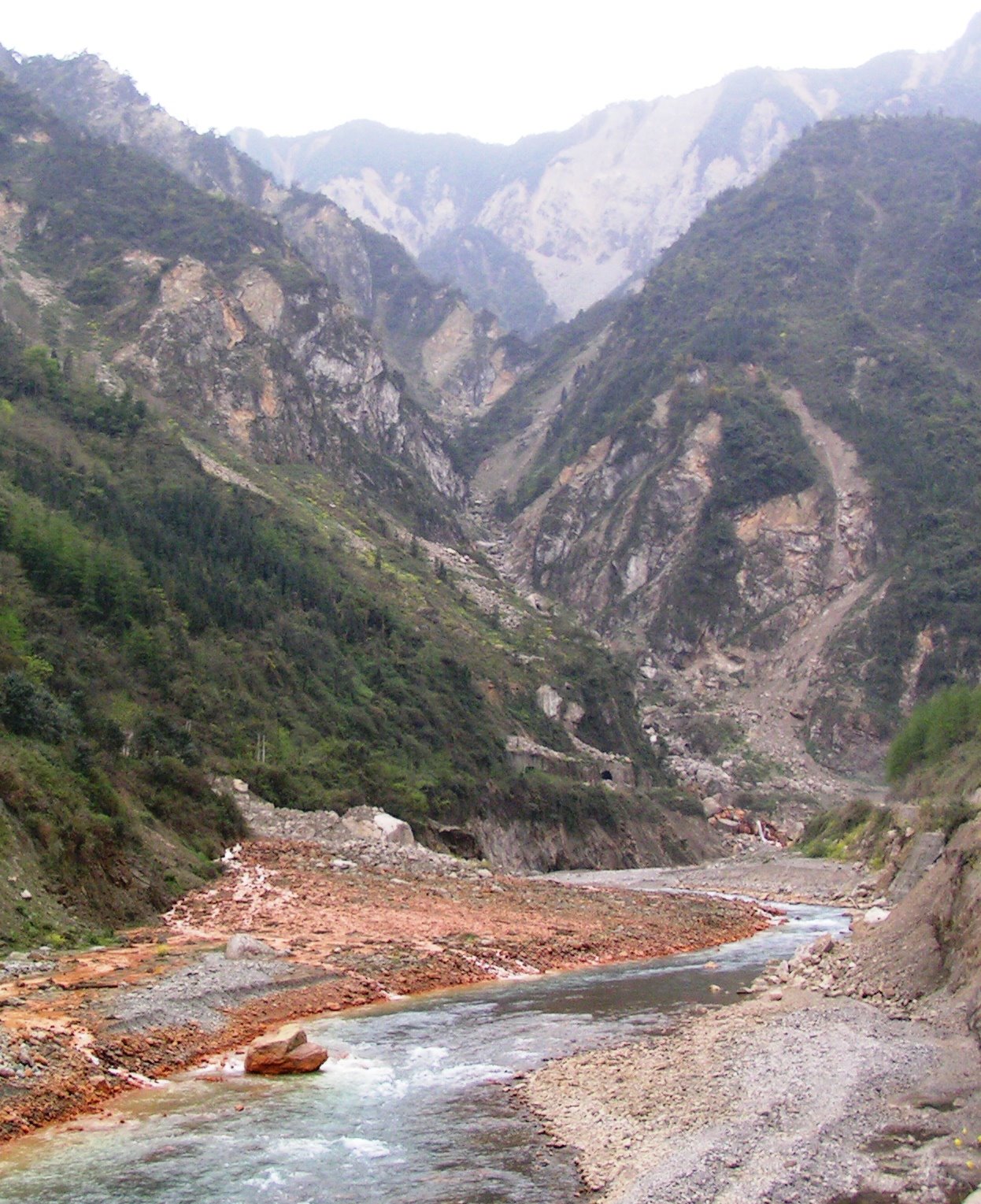
 Coal mining in China has a dreadful environmental and safety record, so one wonders what happened to the miners when the earthquake struck. In fact, the impact that the mine is having on the environment is pretty clear – the red colours here are acid mine drainage, associated with acidic water coming from the underground workings. Note the extensive earthquake triggered shallow rockslides in the background too:
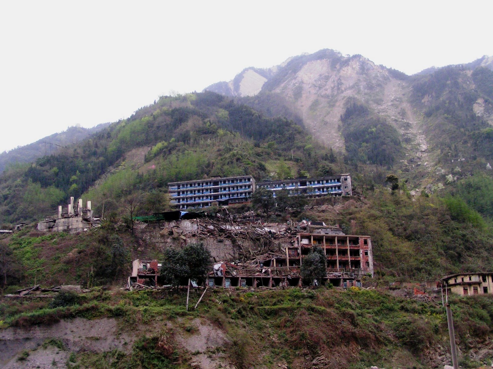
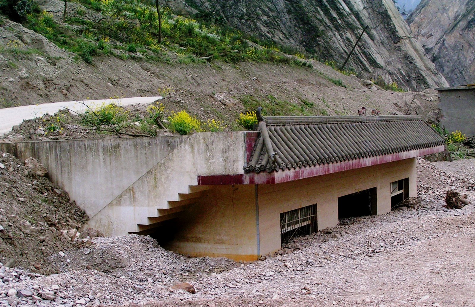
 There has also been a huge amount of damage to buildings, such as this school:
 Unfortunately, destroyed buildings create a huge volume of waste material that is very hard to dispose of without causing real environmental damage:

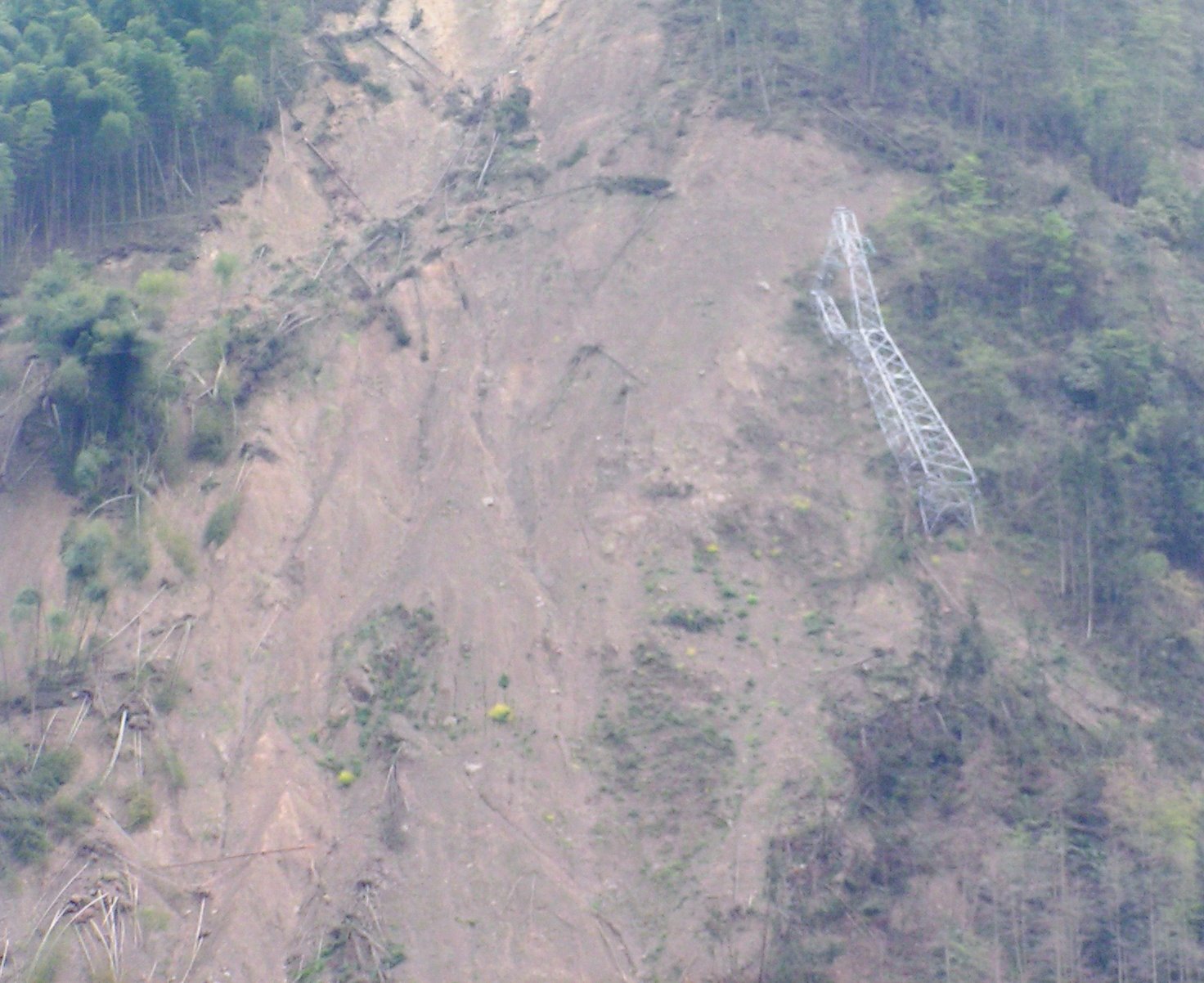
The electricity infrastructure was seriously damaged, as this pylon shows:
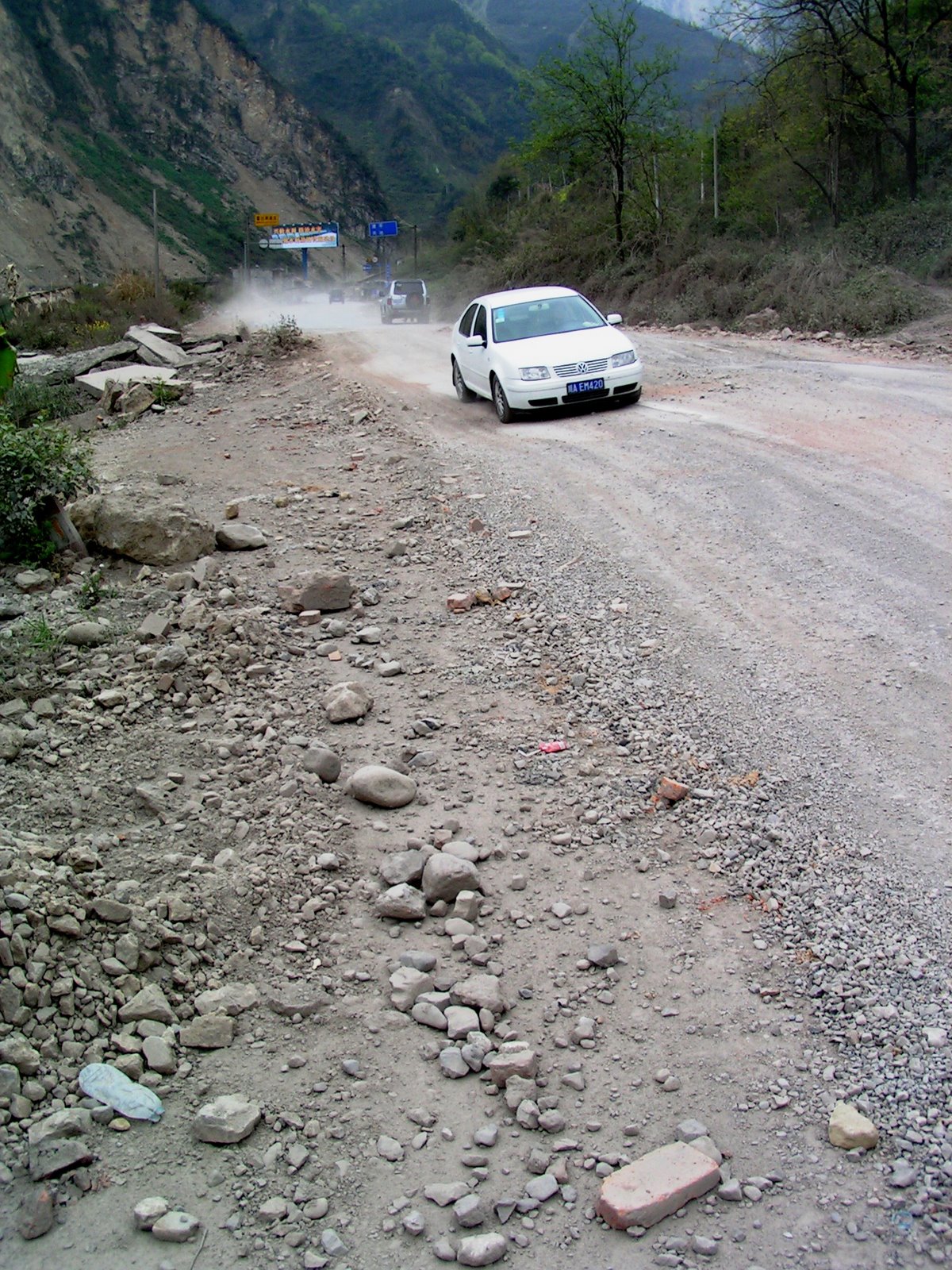
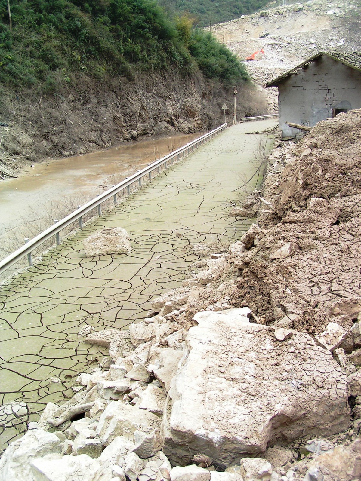
 And of course the roads are in a very sorry state in places:
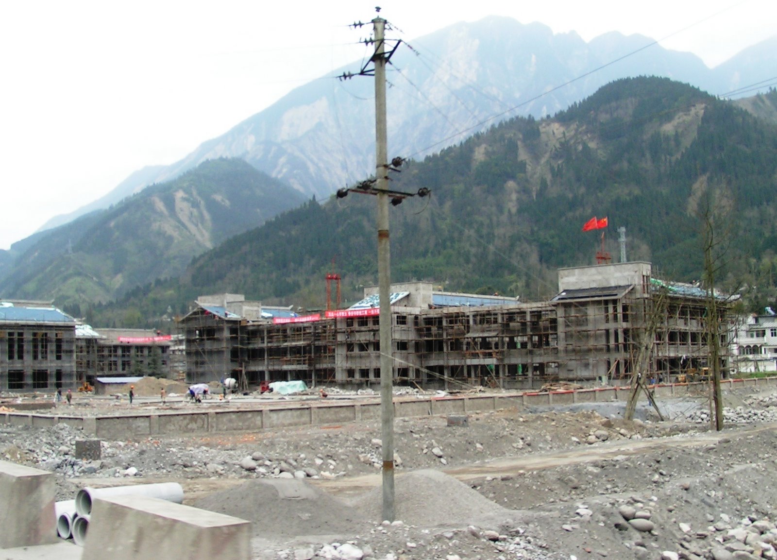
 However, there is a surprising and very impressive amount of rebuilding going on, some of which is now quite advanced:
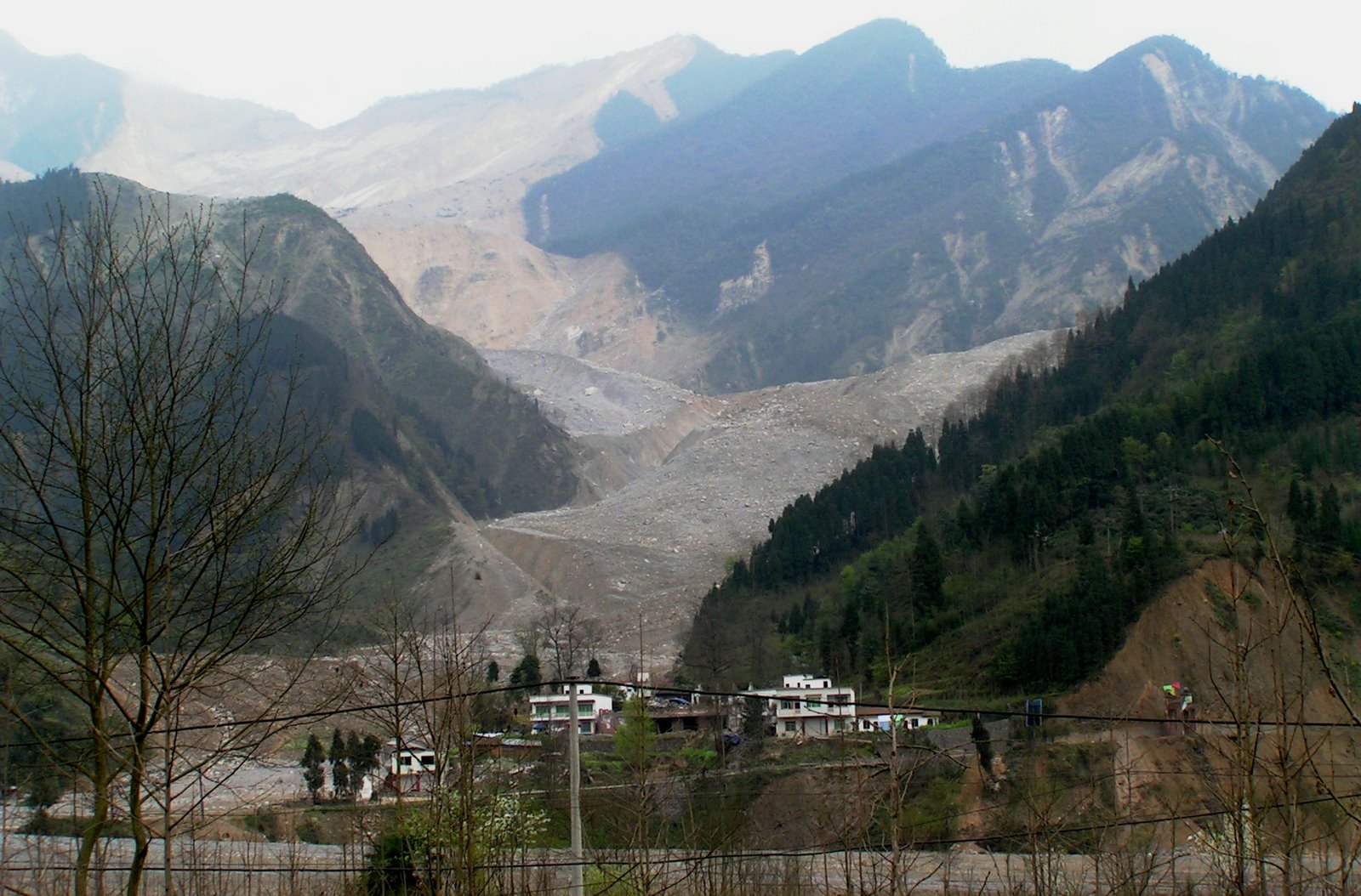
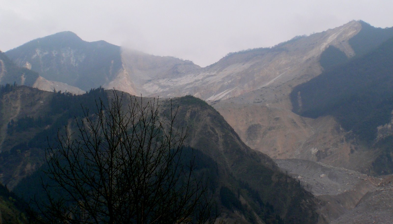
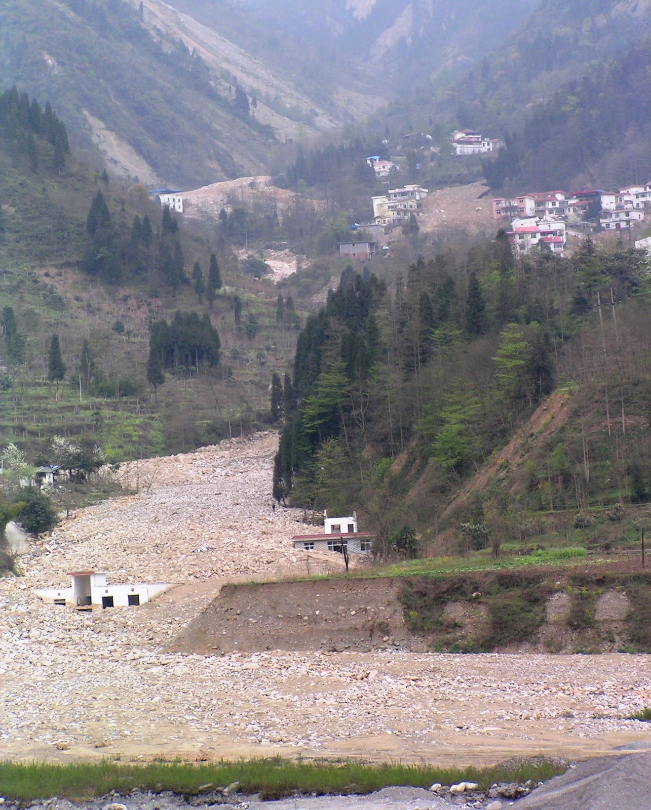
 In this valley the earthquake triggered a vast number of highly destructive landslides, some of which are quite large. This photo, taken just on the hanging wall side of the YBF, shows gives an idea of the number of slides, as well as the level of damage to buildings:
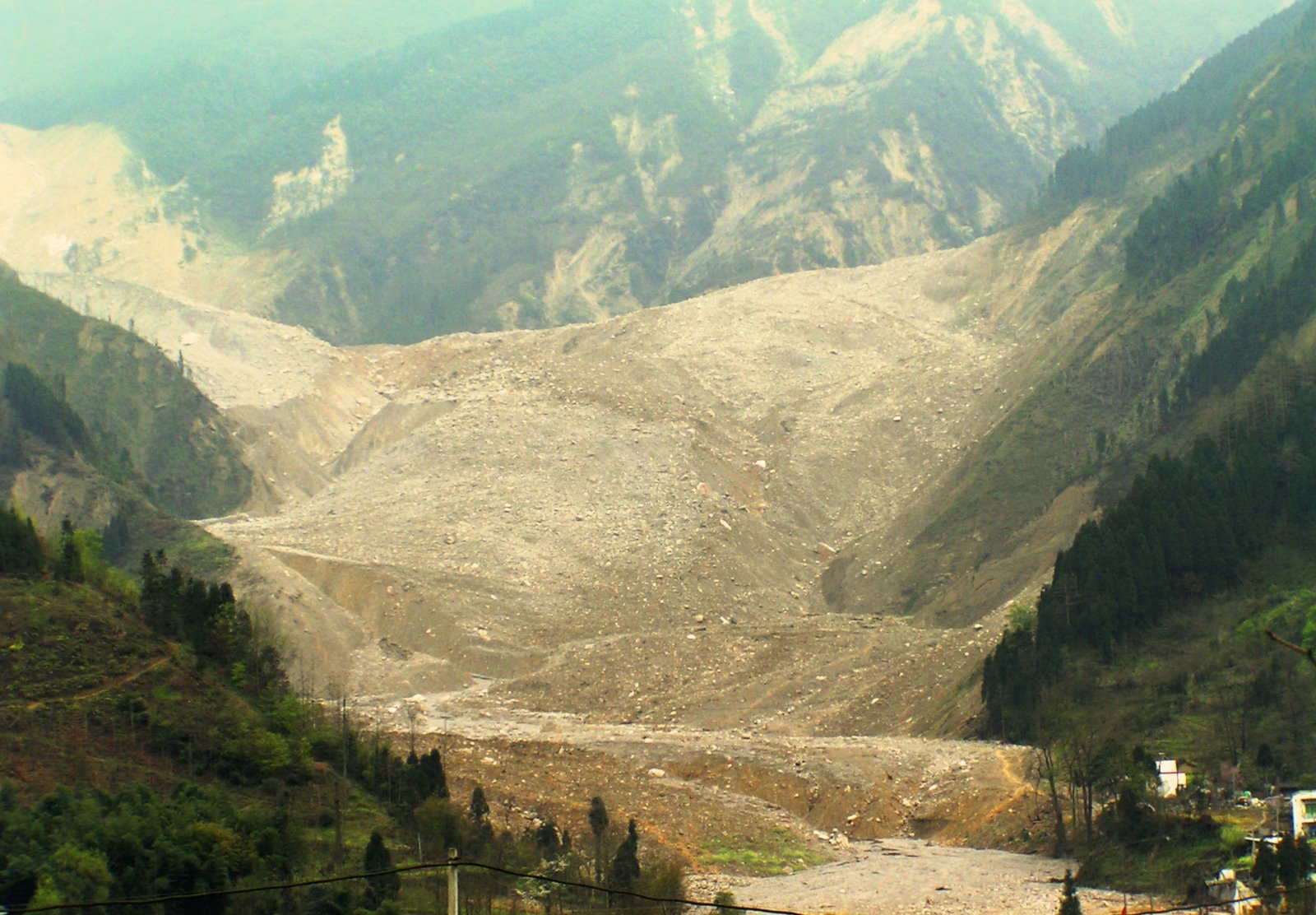
 The second largest mass movement triggered by the earthquake, the Wenjiagou landslide, occurred in this area. It is located between the two faults. This is an overview of this large and complex slide:
 The source is a dip-slope failure high up on the left side of the image. The picture below shows the source area more clearly:
 Note that on the steep scarp on the centre-left side of the image dust being blown up from ongoing rockfalls is clearly visible. The landslide slide down the dip-slope, turned to the left and travelled down the valley, and then turned to the right before running out. The movement rate must have been very high as the landslide super-elevated (banked up) as it went around the second turn, as this image clearly shows:
 About 45 people were killed by the landslide. There is now a problem here with ongoing debris flow activity – more on this below.
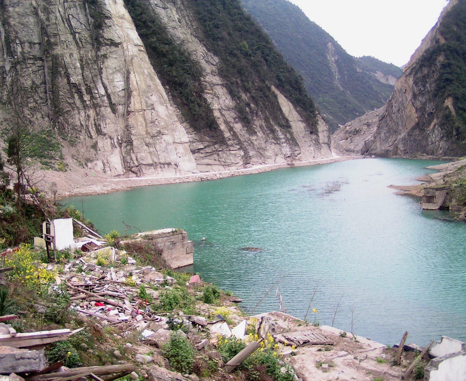
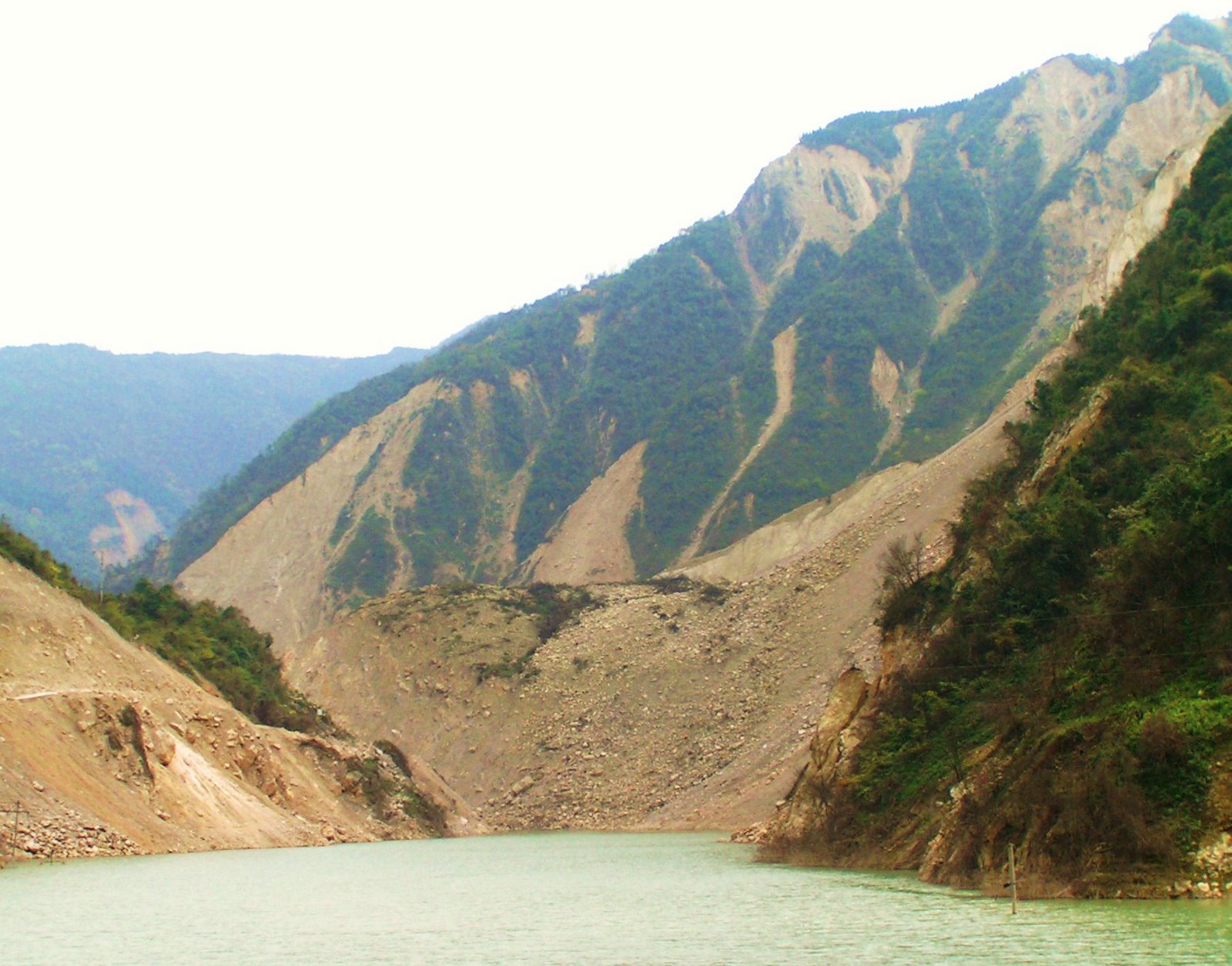
There were also some very impressive valley blocking landslides. The most visually dramatic is this one, which has created a large barrier lake:
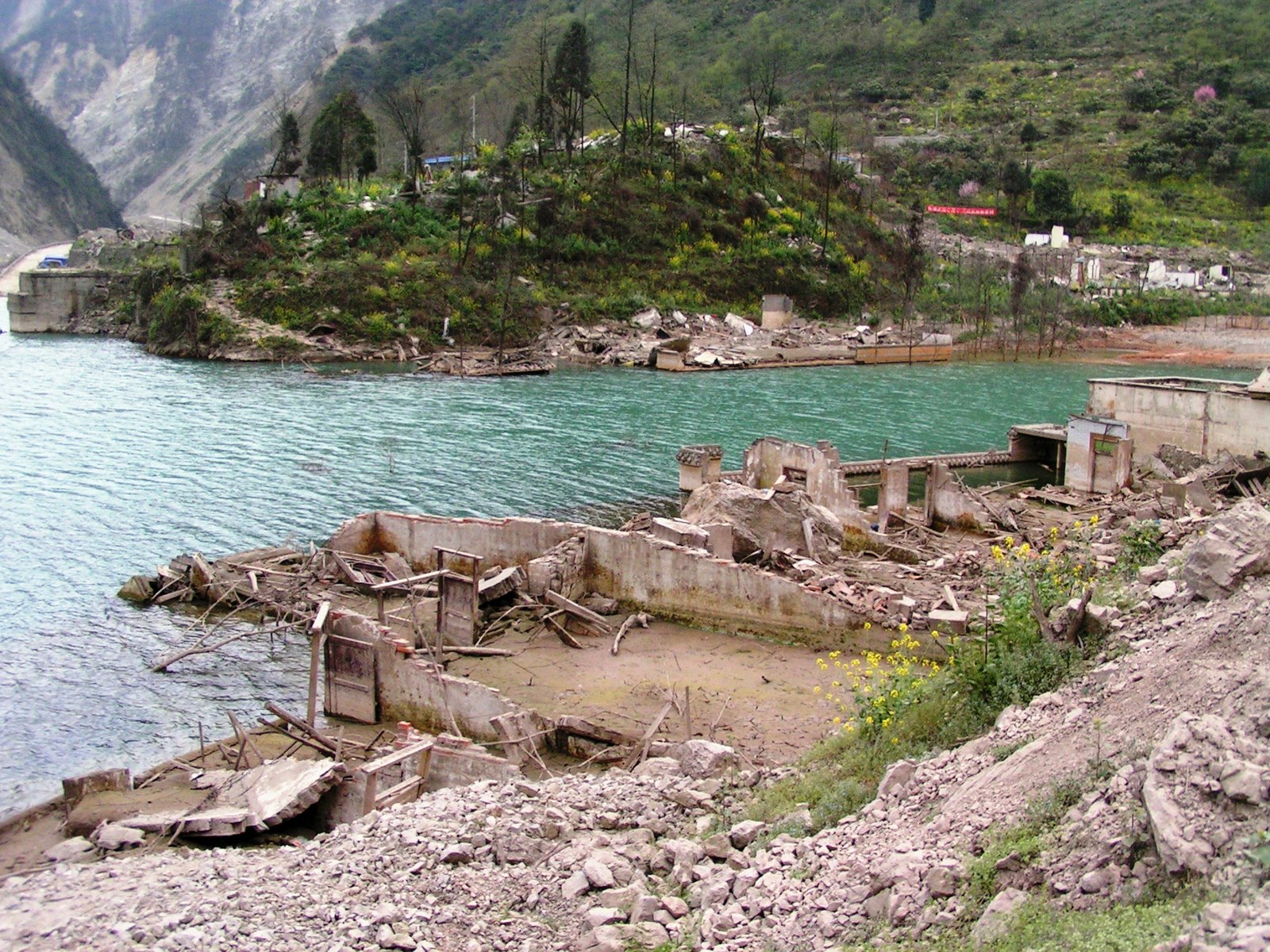
 The slide mass is evident in the gap between the cliffs on the upper centre right of the image. These barrier lakes are causing considerable difficulties (although they are not dangerous now). For example, they are causing flooding of properties and roads:
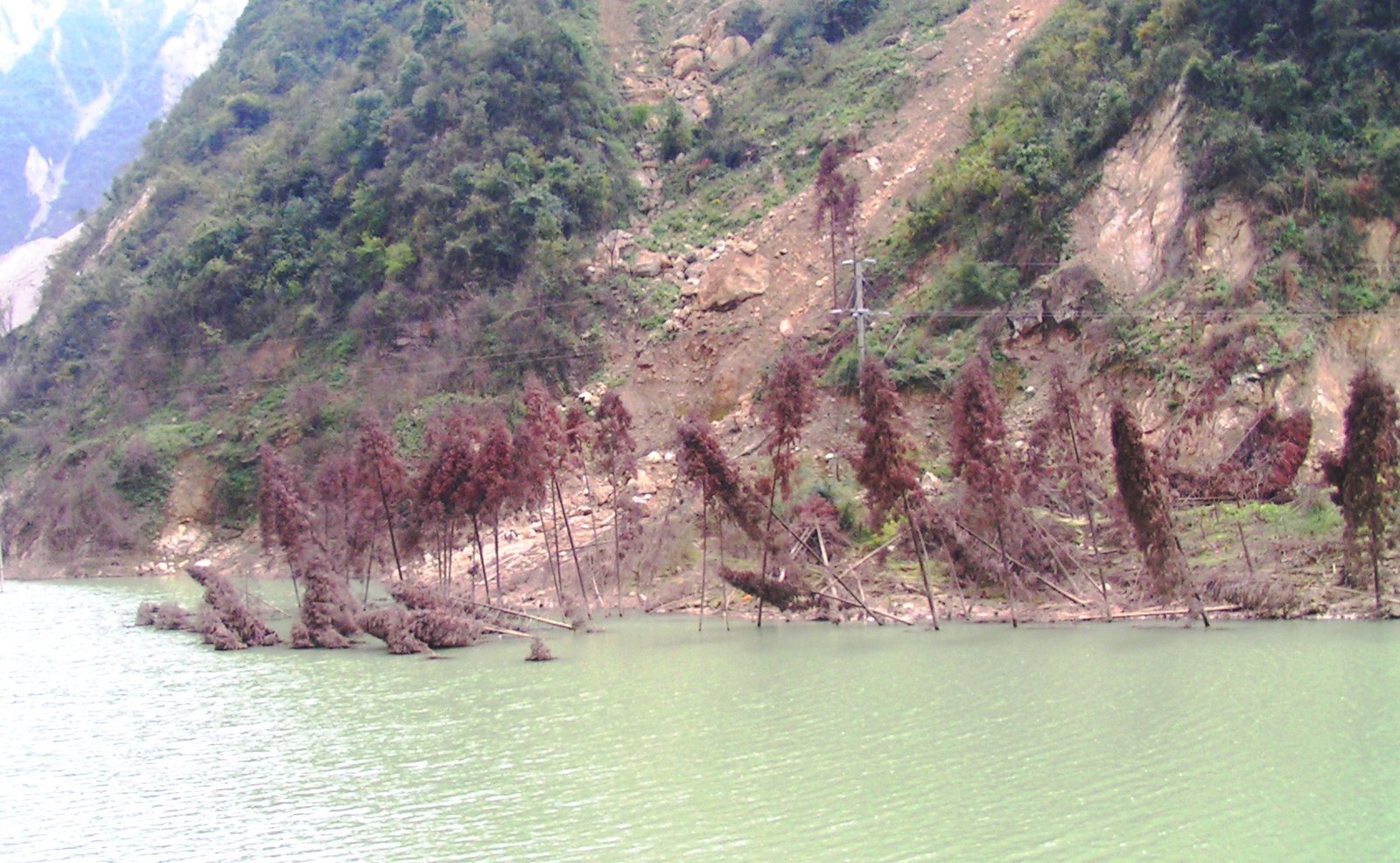
 Even the natural vegetation is being killed:
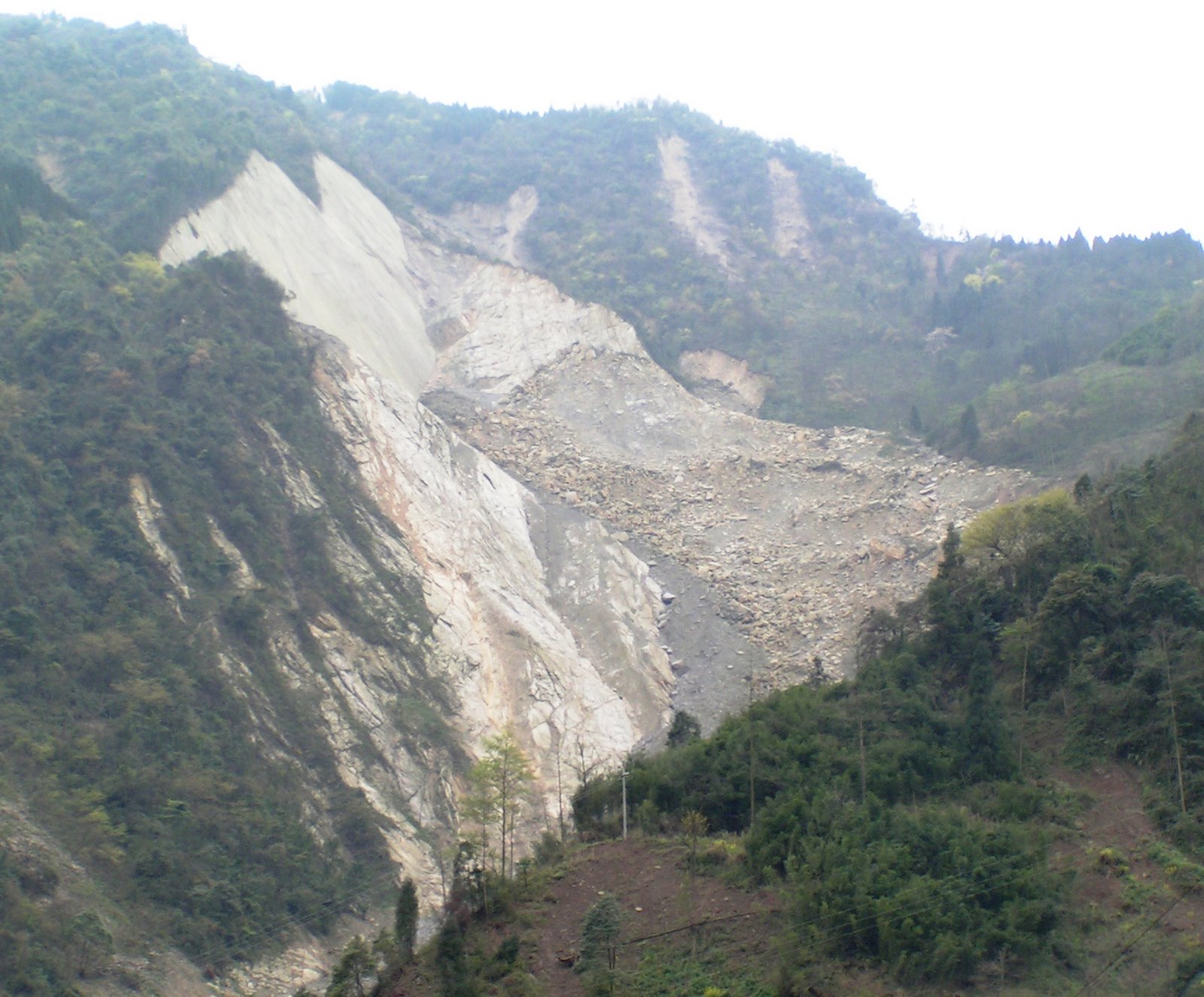
 There are several of these very large valley blocking landslides, such as this one (which is different from the one above):
 Note the multiple landslides in the background.
One of the most interesting slides lies on a tributary valley to the main one. This is a c.1 km long rockslide that has created a very tall but restricted debris pile:
 This slide appears to have originated as a wedge failure controlled mainly by a bedding plane that has then changed direction and slid into the valley. In the foreground is a school – it is lucky that the slide did not spread. The bedding plane is pretty clear on this image:
 The landslide blocked the valley to a height of over 50 m. A lake built up behind the blockage, but in this case drainage has not been necessary as water flowed through the rock dam. The muddy sediments laid down in the lake show this very clearly:
 And there are natural markings and pieces of debris showing the old lake levels on the valley sides:
 Finally one of the major problems that lies ahead is that of ongoing landslide and debris flow activity, and the resultant impact on the river systems. There are already plenty of signs that these problems are very serious indeed:

 Your comments, thoughts and corrections, and indeed you general impressions, are very welcome. Please feel free to use the pictures in lectures and seminars, but please do acknowledge me. I retain copyright on the images.
Finally, just a reminder that this is the fourth part of my photographic description of damage caused by the Sichuan earthquake. The other parts are as follows:
Part 1: Beichuan town
Part 2: The Tangjiashan landslide
Part 3: Hanwang town
Part 4 (this part): The Mianyuanhe area
Part 5: The Xingyiu area
 Dave Petley is the Vice-Chancellor of the University of Hull in the United Kingdom. His blog provides commentary and analysis of landslide events occurring worldwide, including the landslides themselves, latest research, and conferences and meetings.
Wow — a superb contribution. Thanks so much for sharing these images and analysis!
Wow! Dave, your Sichuan special feature is really amazing. There is still so much to learn from this event.Regards, Christoph