
30 March 2009
Images from the Sichuan earthquake part 5 – Xingyiu
Posted by Dave Petley
This is the fifth and last part of my photographic description of damage caused by the Sichuan earthquake. The other parts are as follows:
Part 1: Beichuan town
Part 2: The Tangjiashan landslide
Part 3: Hanwang town
Part 4: The Mianyuanhe area
Part 5 (this part): The Xingyiu area
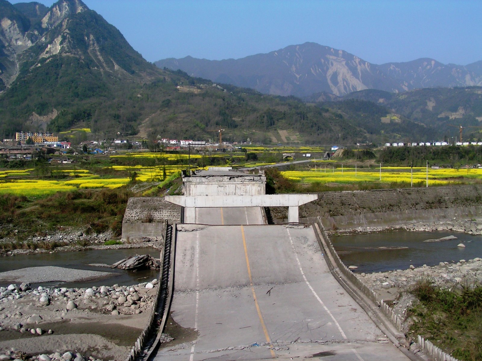
This final section shows images from a visit to the Xingyiu area, which is quite close to the main epicentral region. In this area the main fault rupture appears to sit just out on the plain, being picked out by the line of a river. This is of course bad news for any bridges in the local area. This one has been impacted twice. First, the displacement on the fault has cut through one section of the bridge itself, uplifting one half compared to the other:

The fault runs through the abutment in the foreground, which has been lifted up about 1.5 metres to form this scarp. In addition, because the fault was so close to the fault the bridge was also intensely shaken. As a result, a few of the decks collapsed completely:
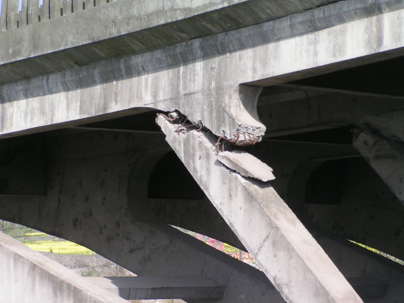
 Parts of the bridge do show rather nicely the advantages of having rebar in the concrete (these are steel reinforcing rods). Here the concrete has failed completely but the bridge has been prevented from collapsing by the rebar:
Fortunately, at this site rebuilding is well under way – a new bridge is already half constructed (it is visible in the background of the image below). The rush presumably is to get the structure open before the summer rains, when the river bed crossings will become very difficult:

The local authorities have turned the bridge into a memorial and have erected a monument to the event. Note the rockslope failure in the background.
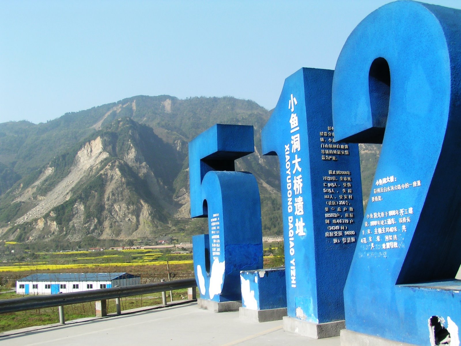
Of course because the fault is in the plain, the mountain front was on the hanging wall block, which means that it was very seriously shaken in the earthquake. This is reflected in the presence of multiple landslides, which I have photographed through the numbers of the monument. Note the damaged town at the bottom of the image, and the temporary structures just in front of them:
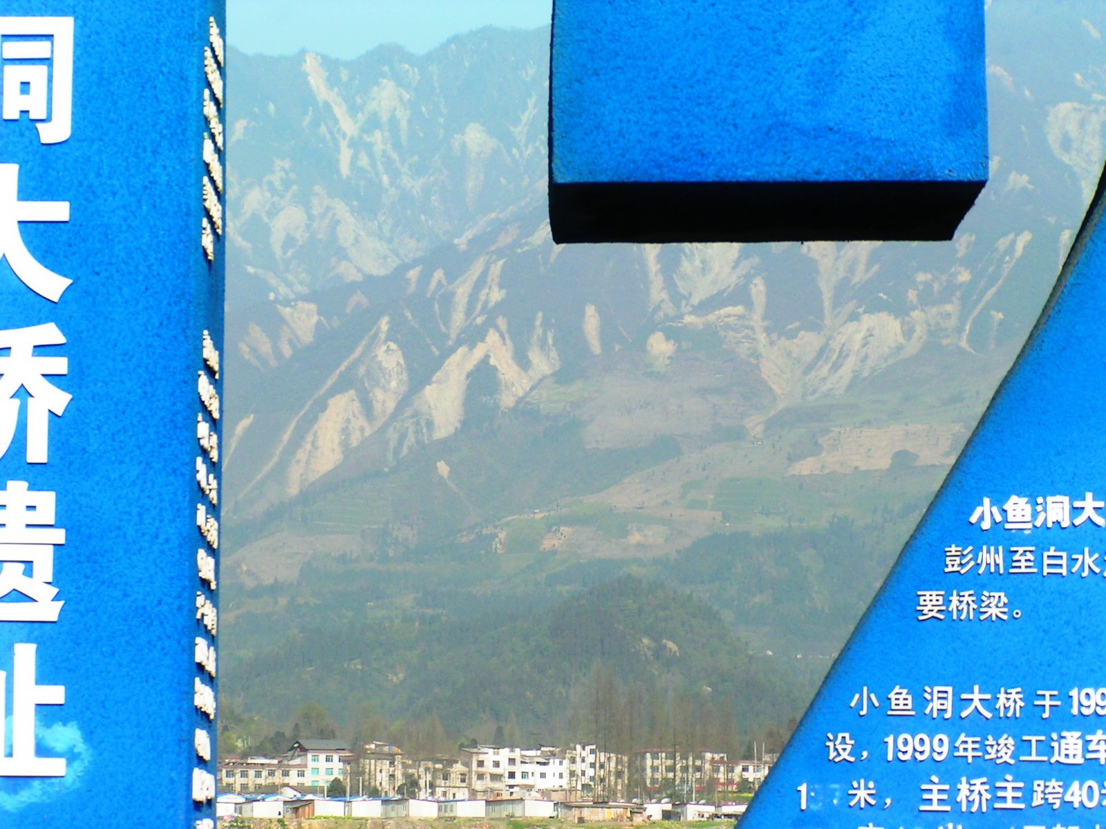
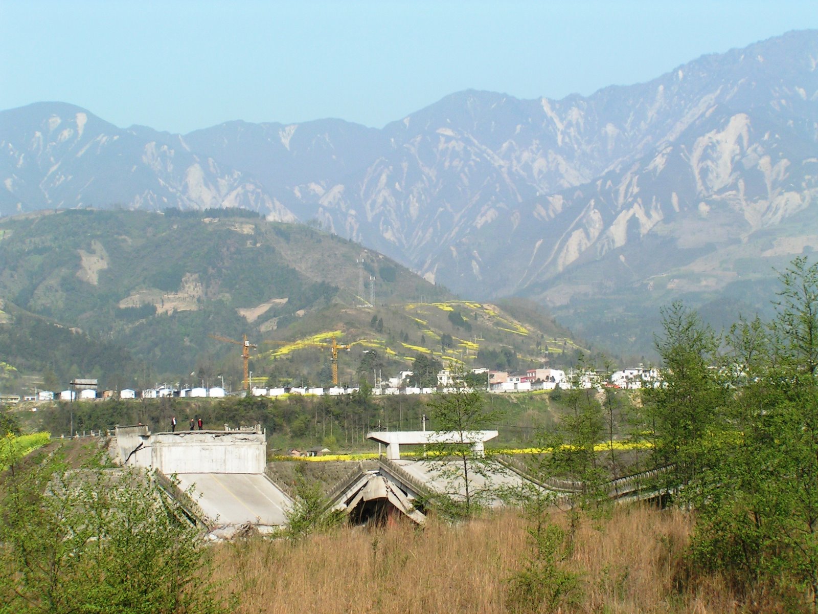
In fact the following picture gives a rather more dramatic overview of the full range of landslide impacts:
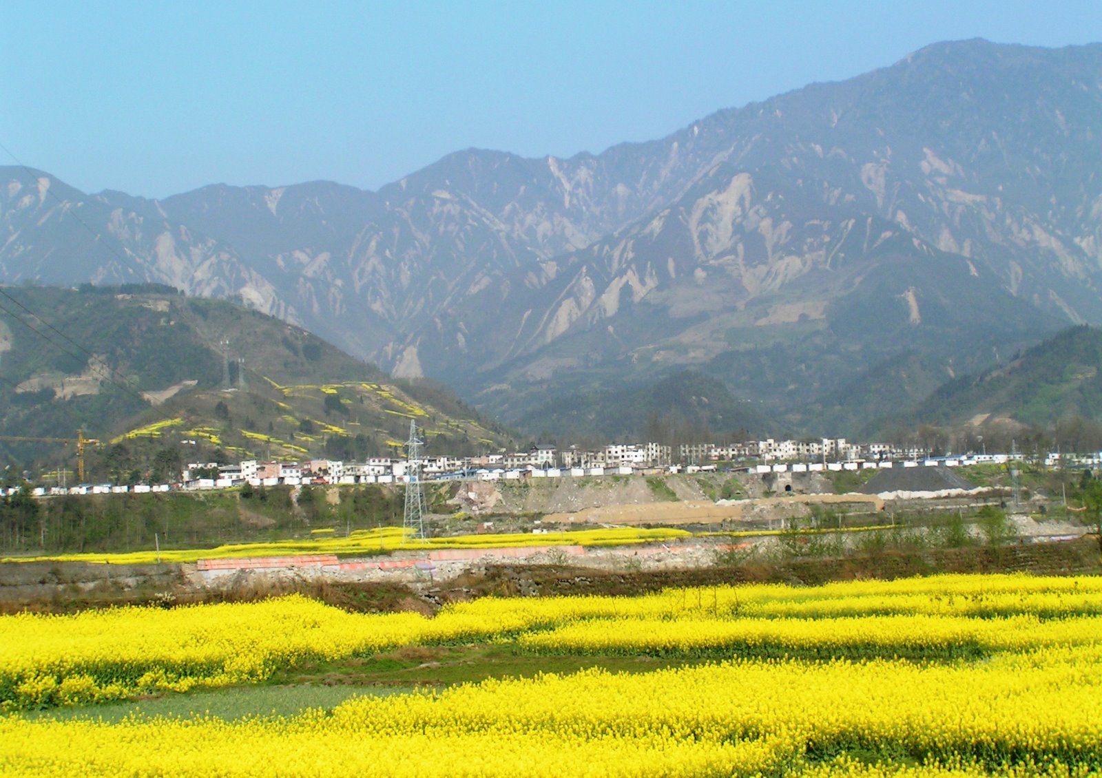
Or perhaps most usefully, this picture shows the effects of the earthquake rather better. The fault is at the bridge, which has collapsed, severing communications. The town in the middle distance has been badly affected by the earthquake shaking – the damaged buildings and temporary structures are visible – and finally, in the background, lie the earthquake induced landslides:
Another section of the fault runs through one of the small towns in the area:
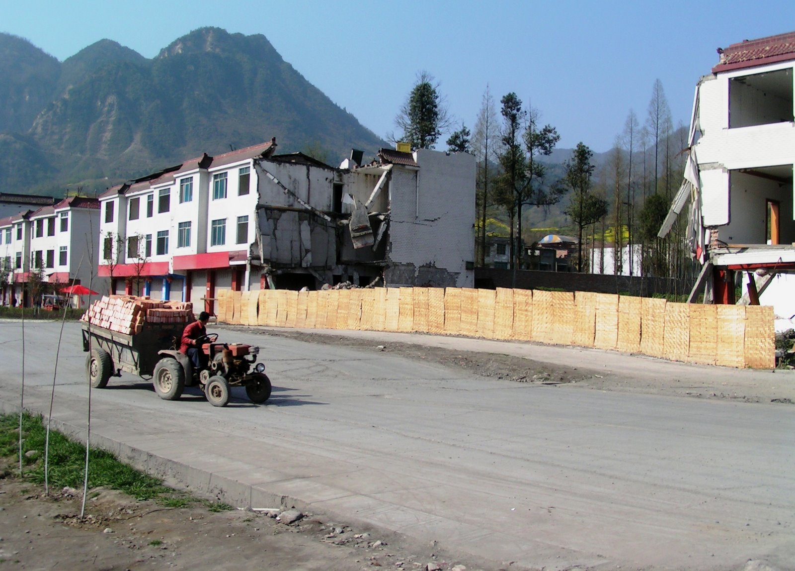
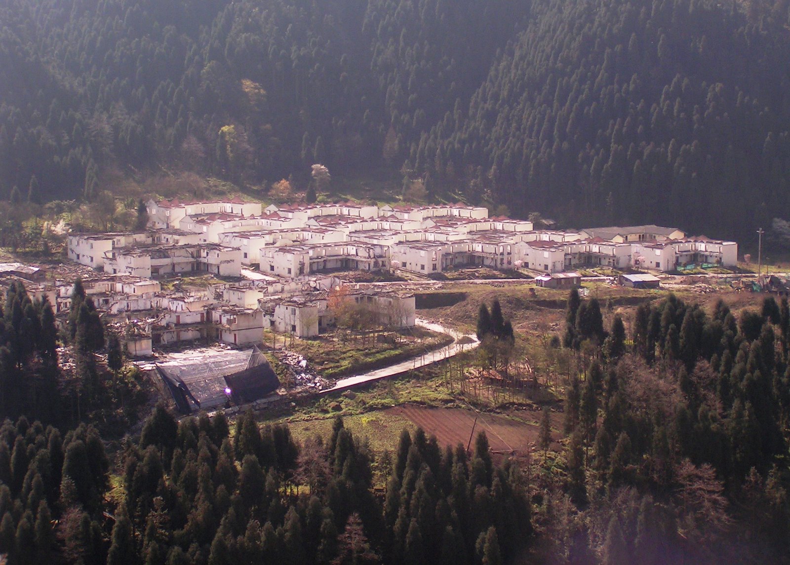
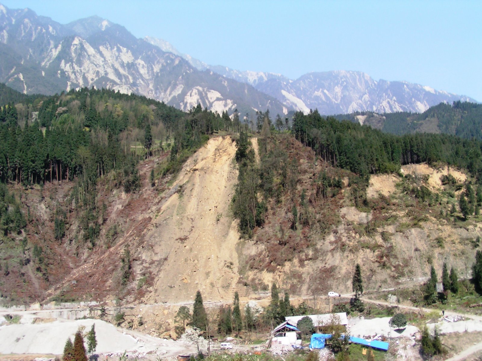
The tractor is on the trace of the fault (note the ramp and the cracks in the road. The buildings on the fault have collapsed completely, those near to it are intact but so badly damaged that they have had to be abandoned. In the mountains the picture is even worse. Here, whole communities have been devastated and hav
e had to be abandoned. For example, in this settlement every building is very seriously damaged. There is clearly no-one living there now, and rebuilding has yet to start here:
In this area, which is quite beautiful actually, despite the devastation (mind you the weather helped as the pictures show), there was one very large landslide that created a barrier lake. This is a high speed rather complex earthflow, which has a steep rockslope source. The picture below provides quite a reasonable overview of it. The source is a steep rock wall. The main flow has come down a moderately steep gully to enter the main channel, which was duly blocked.

The complexity here is in the volumes, as you can probably see that although the rockslope is large, the amount of material that has detached from it is nothing like enough to have created this enormous deposit at the toe. My interpretation is as follows:
1. The landslide started with a substantial rockfall (or several rockfalls perhaps) from the back wall of the landslide. This is shown quite well in the following image:

2. At the toe of the slope was located a large body of old landslide and rockfall material. This was probably holding quite a large amount of water below the surface. The sudden fall destabilised this material, which started to flow. Note that the rock debris that can be seen in the picture above is mostly weathered (there are a few fresh fragments too, but not much), reflecting the fact that most of this material had been sitting on the hillside for a long period. This steep upper track is shown in the image below. Note also the very small volume of material at the toe of the rockslope, even though the face has clearly undergone wide scale rockfalls. This indicates that most of the rockfall material fell onto the landslide below before it moved, and was then carried downhill, supporting the notion that the trigger for the main slide was the rockfalls from the back wall.

3. As the slide moved down the slope it loaded and these entrained material along its track. In the image below you can clearly see how the landslide has eroded and entrained material along its track:

The landslide buried several houses towards the toe of the slope, killing the occupants. Several other houses very narrowly escaped being buried. The pile of debris behind the house is the landslide:

4. Finally, the landslide stopped in the valley allowing the formation of a barrier lake, the last vestiges of which can still be seen:
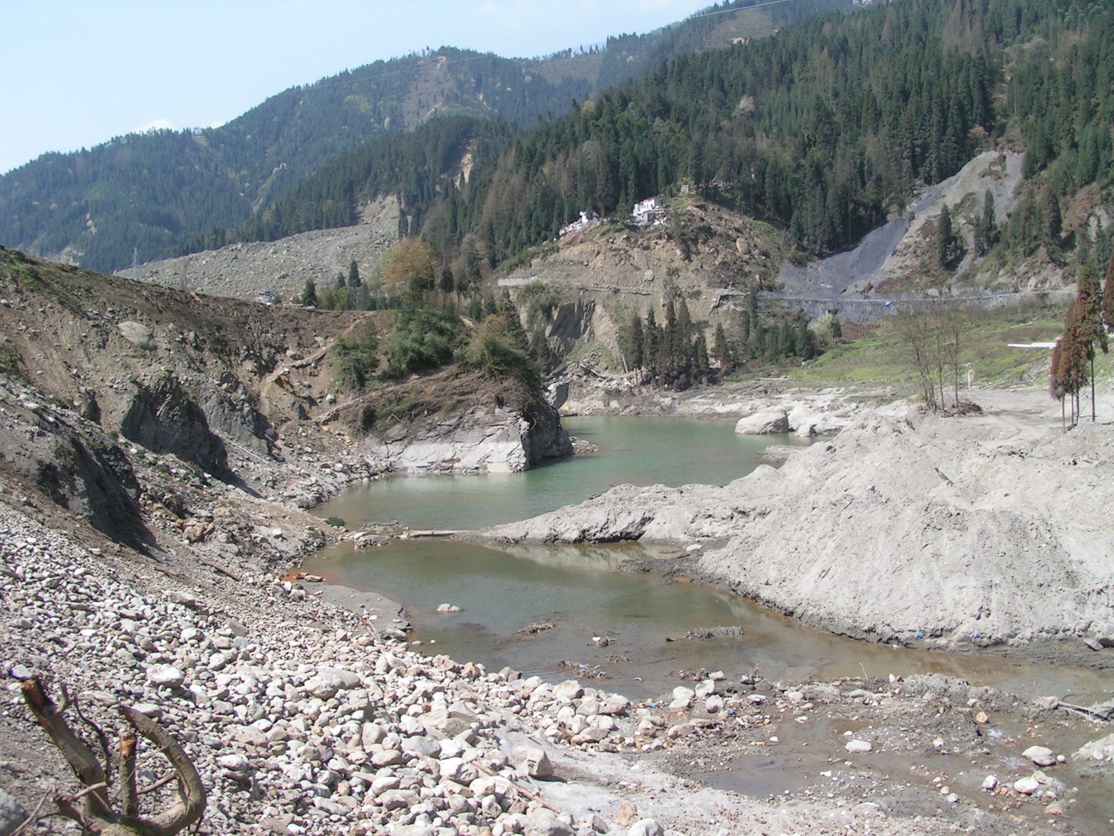
Note the landslide on the upper left side of the image, and the signs of the previously higher water level left on the rockwalls beside the lake. Of course, this was not the only landslide in this mountainous area. There are many other examples:
Finally, one of the great threats here in the aftermath of the earthquake is wholescale environmental damage. This is shown below, where local people are harvesting trees to be used in rebuilding. I mean no criticism by this (it is a very understandable thing to do), but the impacts could be severe:

That completes my photographic description of damage caused by the Sichuan earthquake. The other parts are as follows:
Part 1: Beichuan town
Part 2: The Tangjiashan landslide
Part 3: Hanwang town
Part 4: The Mianyuanhe area
Part 5 (thia part): The Xingyiu area
Of course there is a lot more that I could included – I will return to specific issues over the next few months. There are still some surprises up my sleeve…
Comments, corrections and requests are very welcome. Finally, thanks to my friends at the State Key Laboratory for Geohazards at the Chengdu University of Technology for arranging my visit and looking after me so well.
 Dave Petley is the Vice-Chancellor of the University of Hull in the United Kingdom. His blog provides commentary and analysis of landslide events occurring worldwide, including the landslides themselves, latest research, and conferences and meetings.
These pictures are pretty disastrous. I just head about the incidence but never got to see the exact situation. Whatever, i was too concerned about the bridge construction isnt seems to be a high quality work. I guess the material used isnt of good quality.
no pictures Dave do I need to load an item to see them ?Sichuan instant today 29 30 June 2009 USGS 5.1 Richter as the people have left in part is Sichuan liable to these recent Pacific Russia Greece Atlantic events as it has much derelict structure from the last eventMike Stagg