March 15, 2017
Klippi Glacier Retreat Causes Separation, British Columbia
Posted by Mauri Pelto
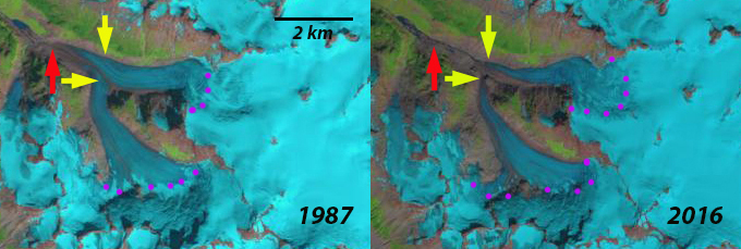
Klippi Glacier in Landsat images of 1987 to 2016. Red arrows indicate 1987 terminus, yellow arrows 2016 terminus and purple dots the transient snowline.
The glacier beings at 2600 m sharing a divide with Klinaklini Glacier, flowing northwest from Silverthrone Mountain and terminating at 1040 m in 1987. Klippi Glacier drains into the Machmell River, Owikeno Lake and then River Inlet on the British Columbia Coast. The Machmell River is an important spawning area in its lowest 20 km, particularly for sockeye salmon, with chinook, coho, pink and chum salmon also present The Machmell River is accessible to anadromous fish to the cascades just downstream of junction with Pashleth Creek, where runoff from the Pashleth Glacier enters (Hillaby, 1998). The Rivers Inlet sockeye stock is the second largest in BC and has recently received much attention because of a dramatic decline in total abundance from the 1980s. In the 1980’s Machmell River escapement numbers averaged 20,000, dropping to 5000 in the 1990’s (Rutherford et al 1998). This has led to an ecosystem study by UBC and SFU of Rivers Inlet. Rivers Inlet in the 1970’s began to experience sockeye population decline. Harvest rates were reduced in the 1980’s and the commercial fishery closed in 1996. In 1999 the stock reached a record low of ~ 3600 fish, just 0.1% of historic levels (Rivers Inlet Ecosystem Study). The commercial fishery has remained closed since 1996, with a small amount of fishing permitted by the Wuikinuxv First Nation for cultural purposes, the stock has not recovered.
Here we examine the response of this glacier to climate change from 1987-2016 using Landsat imagery. In 1987 Klippi Glacier’s two main tributaries joined 1.8 km from the terminus, red arrow in each image. The transient snow line was at 1800 m, purple dots. By 1995 the glacier had retreated 750 m but still had a joined terminus. The transient snowline remained close to 1850 m. In a 2012 Google Earth image the tributaries are still connected, but barely as a drainage stream has nearly isolated them. The lower 800 m of both glaciers illustrate limited crevassing and significant downwasting. By 2016 the tributaries had separated with a retreat of 1400 m since 1987. The transient snowline in 2016 was at 1900-1950 m. The glaciers will continue to retreat due to high snowlines in recent years with each of the last three years being above 1950 m by the end of the melt season. The retreat here is similar to that of other valley glaciers in the region Jacobsen Glacier and Bridge Glacier.
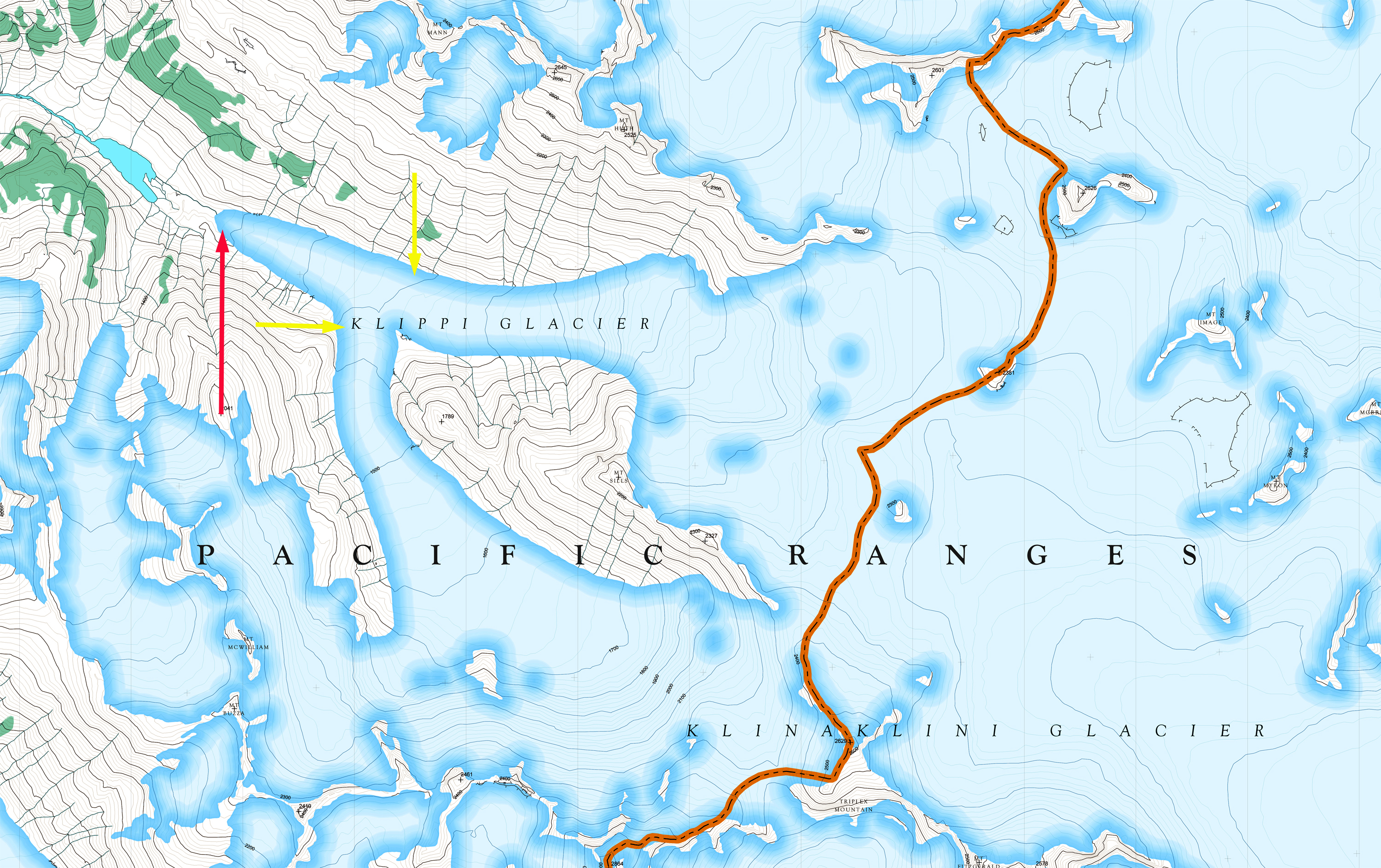
Map of the Klippi Glacier region reflecting the 1980’s terminus position of the glacier. Red arrows indicate 1987 terminus, yellow arrows 2016 terminus
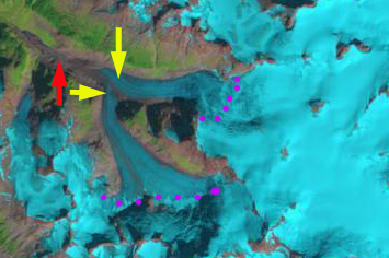
Klippi Glacier in Landsat image from 1995. Red arrows indicate 1987 terminus, yellow arrows 2016 terminus and purple dots the transient snowline.
2012 Google Earth image of the terminus area of Klippi Glacier. Yellow arrow indicate 2016 terminus location.


 Dean of Academic Affairs at Nichols College and Professor of Environmental Science at Nichols College in Massachusetts since 1989. Glaciologist directing the North Cascade Glacier Climate Project since 1984. This project monitors the mass balance and behavior of more glaciers than any other in North America.
[…] glacier runoff. The challenge for the salmon will continue to be in the ocean. The neighboring Klippi Glacier retreated 1400 m from 1987-2016, with the two main branches having separated and also feeds the […]