16 December 2022
A major, deadly landslide in Genting Highlands, Malaysia
Posted by Dave Petley
A major, deadly landslide in Genting Highlands, Malaysia
On this, the 15th anniversary of the Landslide Blog, there is tragic news of a major landslide in the Genting Highlands of Malaysia. The situation remains dynamic as I write, but it is clear that the landslide inundated a campsite at a location known as Father’s Organic Farm. News reports indicate that there were 81 people registered to stay at the site, 30 of whom were children, plus of course a number of staff. In total 53 people have been reported to have been rescued. As I write, there are 16 confirmed fatalities, with a further 17 believed to be missing. These numbers will change in the coming hours.
There are some videos on Twitter collected via drones showing the configuration of the landslide. These videos in particular are revealing:-
KEMASKINI KEJADIAN TANAH RUNTUH SEHINGGA JAM 1041 HRS ;-
Jumlah keseluruhan (94) orang, (60) dijumpai selamat, (9) meninggal dunia, (25) masih belum dijumpai. pic.twitter.com/gxcvotFtIz
— BERNAMA TV 🇲🇾 (@BernamaTV) December 16, 2022
.
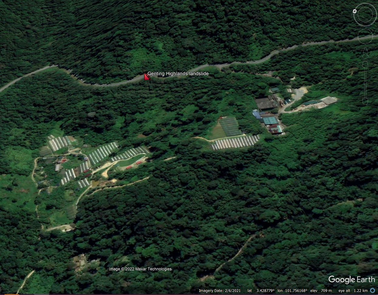
Based on these videos I believe that the site of the landslide is at 3.423, 101.757. This is my interpretation of the location on Google Earth:-

Google Earth image of my interpretation of the site of the 16 December 2022 landslide at Genting Highlands in Malaysia.
.
The landslide occurred at 2:42 am, which sadly will have amplified the human cost of the disaster – to be in tents that are struck by a high mobility landslide in the dark is true horror.
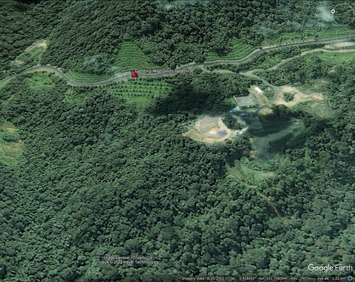
There is already considerable speculation in Malaysia about the likely causes of this tragedy. I suspect that there might be a hint in the archive of Google Earth images, although I can only hypothesise at this point. This image, from 2002, is extremely interesting. As above, I have marked the site of the landslide:-

Archive Google Earth image, from 2002, of my interpretation of the site of the 16 December 2022 landslide at Genting Highlands in Malaysia.
.
It appears to me that the slopes both above and below the road have been engineered. The videos indicate that the slope above the road remains intact, but the slope below the road has failed. The 2002 Google Earth image would seem to indicate that the slope was terraced. I wonder if this was a fill slope, and that the fill has failed to generate the landslide. This would explain the location, the dynamics and the impact of the landslide.
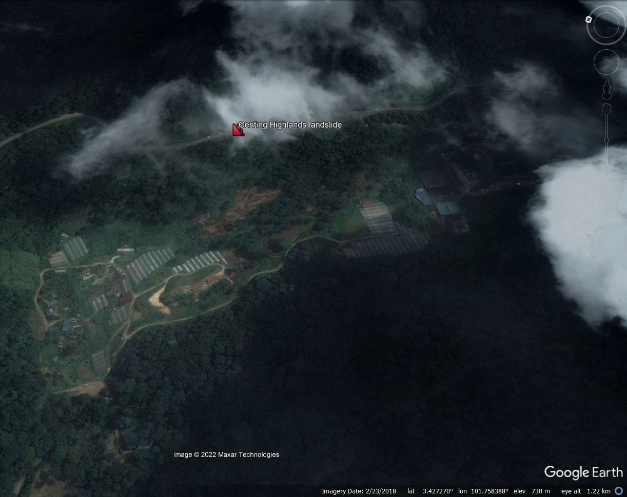
The second element that is interesting is from a 2018 Google Earth image, although the quality is not great:-

Archive Google Earth image, from 2018, of my interpretation of the site of the 16 December 2022 landslide at Genting Highlands in Malaysia.
.
In this image there appears to be bare soil at or close to the toe of the postulated fill slope. It is not clear to me as to what was happening at this time – in subsequent images this area has revegetated, but this needs investigation.
JKR Malaysia Slope Engineering branch has responsibility for analysing these types of events, and a team is reported to be on site today. I am sure we will see a full interpretation of the causes of this landslide in due course. Meanwhile, the recovery work will continue, but sadly the likelihood of further successful rescues seems low.
.
Acknowledgement
Thanks to Riza and Liew SS for their kind emails pointing to information about the landslide at Genting Highlands.


 Dave Petley is the Vice-Chancellor of the University of Hull in the United Kingdom. His blog provides commentary and analysis of landslide events occurring worldwide, including the landslides themselves, latest research, and conferences and meetings.
Thank you very much indeed for your considerable and sustained efforts over the years to produce this blog. It is hugely helpful from both a research and teaching perspective. I hope you are able to continue for many years to come!
please stop spreading false location. its batang kali not genting highlands.
Parece un deficiente manejo de la escorrentía de la vía, que saturo el talud inferior y genero el desplazamiento del talud.