
24 February 2022
The A57 Snake Pass – closed by three landslides
Posted by Dave Petley
The A57 Snake Pass – closed by three landslides
The major road between my home town of Sheffield and the major city of Manchester – two of the largest cities in the north of England – is the A57 Snake Pass. This road, shown on the Google Earth image below, passes through the heart of the Peak District National Park. The road is single lane in each direction, sinuous and challenging (but fun) to drive.
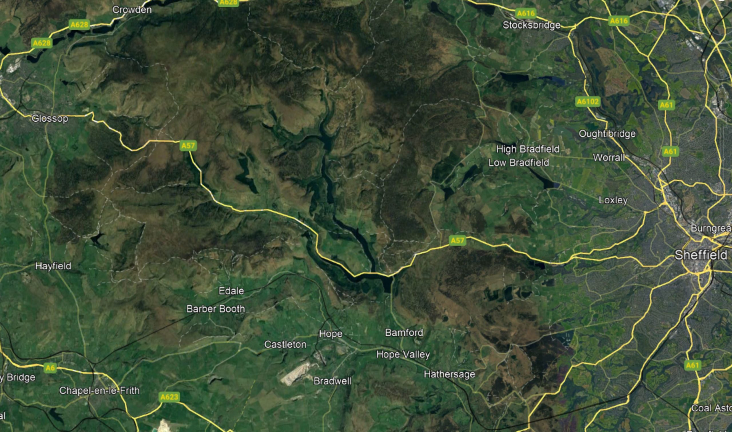
Google Earth map of the A57 Snake Pass in northern England.
.
By global standards the terrain is not high or steep, but the Peak District is subject to quite challenging winter weather, such that the road is closed for an average of 70 days per year.
An interesting aspect of the road is that it crosses a number of landslide complexes. I have written previously about landslides in the Peak District. Over the last weekend three names storms brought very heavy rainfall to this area. As a result three landslides have reactivated – two are previous sites of movement, but the third appears to be new but substantial – the road has reportedly dropped by two metres. Movement is reported to be continuing. The road has been closed, and reports suggest that repairs will take at least a month.
The image below illustrates the scale of the problems that face those responsible for the road. This previously glaciated area has a very complex geomorphology:-
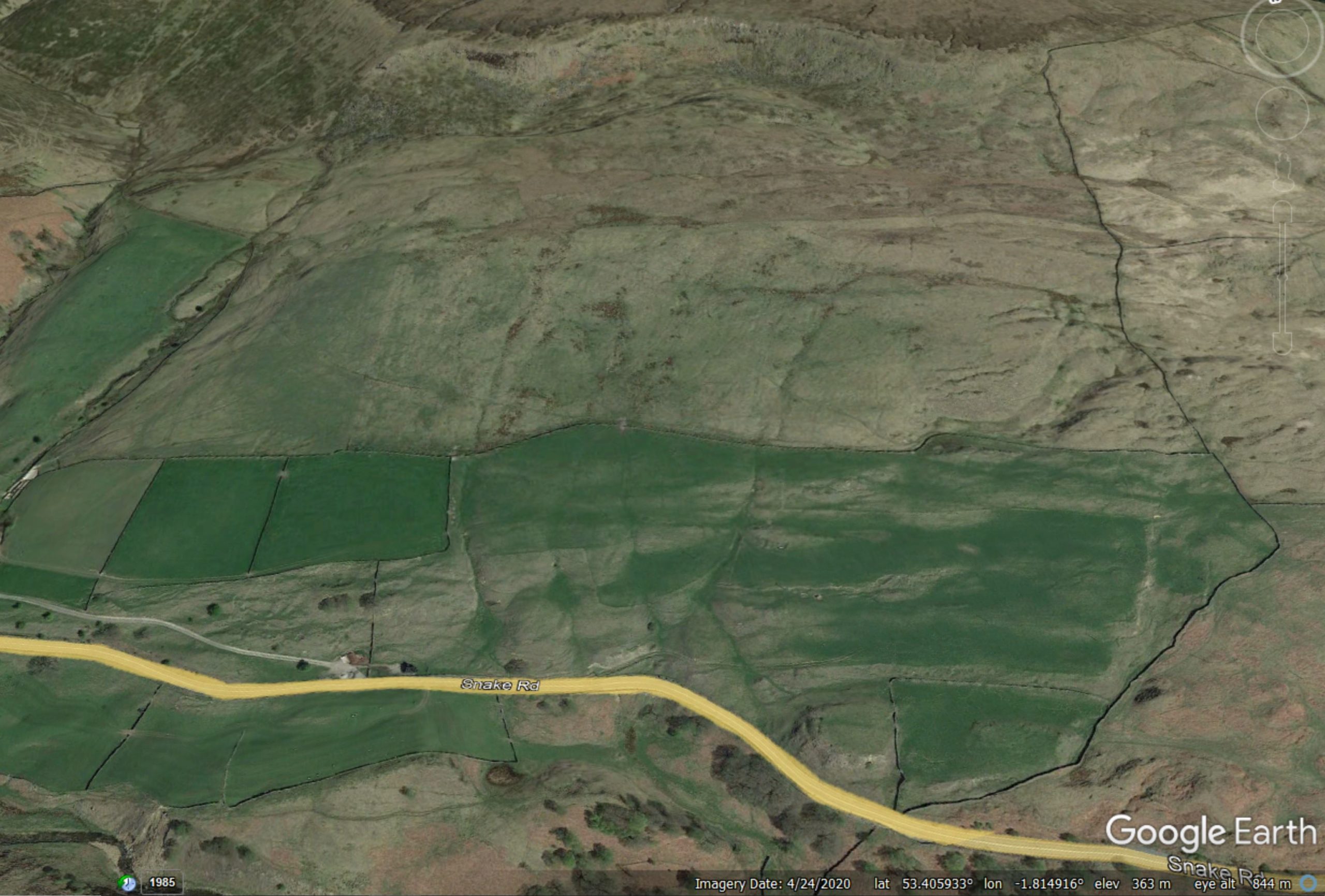
Google Earth image showing a section of the terrain in the vicinity of the A57 Snake Pass in northern England.
.
As an engineering geologist with an interest in landslides, the above image gives lots of reasons to pause for thought. The large arcuate scarp at the top of the slope is of interest for example, as are the areas of hummocky terrain across the slope. Near to the Snake Pass there are areas that look like they might have been unstable.
This pattern is replicated in numerous locations. The manifestation for the highway is a number of sections in which active movement is clearly visible. This Google Street Map image shows such a section:
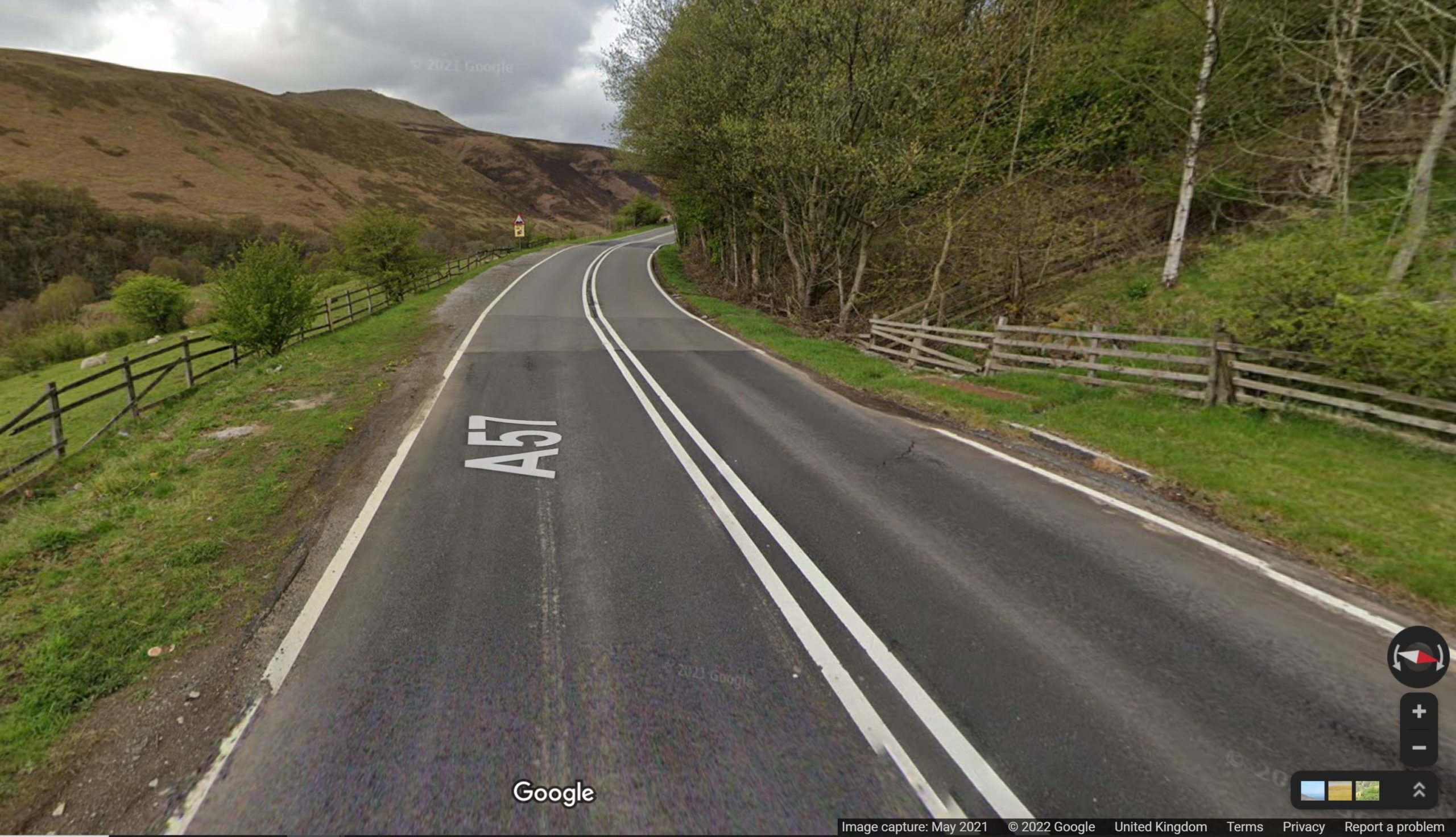
Google Street Map image of a landslide damaged section of the A57 Snake Pass.
.
Most of these landslides are ancient, pre-dating the road by centuries. However, climate change has meant that rainfall intensities are increasing, especially in the series of low pressure systems that frequently occur. It is these rainfall events that are causing the problems.
Unfortunately, this situation is likely to get worse in the coming decades. Upgrading the road is difficult in a national park. Unfortunately, users of the Snake Pass are likely to face many more road closures in the years to come.
 Dave Petley is the Vice-Chancellor of the University of Hull in the United Kingdom. His blog provides commentary and analysis of landslide events occurring worldwide, including the landslides themselves, latest research, and conferences and meetings.
This is one of those examples where the roadway is just along for the ride. No practical way to engineer ones way out of it, just adapt as best you can.
Without a total rebuild, as was necessary for some stretches along A_82, Loch Lomond, via a ‘ground level viaduct’, there’s no easy fix. Likewise, several sections of the A_830, up towards Mallaig, required heroic measures including extensive re-alignment…
At least where road is slowly slip-sliding due vast scree beneath, seen in several ‘linear’ Scottish glens, it is comparatively easy to assess. Just, yet again, re-align and buy another decade…
I went up (by car) a week ago to take some photographs but was firmly turned back just a little passed the ‘dams’ road. Only residents were allowed up. This is in contrast to a previous visit where I went up to look at the damage of (what is probably the main failure site, approximately the G Street Map location) and compare it to the major failure after heavy rain, January 2008. I’ll dig out some photos.