
17 February 2022
The very large urban landslide at Morro da Oficina in Petrópolis
Posted by Dave Petley
The very large urban landslide at Morro da Oficina in Petrópolis
Information is slowly emerging about the magnitude of losses from the landslides and flood resulting from the exceptional rainfall event in Petrópolis on Tuesday. The confirmed death toll is now 104 people, with a further 35 people reported as missing.
The comparative role of landslides versus floods is not clear at this point. There is some extremely harrowing footage of people trying to escape from buses that were being overwhelmed by flooding. But reports indicate that there were at least 170 landslides, and there is no doubt that these will have caused substantial loss of life.
The largest landslide appears to have occurred at Morro da Oficina, where an extremely large urban failure occurred. It is estimated that 80 houses were inundated. Sky News has a good image of the upper portion of this landslide:-
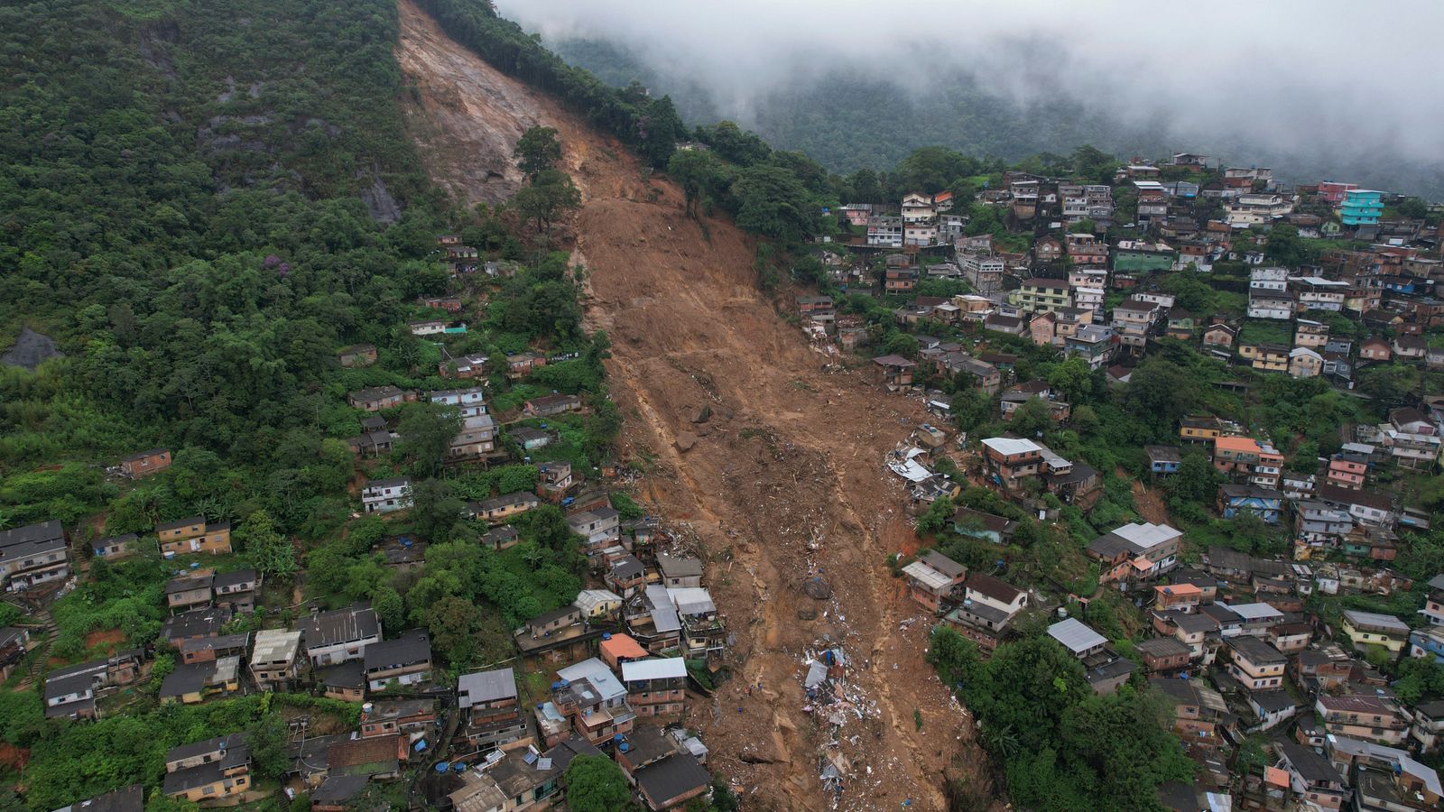
The upper portion of the landslide at Morro da Oficina in Petropolis. Image via Sky News.
.
The upper portion of this landslide appears to be a large slide on the interface between bedrock and regolith. In the mid portion it is a slide in regolith, with large amounts of entrainment. The image below, from CNN, shows the lower portion of the landslide, where it has crashed through the houses. The level of destruction is extreme, and large numbers of fatalities seem very likely:-
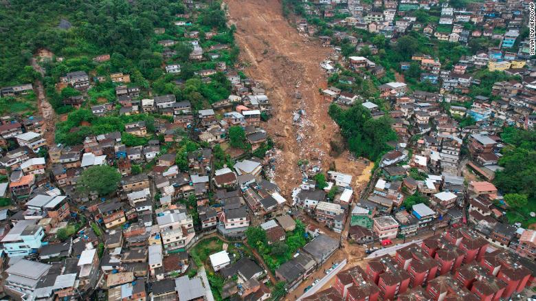
The lower portion of the landslide at Morro da Oficina in Petrópolis. Image via CNN.
.
Some of videos debris flows passing through the streets, for example of Rua dos Ferroviarios, may well be associated with this type of landslide – note how the debris at the bottom of the image above has followed the line of the roads. Globo has some nice infographics showing the distribution of the impacts.
The Google Earth image below shows the site of the landslide at Morro da Oficina. The steepness of the topography is notable:-
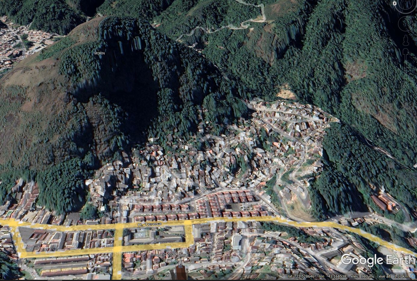
Google Earth image of the site of the landslide at Morro da Oficina in Petrópolis.
.
The location is -22.529, -43.170. O Globo has an article that includes a dynamic map of the main events, including the locations of nine major landslides.
 Dave Petley is the Vice-Chancellor of the University of Hull in the United Kingdom. His blog provides commentary and analysis of landslide events occurring worldwide, including the landslides themselves, latest research, and conferences and meetings.