
14 October 2021
Large rock slope failures on the Southern Patagonian Icefield
Posted by Dave Petley
Large rock slope failures on the Southern Patagonian Icefield
Loyal reader Hernán De Angelis has very kindly highlighted two very interesting large rock slope failures on the Southern Patagonian Icefield (SPI) at Glacier Amalia. He has written about these on his blog, including some excellent satellite images. I decided to take a look at them using Planet Labs imagery.
The first that he has highlighted occurred between 24 and 27 March 2018 at -50.919, -73.601. This is a Planet Labs image of the aftermath of the landslide, with a large volume of debris sitting on the glacier:-
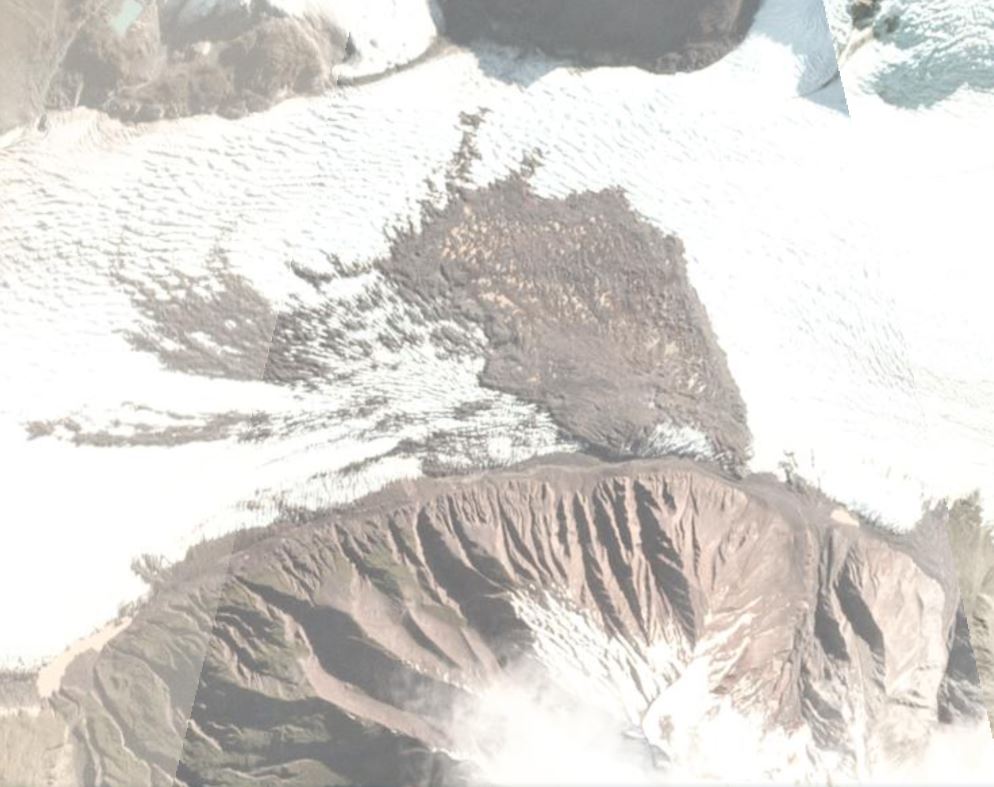
A satellite image of the landslide debris at Glacier Amalia on the Southern Patagonian Icefield, collected on 27 March 2018. Image copyright Planet Labs, used with permission.
.
Hernán has run the stats on this failure – it has a surface area of 1.6 square kilometres, with a runout length (on the glacier of 1.6 km – about a mile) and a width of 1050 metres. There are also some smaller failures, such as the one on the very right of the image. Interestingly, on flickr there is an image of the landslide deposit on the glacier.
Hernán has identified a second event a little to the east of this location on the Southern Patagonian Icefield, this time in 2019. This can be seen in a partially obstructed image on 28 April 2019 but the first image that captures it clearly is on 8 May 2019, when it was covered in a layer of snow:-
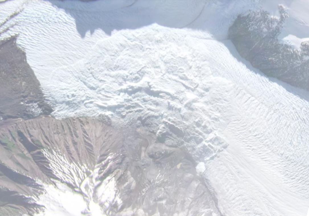
A satellite image of the 2019 landslide debris at Glacier Amalia on the Southern Patagonian Icefield, collected on 8 May 2019. Image copyright Planet Labs, used with permission.
.
This is a slope failure on a similar scale – about 1.6 square kilometres surface area. It is about 1,100 metres long (on the ice) and about 1,600 metres wide. Including the source area the length is about 2.5 km.
Hernán has pointed out that an abstract for the AGU Fall Meeting in 2019 (Van Wyk de Vries et al. 2019) mentions two landslides of this scale on the flanks of Reclus volcano. This is likely to be these two events. This what they wrote:
We identified a series of large debris avalanches from the volcanoes, suggesting that previously stable slopes have been disrupted. Two large (1-5 km2) avalanches occurred on the north flank of Reclus over the last two and a half years, and one 12 km2 avalanche occurred on the north flank of Lautaro earlier this year. Here we present a detailed description of the conditions preceding each collapse, and the properties of each collapse. The Reclus collapses are inferred to have been mostly unconsolidated rock, with moderate to low cohesion. The 2019 collapse was the larger of the two and settled onto Amalia glacier, causing local speedup and slowdown, possibly due to the loading of the ice.
.
References
Planet Team (2021). Planet Application Program Interface: In Space for Life on Earth. San Francisco, CA. https://www.planet.com/
Van Wyk de Vries, M. S. ; et al. 2019. Large Volcanic Landslides on the Southern Patagonian Icefield and Linkages to Glacial Retreat. American Geophysical Union, Fall Meeting 2019, abstract #V52C-07
 Dave Petley is the Vice-Chancellor of the University of Hull in the United Kingdom. His blog provides commentary and analysis of landslide events occurring worldwide, including the landslides themselves, latest research, and conferences and meetings.
Dear Dave,
Here are two interesting timelapses of Amalia Glacier with shows both debris deposits on the glacier.
The first one made of Sentinel 1 radar images:
https://youtu.be/Umh0dxzEz0A
And the second, made of Planet images:
https://youtu.be/CIIqamrFapM
Note two precursory-like landslide-debris on the Amalia Glacier before the first massive landslide of 2017 (around 0:13)
Regards,
Felipe
Have you seen
https://www.msn.com/en-gb/news/world/eight-dead-as-downpours-trigger-landslides-across-southern-indian-state/ar-AAPCsod?ocid=msedgntp