
15 December 2020
The large landslide at Gamsberg mine: high resolution satellite images
Posted by Dave Petley
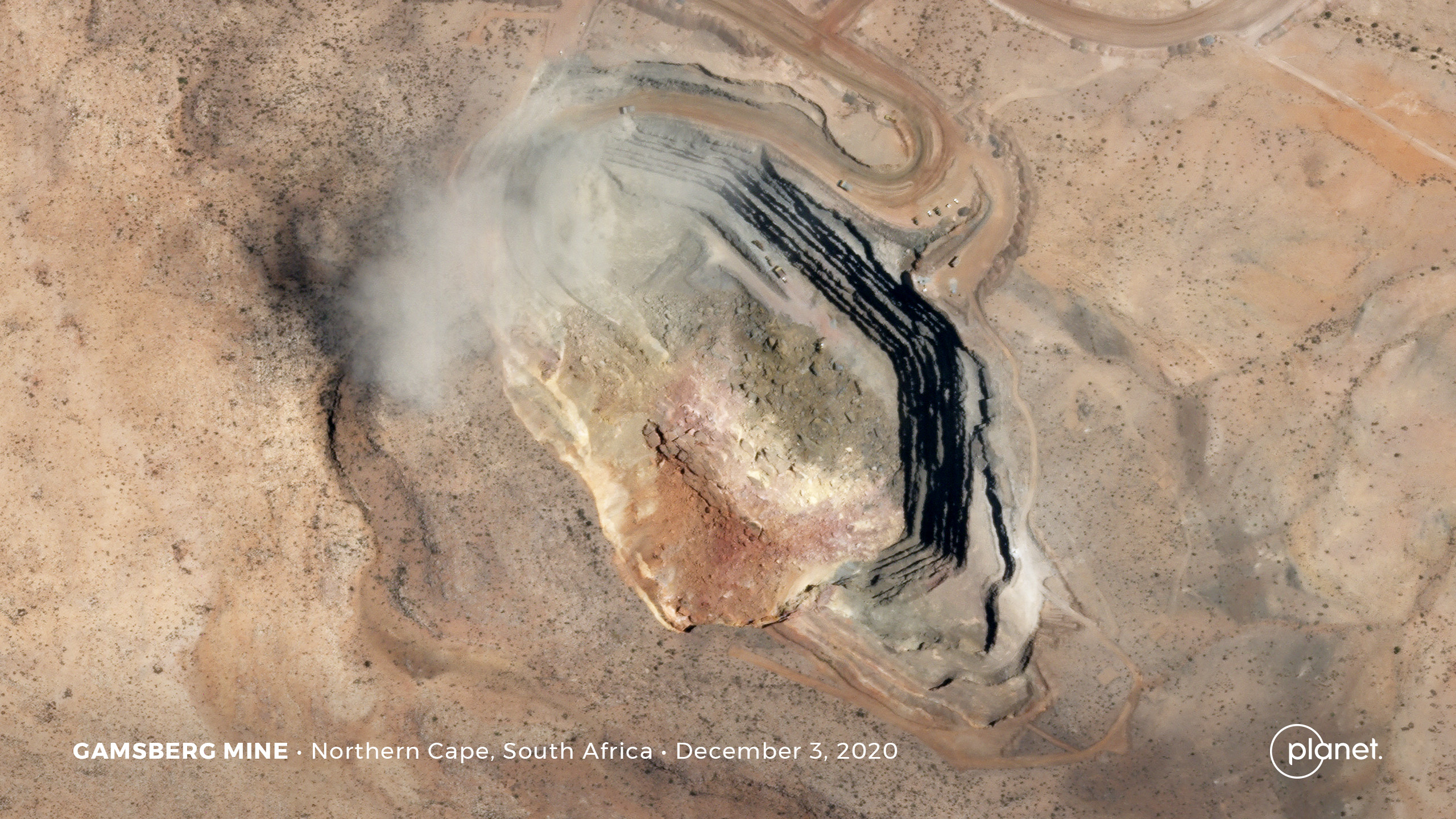
A high resolution Planet Labs SkySat image of the landslide at Gamsberg mine in South Africa. Image copyright Planet Labs, used with permission.
The large landslide at Gamsberg mine: high resolution satellite images
A month ago, on 17 November 2020, a large slope failure occurred at the South Pit of Gamsberg mine in South Africa. This failure, which appears not to have been anticipated, killed two people. The body of one of the victims had not been recovered as of a week ago. News reports on 7 December indicated that mining operations remained suspended.
I thoroughly recommend that you read a comment to my original post about this failure – it provides some interesting insight.
My friends at Planet Labs have captured a high resolution satellite image of the site, dated 3rd December, using their wonderful SkySat instrument:-
A high resolution Planet Labs SkySat image of the landslide at Gamsberg mine in South Africa. Image copyright Planet Labs, used with permission.
.
It is worth calibrating this image against the view from the ground that I included in my original post – used together one can get a good impression of what transpired at Gamsberg mine:-
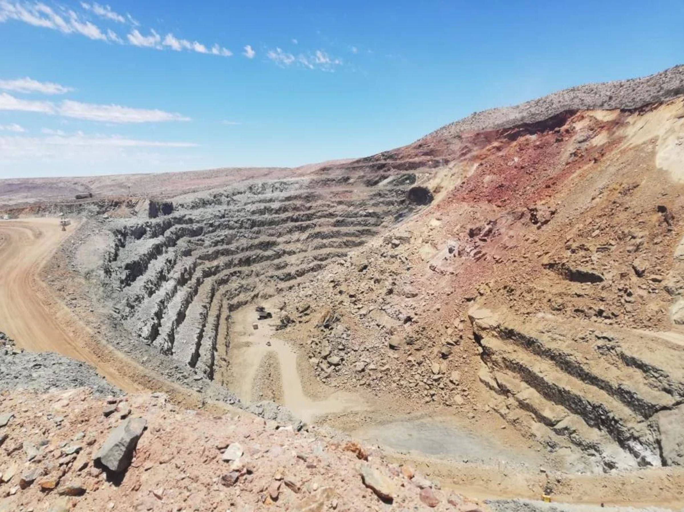
An overview of he landslide at Gamsberg mine. Image posted anonymously to Reddit.
.
It is clear that the landslide occurred on a slope across which the access ramp crossed. The failure appears to have occurred above the access ramp, although the debris has reached the pit floor, and has covered most of it. The image below is an enlargement of the Planet Labs image:-
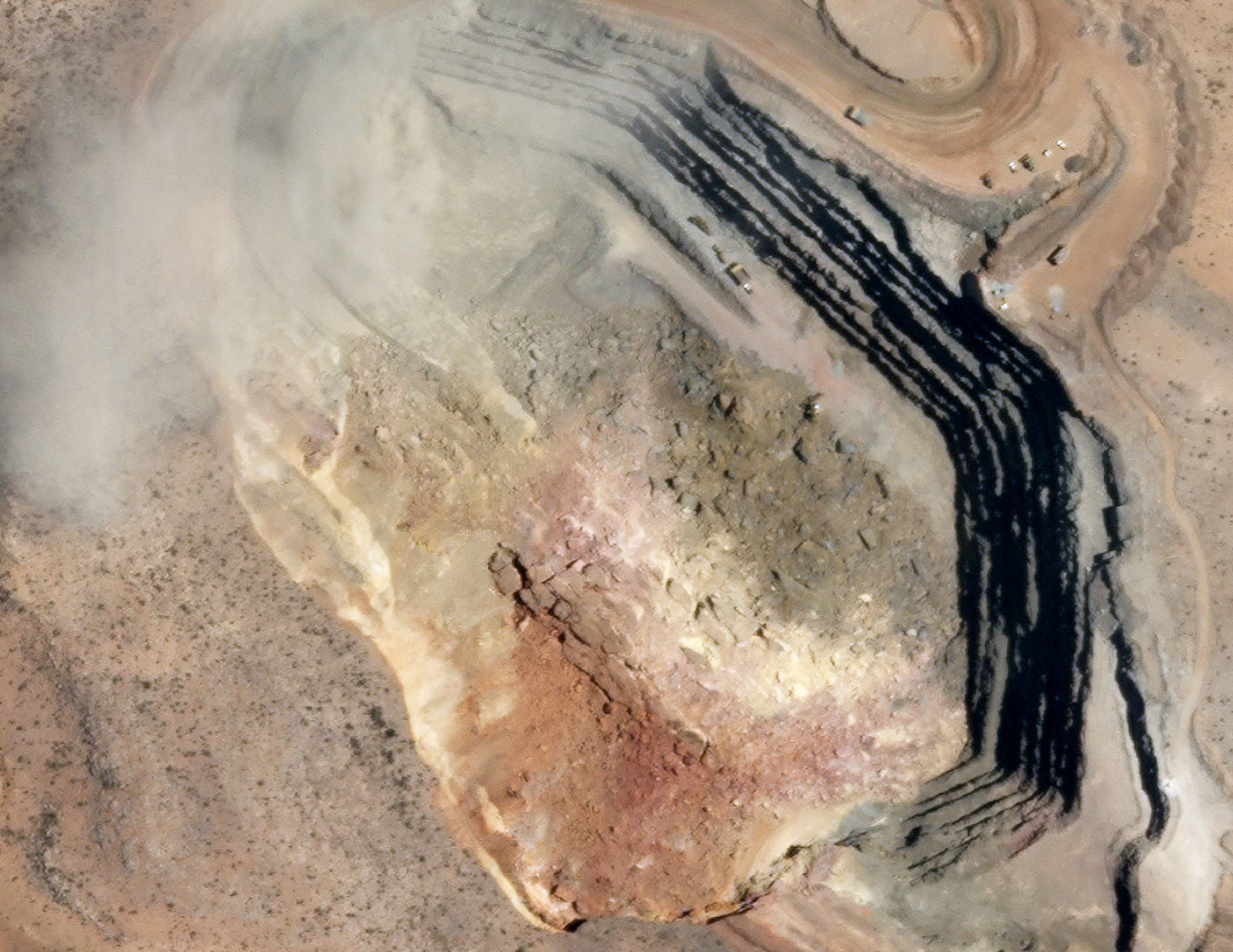
A high resolution Planet Labs SkySat image of the landslide at Gamsberg mine in South Africa. Image copyright Planet Labs, used with permission.
.
Note that the stratigraphy is roughly preserved in the landslide deposit, with the deeply weathered (reddish) rocks being closest to the landslide scar. This might suggest that it was a rockslide with failure starting low on the slope? It appears that there has been a smaller secondary failure to the northeast of the main collapse. The deposits are quite distinct. I am not sure whether part of the mine is obscured by thin cloud or by dust. If the latter then some collapses may still be occurring.
There is not much evidence in the images of heavy equipment working on the landslide on 3rd December, but if collapses were continuing then this might be understandable. Of course a satellite image is just a snapshot, so there might be activity that was undetected.
The size of the bite out of the boundary of the mine is quite striking. The long term questions at Gamsberg mine will be how such an apparently unanticipated failure could occur so early in the mining operations, and how the mine can be operated safely in the future. In the meantime the economic costs of this failure will be accumulating rapidly.
Reference and acknowledgement
Planet Team (2020). Planet Application Program Interface: In Space for Life on Earth. San Francisco, CA. https://www.planet.com/
Thanks to Rob Simmon for collecting and providing the image.
 Dave Petley is the Vice-Chancellor of the University of Hull in the United Kingdom. His blog provides commentary and analysis of landslide events occurring worldwide, including the landslides themselves, latest research, and conferences and meetings.
From the top image, it looks like the slope from which the landslide came from was really steep and instead of stabilizing it by widening up top, they just dug down. Wouldn’t this have increased the likelihood of a landslide?
Very large landslide at Bute inlet in BC