
17 July 2020
Satellite imagery of the Myanmar jade mine landslide
Posted by Dave Petley
Satellite imagery of the Myanmar jade mine landslide
Myanamar in the summer is not an easy place in which to acquire satellite imagery, because of the high incidence of cloudy conditions. This has meant that tracking down the site of the 28 June 2020 Myanmar jade mine landslide has been difficult. However, fprovost posted an article on Discuss that highlights the use of Sentinel-1 radar imagery to identify the site. Radar can see through cloud, but is hard to interpret. Change maps are the answer for large landslides, allowing the site to be pinned down to 25.477°, 96.259°.
The advantage with Planet Labs daily imagery is that it allows far more opportunities to capture an image. This is an image of the site before the landslide, collected on 18 May 2020 when the conditions for capturing imagery were better:-
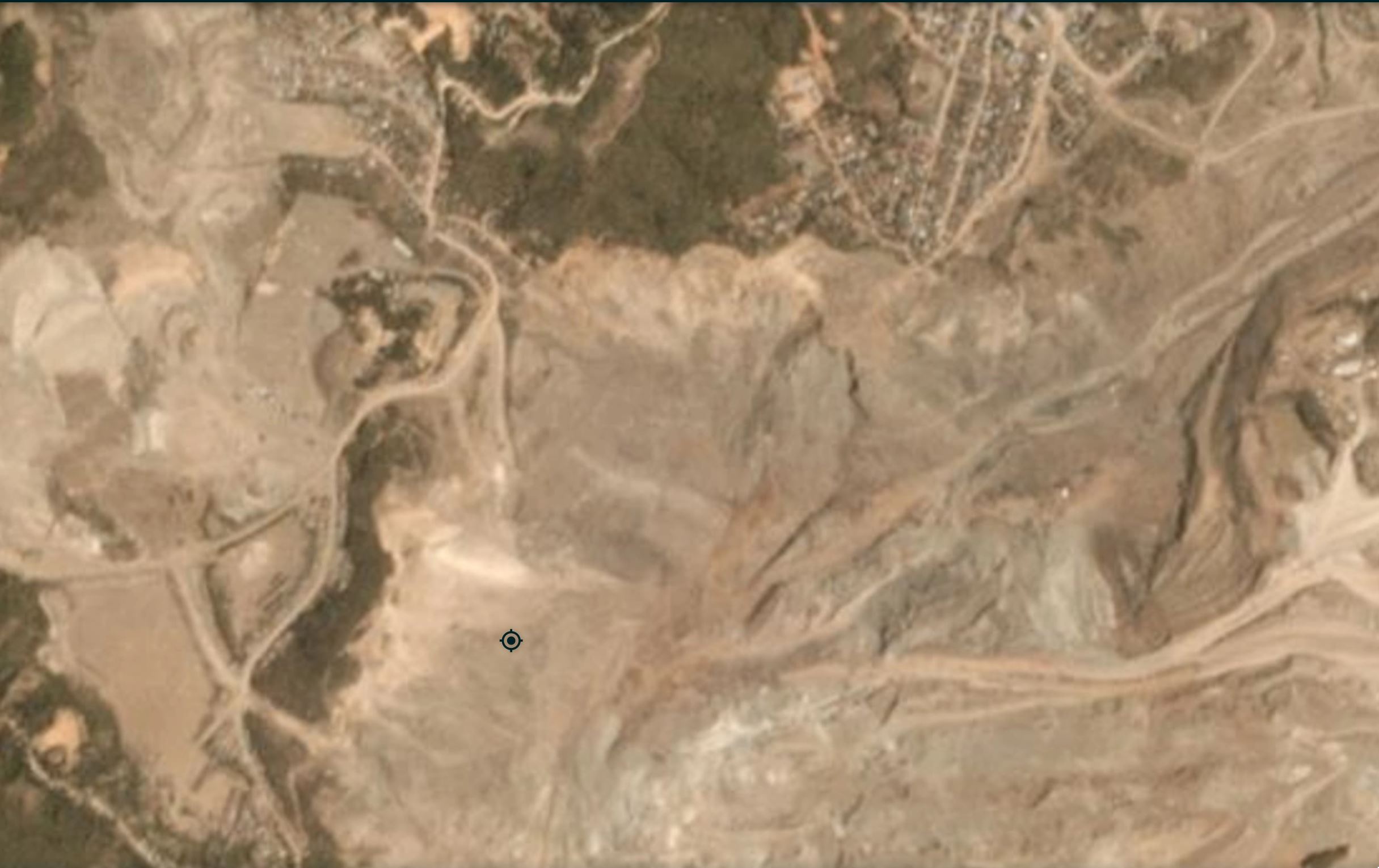
Satellite image of the 28 June 2020 Myanmar Jade mine landslide. Image copyright Planet Labs, used with permission.
.
The extraordinary level of environmental degradation caused by the jade mining activity in the Hpakant area is clear. Note that this does not appear to be well organised mining – look how close the houses are to the edge of the mine workings for example.
This an image after the landslide, captured on 10 July 2020:-
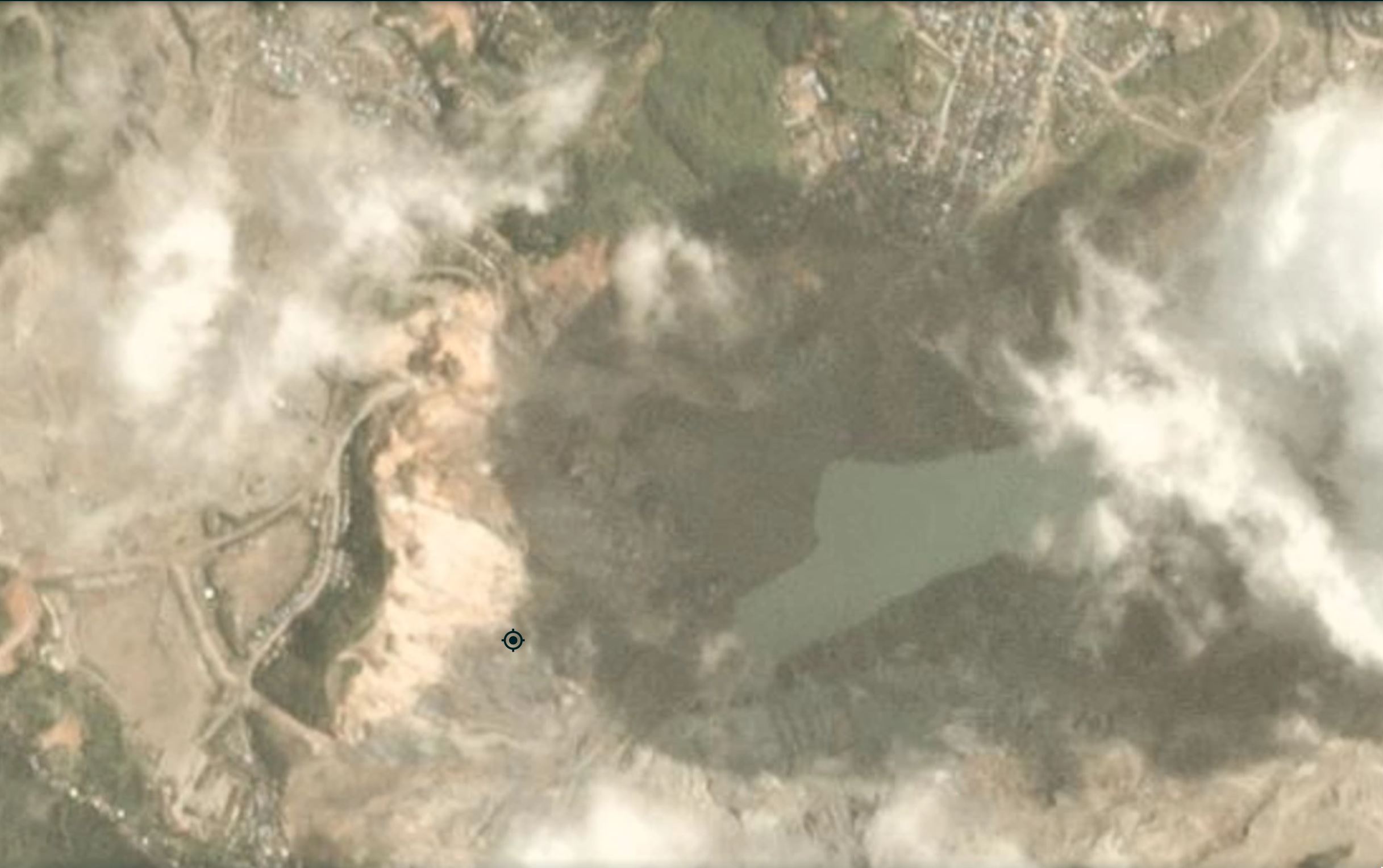
Satellite image of the aftermath of the 28 June 2020 Myanmar Jade mine landslide. Image copyright Planet Labs, used with permission.
.
The slope failure is just to the north of the position marker in the image, travelling roughly towards the east into the lake. It is not a huge failure – about 400 m x 400 m. The problem of course was the number of people on the slope at the time, and the displacement waves in the flooded pit bottom. Although the site is in shadow, the landslide is clear.
The image below is from Google Earth, from December 2018, showing the mining operations at the site:-
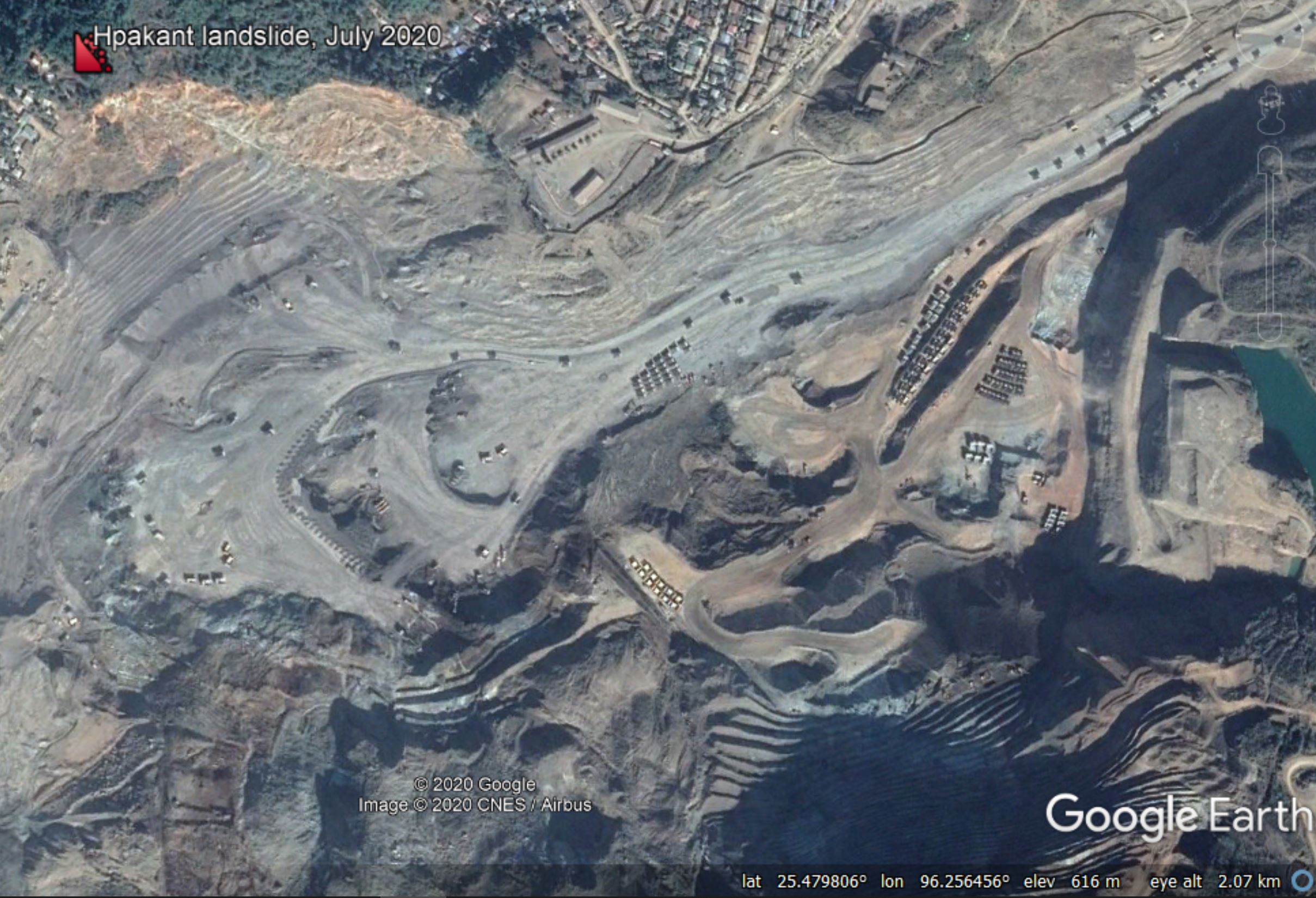
Google Earth image of the location of the 28 June 2020 Myanmar Jade mine landslide.
.
The image above shows the extremely large-scale of the mining operation at this site.
.
Quickslide 1: More fatal landslides in Nepal
This morning a further fatal landslide occurred in Nepal, with a family of three being killed in Machhapuchhre Rural Municipality in Kaski. Meanwhile, up to five people have been killed by a landslide at Pulpingkatti in the Bhotekoshi rural municipality in Sindhupalchowk.
.
Quickslide 2: Old Fort Road reopens
The landslide at Old Fort in Canada has now stabilised sufficiently for the road to reopen.
.
Reference
Planet Team (2020). Planet Application Program Interface: In Space for Life on Earth. San Francisco, CA. https://www.planet.com/
 Dave Petley is the Vice-Chancellor of the University of Hull in the United Kingdom. His blog provides commentary and analysis of landslide events occurring worldwide, including the landslides themselves, latest research, and conferences and meetings.
In the article you cite images with certain dates but then the image below is a different date. Are you missing the Planet Labs 18 May 2020 image and the Google Earth image from Dec 2018?
the amount of rainwater that accumulated in the excavation between the two photos is truly remarkable. The video of the slide suggests it was very deep when the slide mass displaced it.