8 April 2020
Denali Park Road: fascinating landslides in a subarctic mountain environment
Posted by Dave Petley
Denali Park Road: fascinating landslides in a subarctic mountain environment
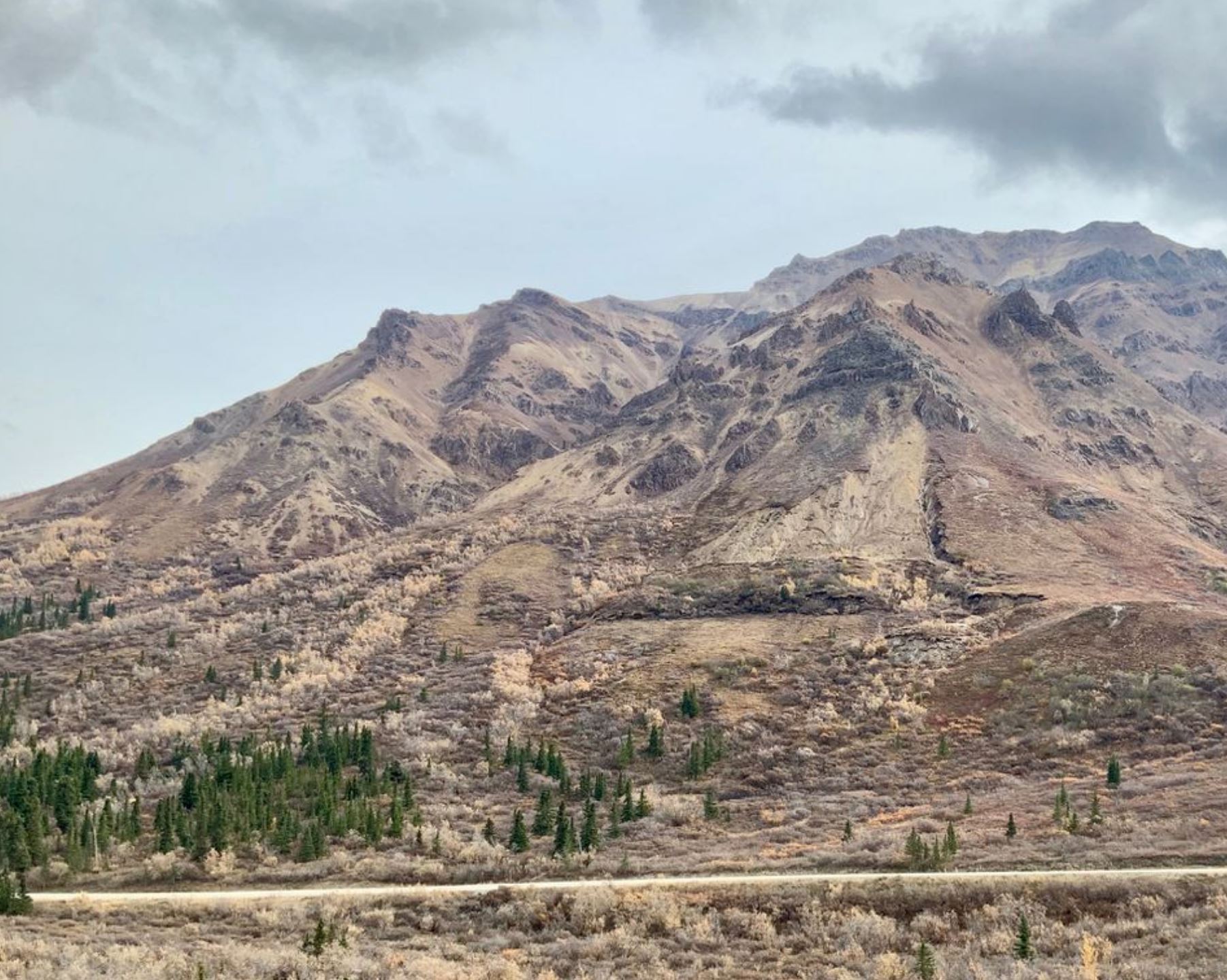
Back in January, an article in the Anchorage Daily News highlighted landslides on Denali Park Road, a high latitude highway through Denali National Park in Alaska. This was based on a paper presented at the 2019 AGU Fall Meeting in San Francisco by Zena Robert, a graduate student at the University of Alaska Fairbanks. Zena reports on work by National Park staff that has identified over 150 landslides along the 150 km length of the road, many of which are really fascinating. For example, accompanying the article is this image, taken by Zena, of a large-scale slope failure:-

A large landslide on Landslide on Denali Park Road in Alaska. Image by Zena Robert via Alaska Daily News.
.
This is a broadly similar to an active layer detachment slide, and has probably occurred because of summer melting of permafrost, which generates water-saturated, weak materials that are then able to slip on the steep slopes. Note the interesting landslide deposit, also the potential for instability lower on the slope and at the landslide crown.
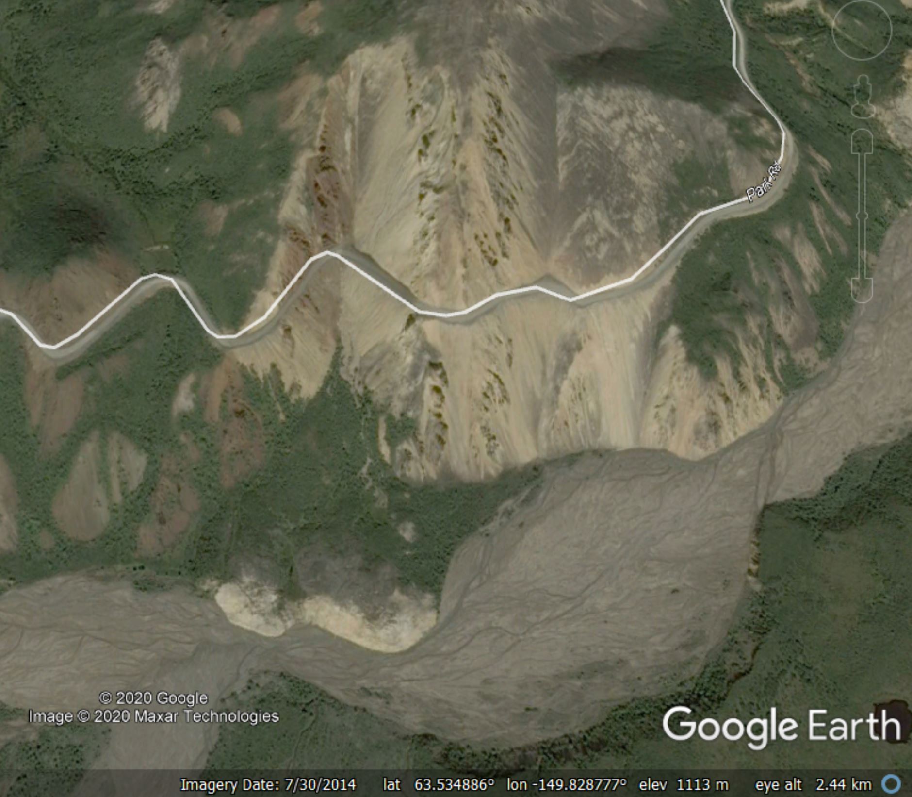
A further landslide that she highlighted on Denali Park Road is at the Pretty Rocks area on the pass adjacent to Ploychrome Mountain (63.537, -149.815 if you wish to take a look). This landslide is pretty easy to identify on the Google Earth imagery:-

Google Earth image of the landslide at Pretty Rocks in Denali National Park
.
The National Park Service are actively monitoring this landslide. Their records suggest that this landslide reactivated in 2004, moving at a rate of about 60 cm per year. The rate of movement has increased, and at times in 2019 in was moving at a rate of about 50 mm per day.
Of course this road is inaccessible in the winter because of snow. It will be fascinating to see how the slide has progressed when the road reopens for the summer season. As no alternative route is immediately available, the National Park Service have committed to keeping the road open this year.
[NB I have made some minor edits to this post since it was uploaded to improve accuracy].


 Dave Petley is the Vice-Chancellor of the University of Hull in the United Kingdom. His blog provides commentary and analysis of landslide events occurring worldwide, including the landslides themselves, latest research, and conferences and meetings.
Thank you.
Brrr… That landscape reminds me of the big-for-UK scree slope on A82 near Glen Coe. Road runs across its vast tail, which c-r-e-e-p-s. What begins as a laser-straight road alignment gradually bends, sags towards the road’s previous incarnations, re-purposed as wiggly, undulating lay-bys and scenic parking.
The size of clean-up should some combination of weather etc mobilize much of the slope always set us to think…