29 October 2018
Rockfalls from the 25th October 2018 M=6.8 Zakynthos earthquake
Posted by Dave Petley
Rockfalls from the 25th October 2018 M=6.8 Zakynthos earthquake
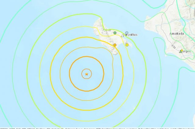
On 25th October the M=6.8 Zakynthos earthquake struck offshore the west coast of Greece, at a depth of just 14 km. The USGS Shakemap data is presented in the map below:-

USGS Shakemap data for the 25th October 2018 M=6.8 Zakynthos earthquake.
.
Fortunately, the location of the earthquake offshore limited the impacts, but there are reports of rockfalls on the rugged island of Zakynthos. To date only one image has emerged (as far as I can tell), showing a significant collapse on Myzithres Beach. Ermisnews has this before and after pair of images of the event at Myzithres Beach:-

A major rockfall on Myzithres beach. This collapse was reportedly triggered by the 25th October Zakynthos earthquake. Image via Ermisnews.
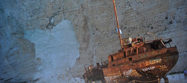
Potentially the most significant rockfall occurred on the famous tourist site known as Shipwreck Beach. This area had been subjected to rockfalls prior to the earthquake, but a significant failure appears to have occurred. Unfortunately no images are yet available. Imerazante has a good image of the collapse in September, with appears to have occurred on face-parallel joints:-

The rockfall scar from the failure at Shipwreck Beach in September 2018. Image via Imerazante.
.
Meanwhile, Neakriti has some images after the September 2018 event:-

The debris from the rockfall on Shipwreck Beach from the September 2018 rockfall. Image via Neakriti.
.
Meanwhile, there are also reports of rockfalls on inland slopes. Neakriti reports that in Panagoula on Zakynthos several houses have been evacuated due to the risk of rockfalls. The aftershock sequence appears to be quite active, so further rockfalls cannot be ruled out, and there will also be a substantial level of hazard in the next major rainfall event. Meanwhile there is also some evidence of liquefaction or foundation problems in the port at Zakynthos, as would probably be expected in an event such as this.


 Dave Petley is the Vice-Chancellor of the University of Hull in the United Kingdom. His blog provides commentary and analysis of landslide events occurring worldwide, including the landslides themselves, latest research, and conferences and meetings.