28 June 2016
New Zealand Society for Earthquake Engineering report on the Kumamoto Earthquake
Posted by Dave Petley
New Zealand Society for Earthquake Engineering report on the Kumamoto Earthquake
The New Zealand Society for Earthquake Engineering has produced a report, available online, on the Kumamoto Earthquake. This is apt given that this area is once again suffering very heavy rainfall today – this is the Japan Meteorological Agency landslide hazard map as I write:
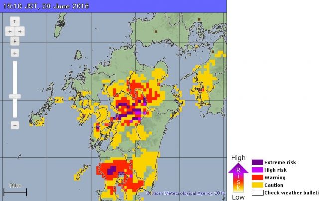
Japan Meteorological Agency landslide hazard map for the Kumamoto Earthquake area for the afternoon of 28th June 2016
.
Fortunately, so far at least, rainfall totals have not approached those of earlier in the month.
The New Zealand Society for Earthquake Engineering report provides some real insight into the landslides triggered by the Kumamoto Earthquake. It notes that of the 49 deaths in the earthquake, 10 were caused by landslides, of which five occurred at a site at Aso Ohashi Village shown below. This is the source area of the earthslide / flow:-
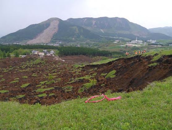
The source area of the Aso Ohashi earthslide / flow via the New Zealand Society for Earthquake Engineering report
.
Whilst this the zone of maximum damage at the toe:-
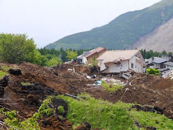
The damage zone for the earthslide / flow at Aso Ohashi Village, via the New Zealand Society for Earthquake Engineering report
.
Of course the best reported landslide in the Kumamoto Earthquake was the large debris avalanche at Aso Bridge. The report also provides a nice image of this landslide:-
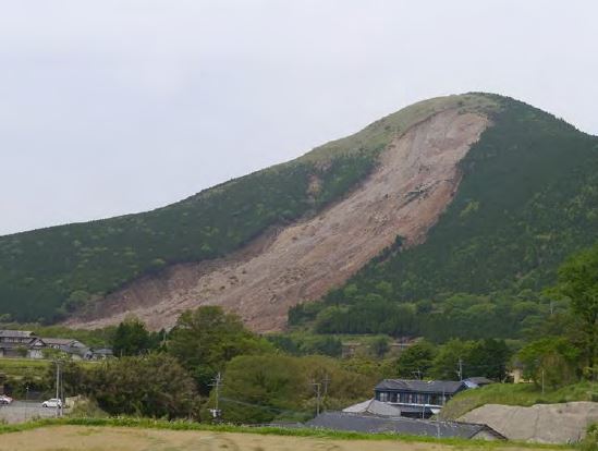
The large debris avalanche at Aso Bridge via the New Zealand Society for Earthquake Engineering report
.
The report notes that this landslide is 950 m long by 200 m wide, and that it caused at least one fatality. What is not often reported in the aftermath of earthquakes is the large numbers of small landslides that have caused local damage. The loss in each event can be comparatively small, but their cumulative impact can be large. This is an example of two small landslides, one of which has caused the failure of a bridge abutment and the other (circled in red) of a cantilevered section of road:
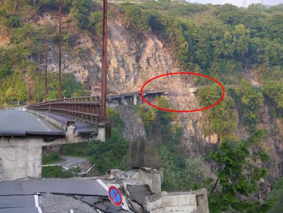
Two small but damaging landslides from the Kumamoto Earthquake, via the New Zealand Society for Earthquake Engineering report
.
There are lots of other reports on the Kumamoto Earthquake on the EERI website. There are some amazing resources there.


 Dave Petley is the Vice-Chancellor of the University of Hull in the United Kingdom. His blog provides commentary and analysis of landslide events occurring worldwide, including the landslides themselves, latest research, and conferences and meetings.
One of the methods of contrast with earthquakes is seismic retrofitting of buildings.
Therefore, old and unsafe buildings should be strengthened by methods such as strengthening with FRP in accordance with ACI 4402R or retrofitted by classical methods such as FEMA 360.