
18 June 2016
Using climbing guides to examine changes in rockfall activity in the European Alps
Posted by Dave Petley
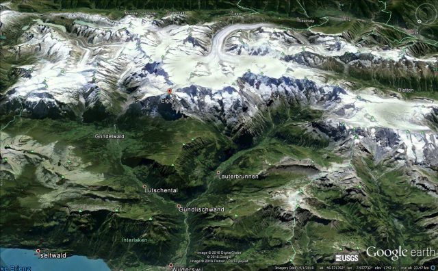
Google Earth image of part of the Bernese Alps, the subject of the study on the use of climbing guides to look at changes in rockfall activity
Using climbing guides to examine changes in rockfall activity in the European Alps
One of the anticipated, and increasingly observed, effects of anthropogenic climate change is the degradation of permafrost in high mountain areas. A key role of permafrost is in holding fractured rock masses together. As the ice melts, the strength of the rock mass rapidly declines, and rockfalls result. Given that some mountain areas, such as the European Alps, have already shown 2 degrees Centigrade of warming, these effects are already with us, and are getting worse. But of course it can be hard to assess the level of rockfall activity prior to the modern instrumental age. As this was not a parameter that was being monitored until recently, understanding of this problem in a historical context is hard.
In a recent paper in the journal Geografiska Annaler, the climber and geomorphologist Arnaud Temme has examined warnings of rockfall activity in Alpine climbing guides over a 146 year period in the Bernese Alps of Switzerland. This is an area that has been extensively climbed for well over a century, with a regular flow of climbing guides through this period. Some of these guides are one-off descriptions by the authors, whilst in others the same author has provided repeated updates. Temme (2015) describes this as an early form of crowd-sourcing of rockfall activity. Of course a substantial advantage here is that climbers have to be very aware of rockfall danger, and the authors are often acute observers of the behaviour of the rock mass. Whilst this is not a real substitute for quantitative data, it does provide very interesting insight into the effects of climate change in high mountains.
The study focuses on 17 Swiss Alpine Club guidebooks dating from 1864. The first four were written by the same English author (Bell), whilst later versions had more local authors. The analysis in the paper is sophisticated because of the need to take into consideration changes in the number of routes described and changes in societal views of risk, as well as changes in authorship. But, allowing for these factors, the results are clear. There has been a strong increase in the reported occurrence of rockfall danger. Temme (2015) presents this graphically:
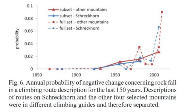
Changes in the perceived danger of rockfalls in the Bernese Alps in climbing guides, from Temme (2015)
.
It is clear that there has been a remarkable increase in the description of rockfall danger over the period, and that most of this has occurred in the last three decades. Whilst an aspect of this could be a increased sensitivity to risk. Temme (2015) is clear that the major factor is increased rockfall activity. In the analysis he also looked at the correlation of this increased rockfall risk with various physical factors, and found that there was a strong relationship with slope aspect. This is consistent with increased rockfall activity occurring on slopes with an eastern or western aspect, where the freeze-thaw effect is known to be strongest.
This is another study that shows elegantly that anthropogenic climate change is having a strong effect on landslide activity. Of course there is an opportunity to continue this study in other intensively-climbed areas of the European Alps, and to use climbers as a crowd-sourced provider of rockfall data.
Reference
Temme, A.J.A.M., 2015. Using climber’s guidebooks to assess rock fall patterns over large spatial and decadal temporal scales: an example from the Swiss Alps. Geografiska Annaler: Series A, Physical Geography. 97, 793–807. doi:10.1111/geoa.12116
 Dave Petley is the Vice-Chancellor of the University of Hull in the United Kingdom. His blog provides commentary and analysis of landslide events occurring worldwide, including the landslides themselves, latest research, and conferences and meetings.