
17 December 2015
First news of a rock avalanche on Mount James Turner yesterday
Posted by Dave Petley
Mount James Turner rock avalanche
Drew Brayshaw has tweeted this image of a rock avalanche that apparently occurred on Mount James Turner yesterday:
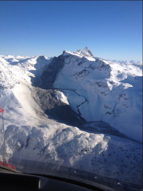
Mount James Turner rock avalanche via Drew Brayshaw and Twitter
.
Mount James Turner is close to Whistler in British Columbia, western Canada. This looks to be a large, very mobile rock avalanche event, with a steep upper portion and a long track. Note the small flow that appears to have left the main flow mid-track, and then rejoined the main flow after descending a step. There is some evidence of dust on the margin of the landslide. Drew also tweeted a pre-failure image of this part of Mount James Turner:
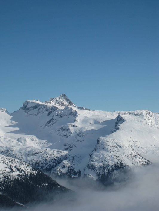
Mount James Turner via Drew Brayshaw and Twitter
.
The landslide appears to have originated from an unsually steep rock cliff on the edge of Fingerpost Ridge and will have had a substantial freefall element. Based on the image, and correlating with Google Earth, the runout distance that is visible will be about 2 km. However, there may be a longer non-visible component. The top of Fingerpost Ridge is at about 2600 m, whilst the foot of the steep slope is at about 2300 m according to Google Earth. The toe of the visible part of the landslide is at 1900 m.
Interestingly, at the toe of the landslide there appears to have been a lake – named Berna Lake:
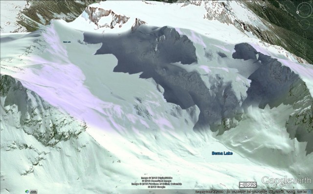
Mount James Turner via Google Earth
.
Is this the snowy apparently-deformed mass that appears to lie at the toe of the landslide in the first image? Canada has a good seismic network, so it will be interesting to see if this landslide has been captured on those sensors.
 Dave Petley is the Vice-Chancellor of the University of Hull in the United Kingdom. His blog provides commentary and analysis of landslide events occurring worldwide, including the landslides themselves, latest research, and conferences and meetings.