
14 February 2014
Xinjiang earthquake: a good new image of the landslides
Posted by Dave Petley
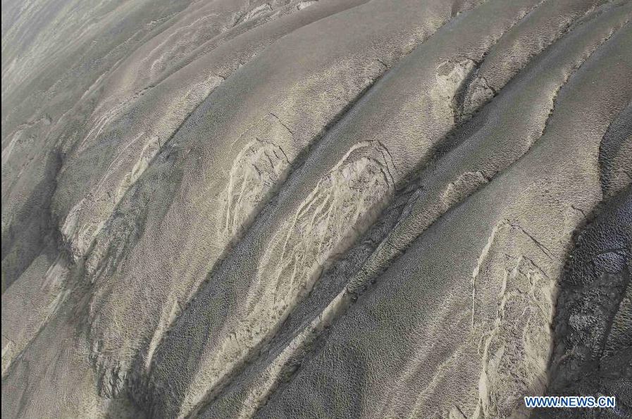
The Xinjiang earthquake (also known as the Kunlun Earthquake) on 12th February is now known to have triggered at least some landslides. A fascinating image has been posted on Xinhua of some of the hillslopes affected by the earthquake:
http://news.xinhuanet.com/english/photo/2014-02/14/c_133115290.htm
..
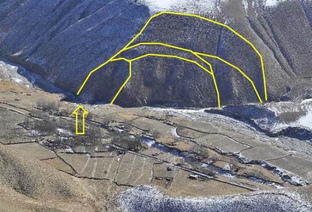
These appears to be shallow rockslides in weathered material – interestingly, most of the slips are on the gully flanks, but do not seem to have progressed to full failure. The more I look at this image the more landslides I see! I find some of the images from yesterday interesting too – for example, this image shows clear signs of old landslides – I have annotated the multiple tension cracks on one of these landslides:
http://news.xinhuanet.com/english/photo/2014-02/13/c_133113060_10.htm
..
The only obvious feature that could be an earthquake induced landslide is highlighted with an arrow (although I am not sure that even this is actually a landslide). There is another possible small slide in the complex further along the valley. If this earthquake was not large enough to reactivate these landslides, I wonder what the original trigger was.
The best source of information about this event, and other earthquakes in this area, is the Tibet Earthquake twitter account: @aam868
 Dave Petley is the Vice-Chancellor of the University of Hull in the United Kingdom. His blog provides commentary and analysis of landslide events occurring worldwide, including the landslides themselves, latest research, and conferences and meetings.
The only other trigger I can think of is another larger earthquake, given that full failure has yet to occur.
I note that the slide planes are slope parallel. I suspect the bedrock is a relatively massive, left-dipping claystone. I’ve seen sheet-like translational slides in claystone of the Wildcat Group on the north coast of California. Slides in small drainages often mimic the local topography, creating sharp V-shaped evacuation scars. I thought I was looking at chevron folds in the bedrock, but it was purely a weathering phenomenon created by seasonal shrink/swell cycles.