
12 July 2013
The deadly landslide in Sichuan Province this week and the prospects for typhoon Soulik
Posted by Dave Petley
The Sanxi landslide in Sichuan, China
The landslide that struck the village of Sanxi in Dujiangyan City in Sichuan Province, China on Wednesday is now known to have killed 31 people, with recovery operations continuing in the attempt to find further victims. Reports vary greatly on how many people have died, with earlier indications suggesting that the number buried was in the range of 30 to 40 people. Some media agencies are reporting that many more, possibly as many as 100 people, are missing in the accident, although it is unclear whether these numbers relate to just this landslide or to the total losses across the region.
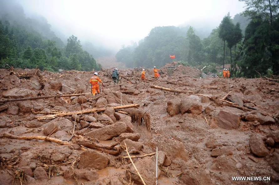
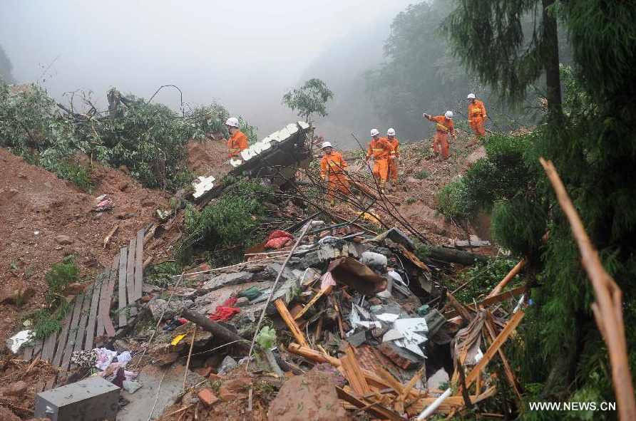
Xinhua has released a gallery of images of the landslide, and I reproduce a couple below, although they do not provide enough information to understand the event:
http://news.xinhuanet.com/english/photo/2013-07/11/c_132533310.htm
http://news.xinhuanet.com/english/photo/2013-07/11/c_132533310.htm
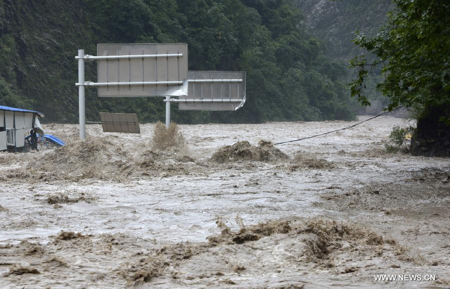
The first image suggests a long run out, very mobile landslide, and gives credence to the suggestion that the run out distance was over a kilometre and the volume over 1.5 million cubic metres. I am sure that Xinhua will provide further updates during the day. The magnitude of the floods is shown well by this image, also from Xinhua, of the road between Hanwang and Qingping, in the same area:
http://news.xinhuanet.com/english/photo/2013-07/11/c_132533348_3.htm
That picture is dated yesterday, so it is clear that the heavy rains are continuing.
..
Typhoon Soulik
Meanwhile, Typhoon Soulik is bearing down on Taiwan and will then make landfall in China:
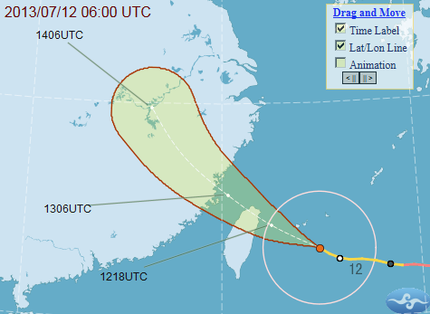
Central Weather Bureau, Taiwan
This very dangerous storm is likely to pass almost directly over Taipei and will bring very heavy rainfall to much of Northern Taiwan, before crossing the Straits of Taiwan to cause widespread damage along the SW coast of China. From a landslide perspective the good news is that at the moment the storm is traveling quite quickly, which reduces the duration of rainfall at any particular location. If this storm were to stall over Taiwan, which does not look likely, the consequences would be very serious.
This is the Taiwan rain radar image at the time of writing, it appears that the impacts are just about to start.
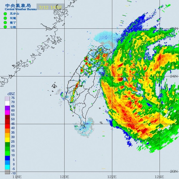
Central Weather Bureau, Taiwan
The best source of information about Taiwan during a typhoon is the accumulated precipitation map from the CWB in Taiwan. As the page says, switch to the second panel (map) when precipitation totals exceed 400 mm (about 13 inches) per day…!
 Dave Petley is the Vice-Chancellor of the University of Hull in the United Kingdom. His blog provides commentary and analysis of landslide events occurring worldwide, including the landslides themselves, latest research, and conferences and meetings.