30 September 2011
Typhoon Nalgae: High landslide potential in the Philippines over the next 24 Hours
Posted by Dave Petley
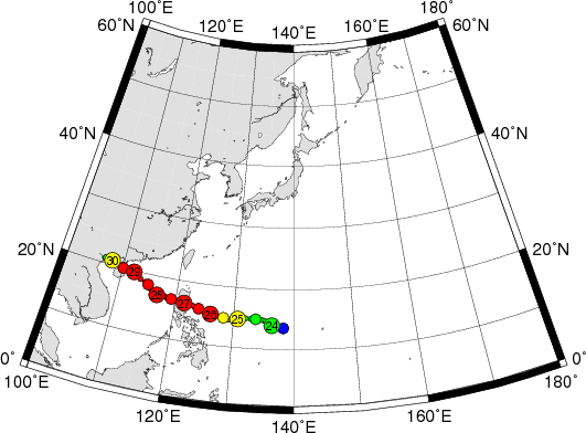
As the map below shows, three days ago Typhoon Nesat tracked across Luzon in the northern part of the Philippines, bringing intense rainfall that triggered landslides and widespread flooding. That storm has now tracked to the west and will shortly make landfall in the northern part of Vietnam, again bringing intense rainfall that is likely to trigger landslides.
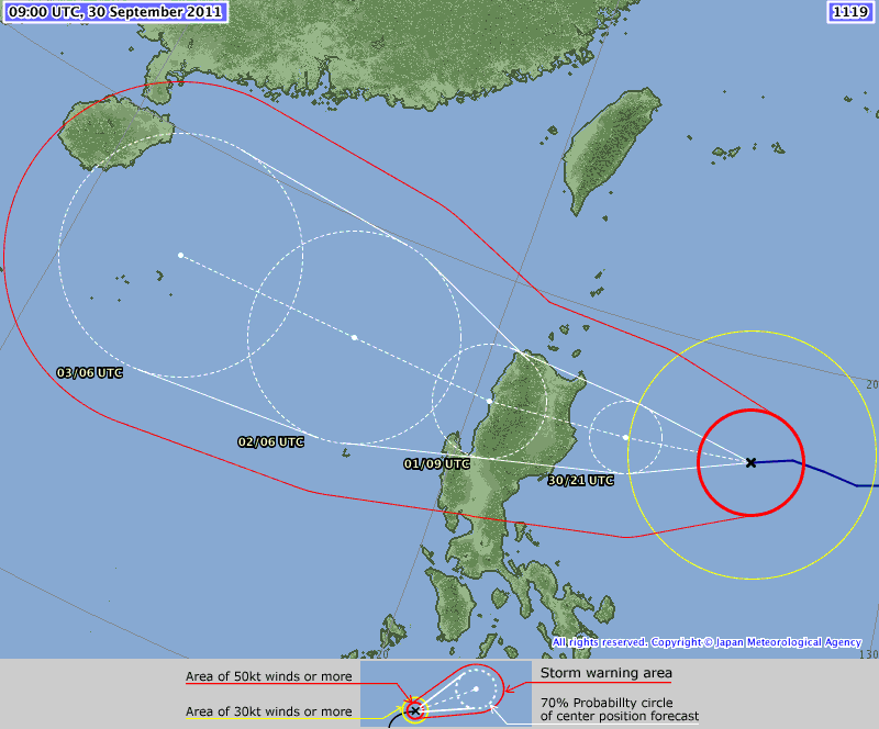
Of perhaps greater otential importance, in terms of impact at least, is the track of the next typhoon, Nalgae. Over the nest 24 hours this is expected to make landfall over the same area of the Philippines, also bringing very heavy rainfall:
In landslide and flood terms, the potential impact of this intense storm is very serious. The heavy rainfall that it is likely to bring will fall on ground that is already saturated and rivers that are still in flood. The potential for damaging landslides is thus much higher. Unfortunately, past history has shown that this part of the Philippines is very vulnerable to typhoon-induced landslides. The next 24 hours will be a very dangerous time in this part of the Philippines. One can only hope that the storm passes across Luzon quickly.


 Dave Petley is the Vice-Chancellor of the University of Hull in the United Kingdom. His blog provides commentary and analysis of landslide events occurring worldwide, including the landslides themselves, latest research, and conferences and meetings.