
19 April 2011
Rockfalls and landslides from the February 2011 earthquake in Christchurch
Posted by Dave Petley
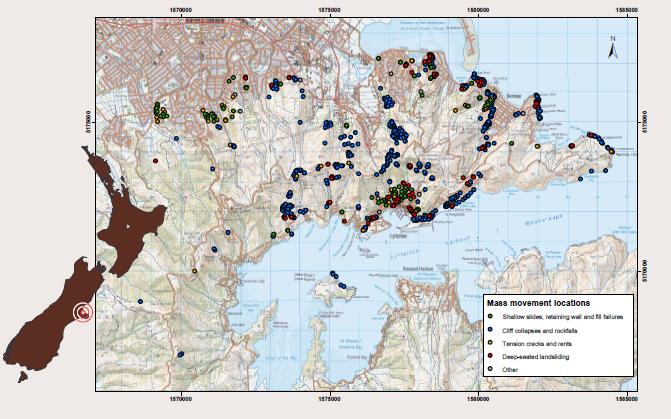
The 22nd February earthquake in Christchurch triggered extensive landslides and rockfalls in the Port Hills area to the east of the city. These mass movements resulted in at least five fatalities, and many homes were damaged. Unfortunately, these mass movements represent a serious long term threat in many areas – in the aftermath of the earthquake several hundred houses had to be evacuated. The science response to the landslide problem was led by GNS Science under the Geonet programme, assisted by partners from the public and private sectors. They have produced an excellent poster describing these activities that is available for download here. The file size is about 1.7 MB.
Perhaps the most interesting data on the poster is a map of the distribution of the different mass movement types:
For reference the image below shows the same area from Google Earth:
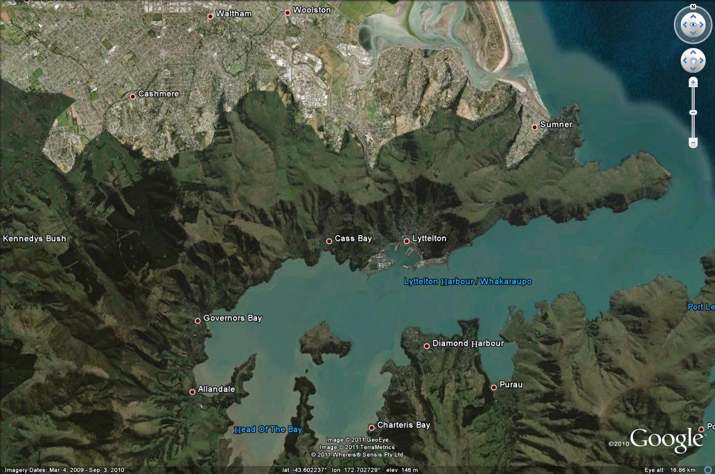
The Google Earth image helps to show the way that the mass movements are concentrated on the steepest slopes, especially the active and abandoned coastal cliffs. There is a very helpful report written by Graham Hancox of GNS describing the helicopter reconnaissance flight that they undertook in the aftermath of the earthquake. Note this is a pdf file, though does not appear to be labeled as such. Firefox couldn’t download it, but Internet Explore had no problems). There are some stunning aerial shots in there, of which I reproduce just two here:

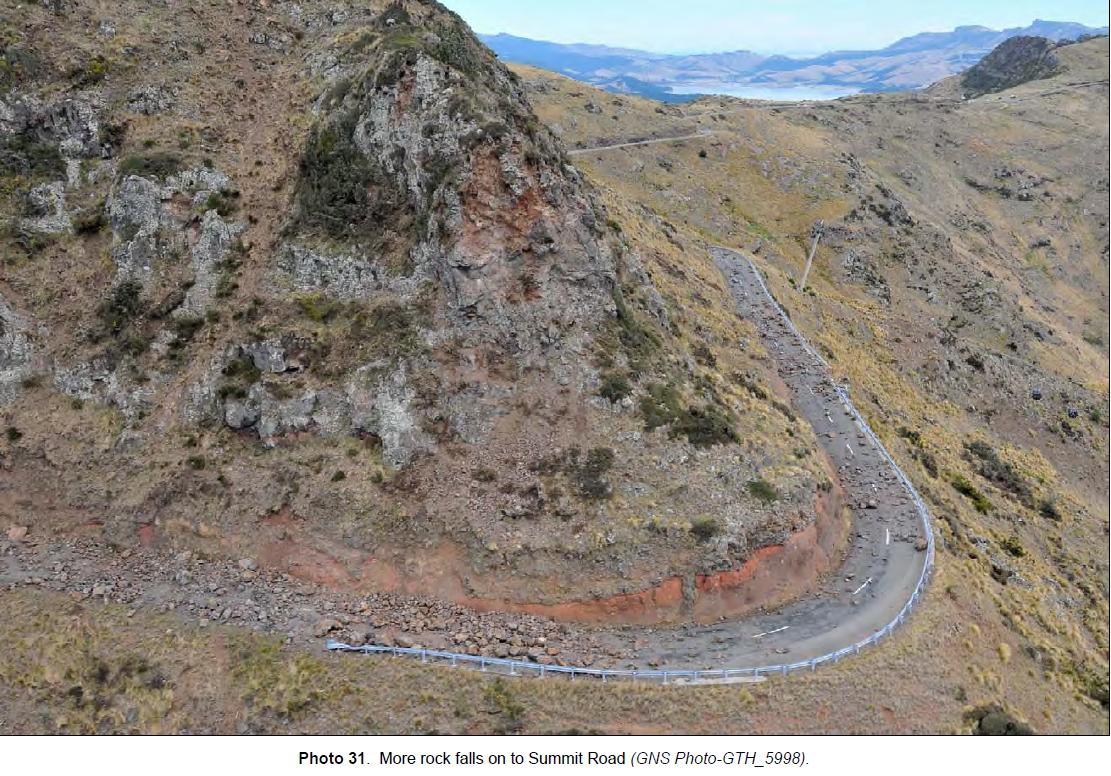
These are remarkable images, which are being backed up with a very comprehensive data collection and hazard analysis exercise. The GNS blog has a short but excellent post outlining some of the work that is being undertaken to understand and mitigate the legacy rockfall hazard, in which with my former PhD student Chris Massey is playing a key role. We will all await the formal reports and scientific papers from this work with great interest.
 Dave Petley is the Vice-Chancellor of the University of Hull in the United Kingdom. His blog provides commentary and analysis of landslide events occurring worldwide, including the landslides themselves, latest research, and conferences and meetings.
Photo 31 the summit road.
The road has a lovely uniform scatter of volcanic rock from the old volcano it was cut from.
I am not an expert, my view is that the road may be cleared relatively quickly, but I bet it remains landslip prone especially after rain.
OT. I just noticed this http://www.bbc.co.uk/news/world-latin-america-13179706
photos 25 and 31
pace dangerus also before earthquake
[…] 6.3 earthquake in February 2011 was multiplied by many buildings on top of, and below, steep cliffs that collapsed and loosed heavy boulders during the […]
[…] The Port Hills area on the edge of Christchurch was very seriously affected by the Christchurch eart…. The Canterbury Earthquake Recovery Authority will today start the process of demolishing the rockfall affected houses in the Port Hills area. Yesterday they released a statement describing the challenges of this work; this statement is well-covered in an article in The Press, which also includes a nice video taken by a drone of some of the sites. A couple of years ago I visited many of these sites, and I have an old post that presents some of the images that I collected. As a reminder, this is typical of the state of some of the buildings at the top of the slopes on the Port Hills: […]
[…] The Port Hills area on the edge of Christchurch was very seriously affected by the Christchurch eart…. The Canterbury Earthquake Recovery Authority will today start the process of demolishing the rockfall affected houses in the Port Hills area. Yesterday they released a statement describing the challenges of this work; this statement is well-covered in an article in The Press, which also includes a nice video taken by a drone of some of the sites. A couple of years ago I visited many of these sites, and I have an old post that presents some of the images that I collected. As a reminder, this is typical of the state of some of the buildings at the top of the slopes on the Port Hills: […]