4 February 2011
Cyclone Yasi – a gallery of the damage
Posted by Dave Petley
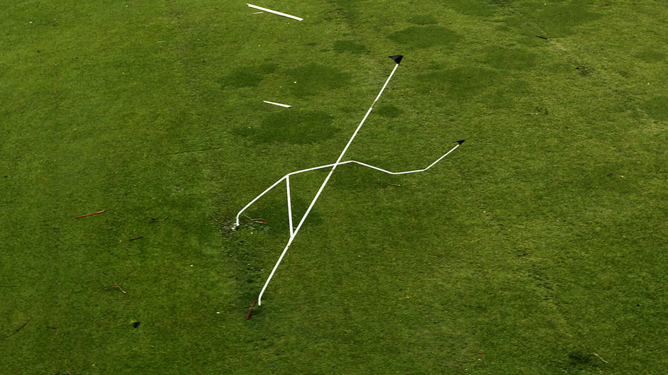
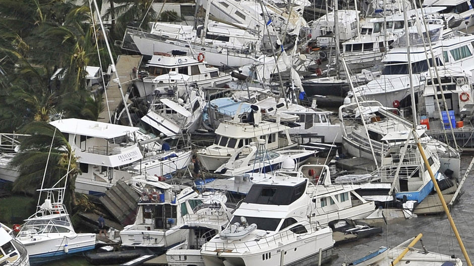
In the UK, the media reports on the landfall of Cyclone Yasi have mostly focused on the impacts not being as serious as had been feared. This is the case only because the storm cams ashore away from the large urban centres. In the communities directly in the path of the cyclone the impact has been dreadful, although fortunately with only a single life lost so far. ABC News has a picture gallery of the worst affected areas here. The two images that best capture the impact of the event are in my opinion these two below.
First, imagine the strength of wind that will do this to a set of rugby goal posts:
And second, this collection of ruined boats is quite extraordinary:
Meanwhile, the remnants of the storm are slowly dissipating across central Australia, but continue to pack a fearsome punch. The current weather warning for the Northern Territory says:
SEVERE WEATHER WARNING
for Damaging Winds and Flash flooding
for people in the eastern Alice Springs, Barkly and eastern Roper-McArthur
Districts.
Issued at 11:00 pm CST Friday 4 February 2011

Synoptic Situation: At 9.30 pm CST, Ex-Tropical Cyclone Yasi 994 hPa was located
in the eastern Alice Springs District near latitude 23.0S, longitude 137.3E,
about 120 kilometres east of Jervois. It is moving towards the southwest at
about 18 km/h.

Damaging wind gusts up to 95 km/h are expected with thunderstorms in the eastern
Alice Springs District overnight. Heavy rain conducive to flash flooding is
expected over eastern Roper-McArthur District,  extending across the Barkly and
eastern Alice Springs Districts, tonight and on Saturday.
It will be a couple more days before this storm is completely finished.


 Dave Petley is the Vice-Chancellor of the University of Hull in the United Kingdom. His blog provides commentary and analysis of landslide events occurring worldwide, including the landslides themselves, latest research, and conferences and meetings.
[…] This post was mentioned on Twitter by Am Geophysical Union, Gary stinchcomb and In Engineering, Chris Rowan. Chris Rowan said: Cyclone Yasi – a gallery of the damage http://bit.ly/eCMUnq […]
AGU Blogosphere | The Landslide Blog | Cyclone Yasi – a gallery of ……
Here at World Spinner we are debating the same thing……