
27 July 2010
The Sichuan landslide – location information
Posted by Dave Petley
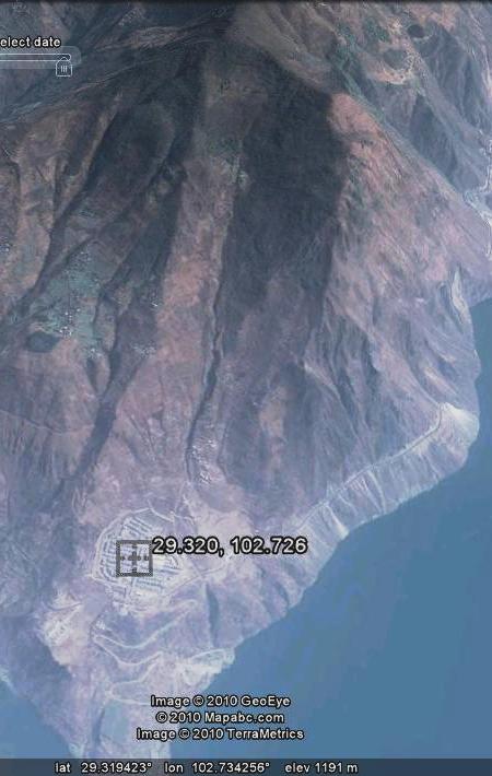
Thanks to Mauri McSaveney for doing the detective work to track down the location of this slide. The village in question is located at 29.320 N, 102.726E (put the following into Google Maps: 29.319631, 102.725816). This is the pre-landslide perspective image from Google Earth:
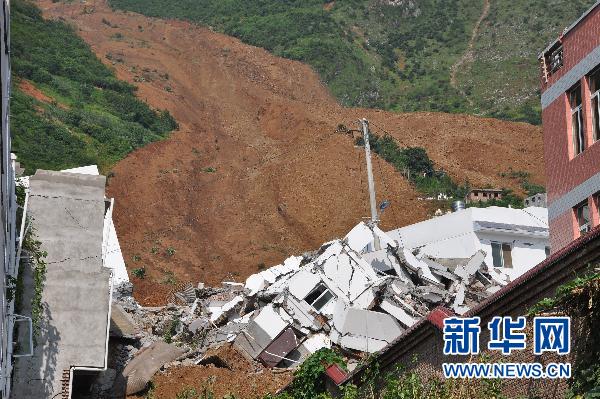
Meanhile Xinhua has a new set of images, of which these two are the best:
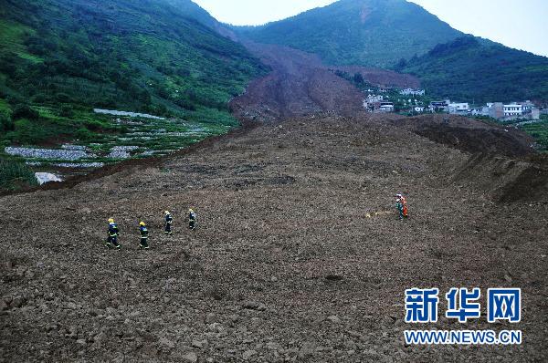
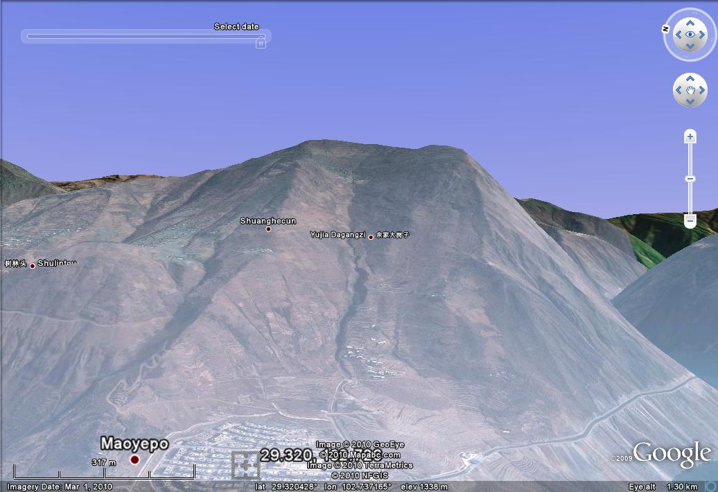
The community on the right of the second image was very fortunate, given that the flow bifurcated above it. A perspective Google Earth view from a similar position to the second photo above, but before the slide, is quite interesting:
The village that has been hit by this landslide looks to be quite new – maybe associated with the construction of the reservoir (that is speculation at this stage). IF that is the case, then questions will need to be asked as to how this location was chosen when even the most cursory examination of the slope above suggests that it is in a poor state.
I do however maintain that is the final loss of life is 21, as is currently reported, then the fatality count is surprisingly low for such an event. That is not to belittle the loss of 21 people – that is clearly a tragedy – but given the timing and the magnitude of the damage this seems remarkably low.
 Dave Petley is the Vice-Chancellor of the University of Hull in the United Kingdom. His blog provides commentary and analysis of landslide events occurring worldwide, including the landslides themselves, latest research, and conferences and meetings.