
16 January 2010
Earthquake-triggered liquefaction damage to the docks at Port-au-Prince in Haiti
Posted by Dave Petley
UPDATE: there is a video of this site here.
One of the major impacts of large earthquakes in coastal areas can be the damage to dock facilities caused by liquefaction. The process of seismic liquefaction is well-explained elsewhere, so I won’t reprise that here. However, if liquefaction does occur then high levels of damage can occur to the very facilities needed to bring aid into the affected area. Given the Google has provided wonderful free GeoEye imagery of the earthquake affected area, allowing a before and after analysis, I thought that it would be interesting to look at the state of the facilities:
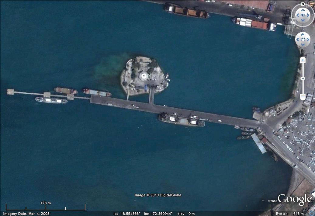
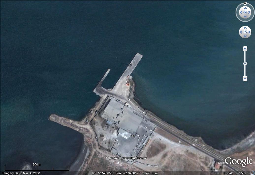
It should be stated here that reports from before the earthquake suggested that the port was not in a great shape. The main port area appears to be this one (you can click on this image, or any other featured here, for a better view in a new window). This image was collected on 4th March 2008.
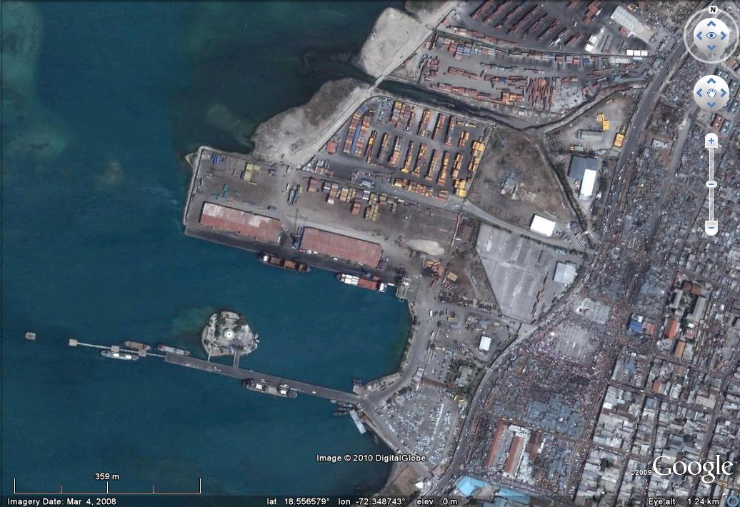
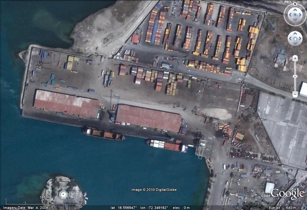
OK, so lets take a look at the main wharf with the warehouses in the centre of the image above.
Before:
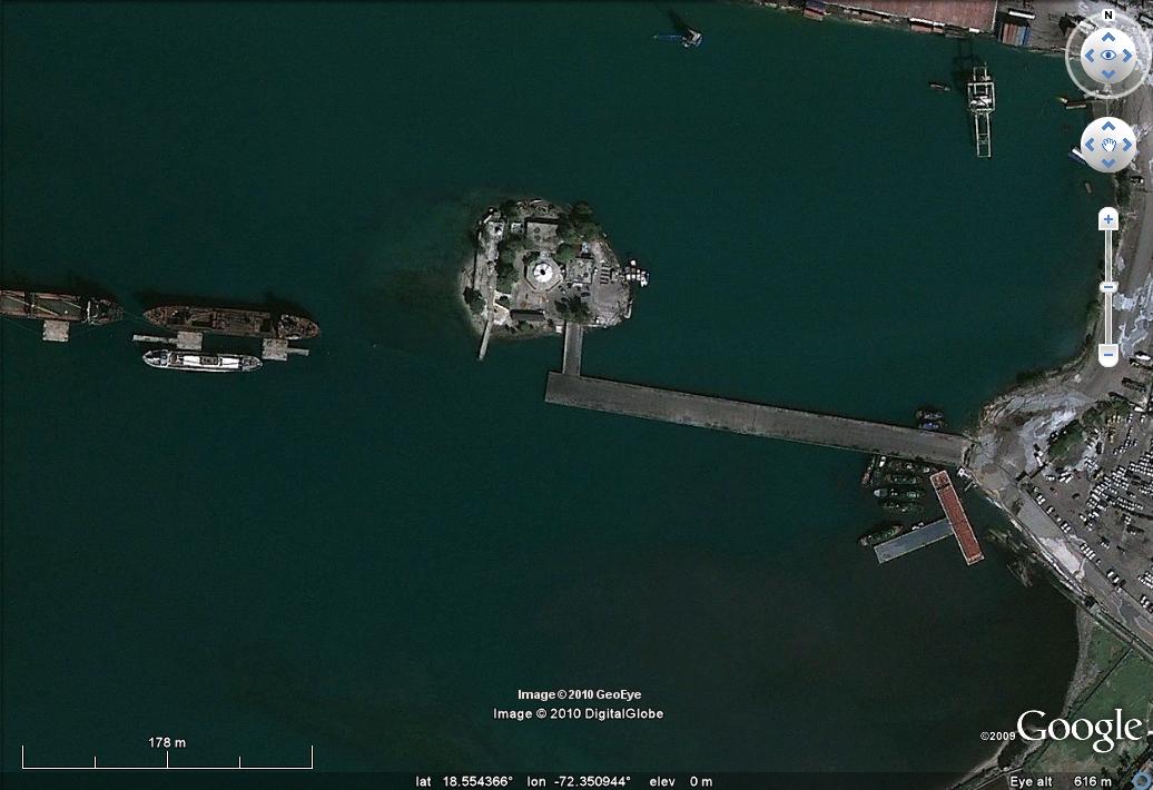
After:
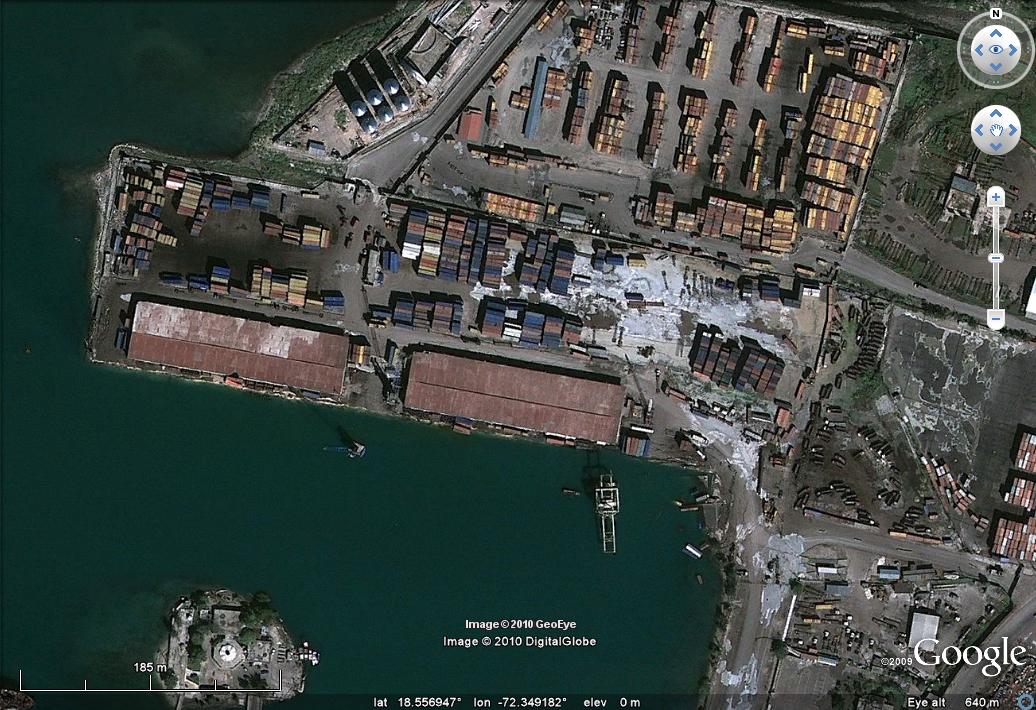
At first glance it may appear that there is little change, but look closely and you will see some extraordinary damage. I have annotated the image below to help:
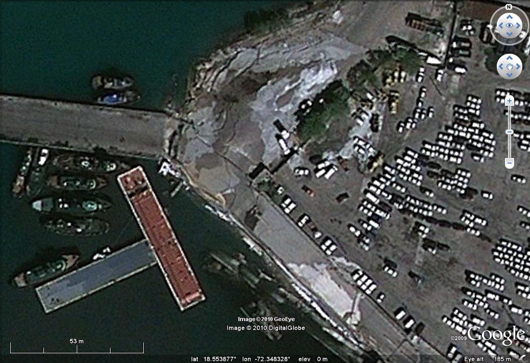
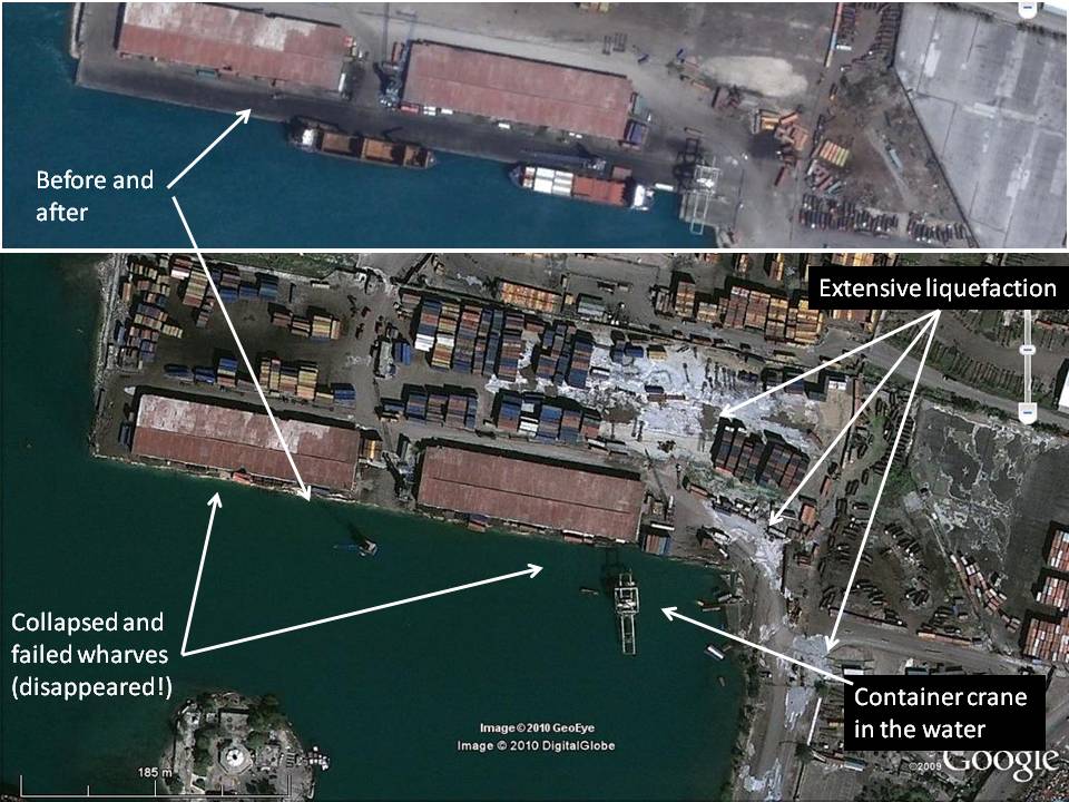 The main impact is that the main wharf frontage has collapsed into the water and has now disappeared. The container unloading crane that sat on the dockside appears to be upright in the water (there appears to be another smaller crane in the water too). The white material covering much of the surface of the land around the docks is, I think, material released by liquefaction. This is best shown by this zoomed image, which shows the crane plus the collapsed wharves. If you look carefully you can see containers in the water in a number of places:

Clearly this part of the docks is not going to be usable until some considerable work has been completed. It is impossible to estimate from thid imagery how long this might take.
To the south the “before” image shows a jetty with ships alongside:
The “after” image shows that a large section of this jetty has collapsed:
The short section that is intact is probably not usable as the ground at the start of the jetty appears to have suffered liquefaction. There also appears to be a ramp structure here that has collapsed and is now floating:
It may be that the damaged ground here can be repaired temporarily to get the docks at least partially functional again.
Further up the coast to the north there is another area of wharf. In the before image this looks to be old and in poor condition, with many old vessels tied alongside. This could be a ship breaker, but nonetheless if intact it could offer some possibility to bring aid in:
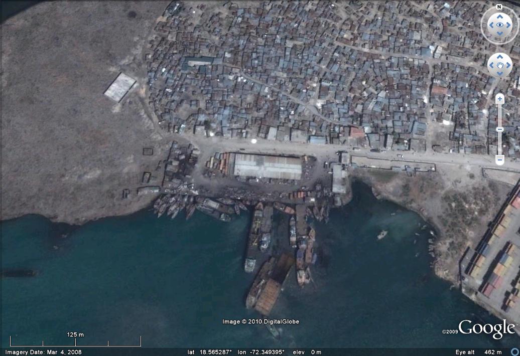
Unfortunately there is no such luck. This wharf has also collapsed due to liquefaction. The warehouse here has also collapsed:


A little further to the north there is another jetty area, which appears to be quite new in the before imagery:
 Unfortunately this one has also collapsed (as has part of the building in fact):
 Round towards Carrefour there appears to be an oil unloading area. Unfortunately, as this before and after shows, this has also collapsed due to liquefaction, leading to a large oil leak:
Before: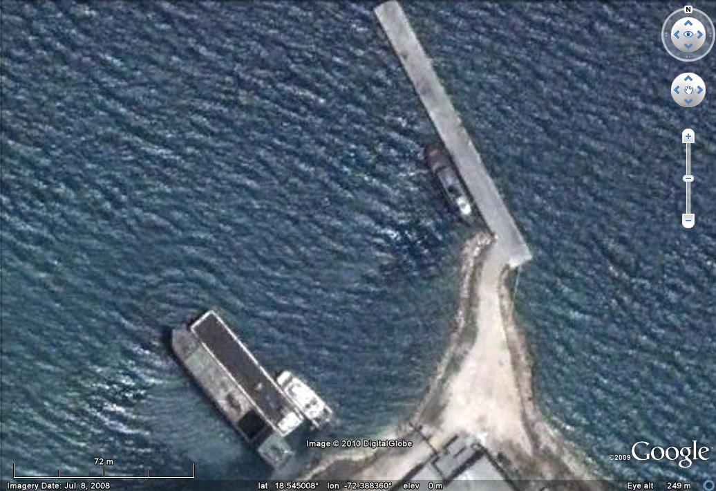 After:
In summary, as the above images show, the port infrastructure is in a dire condition. The upshot is that at the moment most of the aid needs to be brought in by air, which is an extraordinary logistical challenge when there are 3 million people in need of help. A very high priority must be to get some of these docks reinstated. Some reports have suggested that this is already underway.
UPDATE: there is a video of this site here.
Comments and thoughts welcome.
 Dave Petley is the Vice-Chancellor of the University of Hull in the United Kingdom. His blog provides commentary and analysis of landslide events occurring worldwide, including the landslides themselves, latest research, and conferences and meetings.
Very interesting observations!
The US Navy has some hovercrafts that seem to be sent to Haiti:http://www.strategypage.com/military_photos/2010011613030.aspxThis is a promising idea since the ports are heavily damaged. Another option are heavy helicopters. There is only one more bigger airport in the north of the Island (Cape Haitien), the smaller landing stripes (especially the one in Jacmel) will most likely be destroyed, too. Some people report sand blowouts due to liquefaction to be visible on the new satellite images, especially in the harbour area, but I wonder if the resolution is sufficient to judge on this.
I find this to be a really remarkable, thorough, and well documented analysis. This is without a doubt some of the most genuinely useful geoblogging I've ever read. Keep up the great work!
I've been doing some very close comparisons using Google Earth history feature which allows viewing of the same image area on previous dates. I'm appalled with extent of damage. The concentration of misery, damage and despair is unprecedented in our time. Even the earthquake and tsunamis of 2004, as bad as they were were not as intensively deadly as this event. Have to really feel for the people of Haiti. Has anyone else seen the footage taken from the deck of a Canadian warship, showing the actual opening of a huge chasm on the hill tops somewhere near Port Au Prince? I saw it only once, it was pretty grainy. Probably taken with a cell phone. Would have been nice to review it more closely. If anyone knows where it can be viewed on-line, It would be nice to post the link on this site.
I am trying to locate a ferry named Quonset. It was sold to Haiti in 1991 for service between Port Au Prince and Jeremie. Can you help me find out if this ferry is still in service? Do you know who I can contact?
Thank you very much.
[This is a landslide blog! I have no idea why you think this is relevant to a ferry in Haiti? D.]