8 December 2009
Landslide in the Lake District (Cumbria) in the recent floods
Posted by Dave Petley
Thanks to Rhiannon George of Meridian Geoscience for her help with this – the images and most of the information have been provided by her.
The press coverage of the recent (English) all time record rainfall event in Cumbria (in the area most commonly known as the Lake District in NW England) has focused upon the disastrous floods at Cockermouth. However, less well reported is the extensive devastation up in the headwaters of the catchment, and in adjacent areas, where landslides and floods occurred extensively. Rhiannon kindly provided information about two shallow landslides that occurred at Howtown, near to Ullswater. The pictures that Rhiannon has provided are pretty impressive:
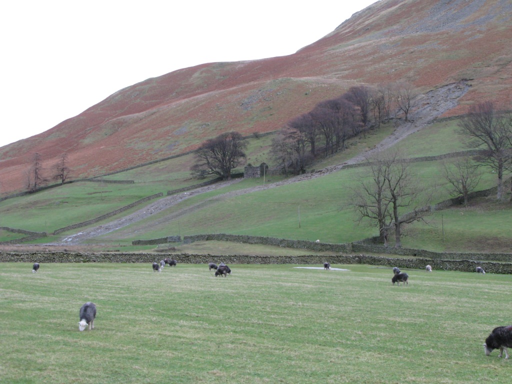
 This is one of the two slides, which appears to have split into two runout tracks.
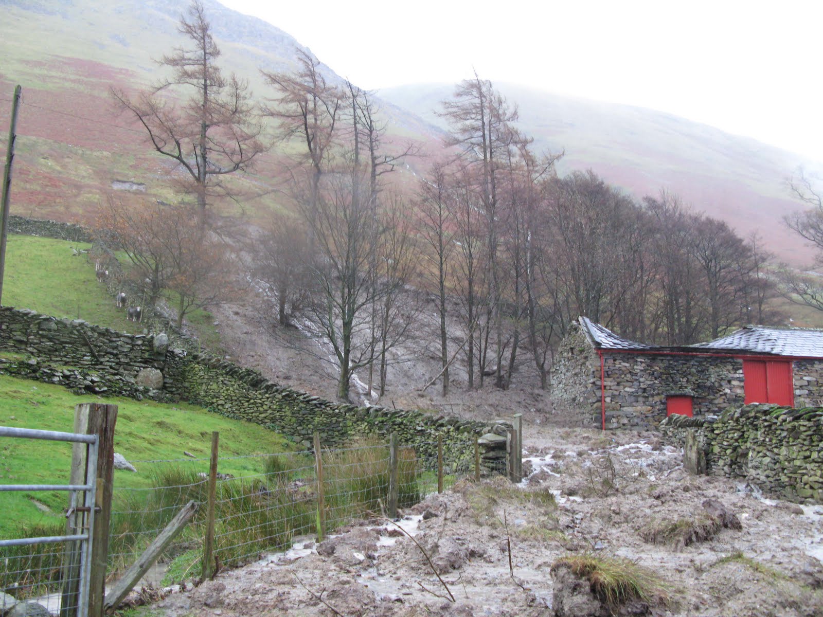
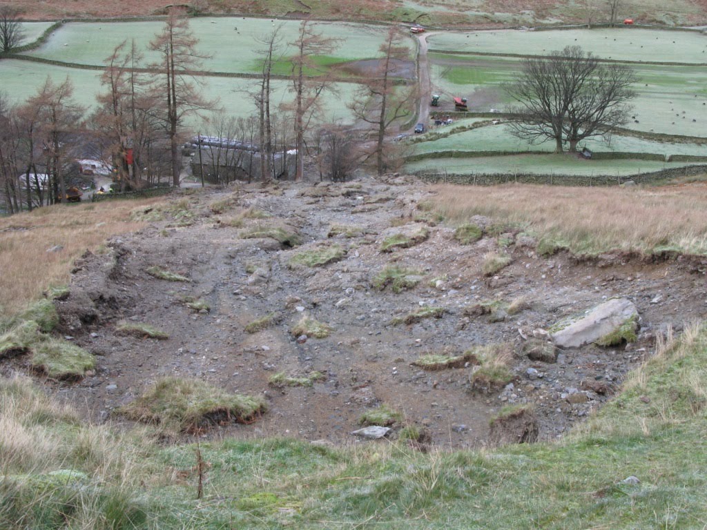
 This, and the image below, is the other.
 These are comparatively small, shallow failures. They appear to have initiated quite low on the slope as shallow slips that have then eroded and entrained the top metre or so of the ground downslope. The cessation of movement appears to be gradient controlled – i.e. the point at which the slope angle decreased to the point that erosion ceased and deposition started.
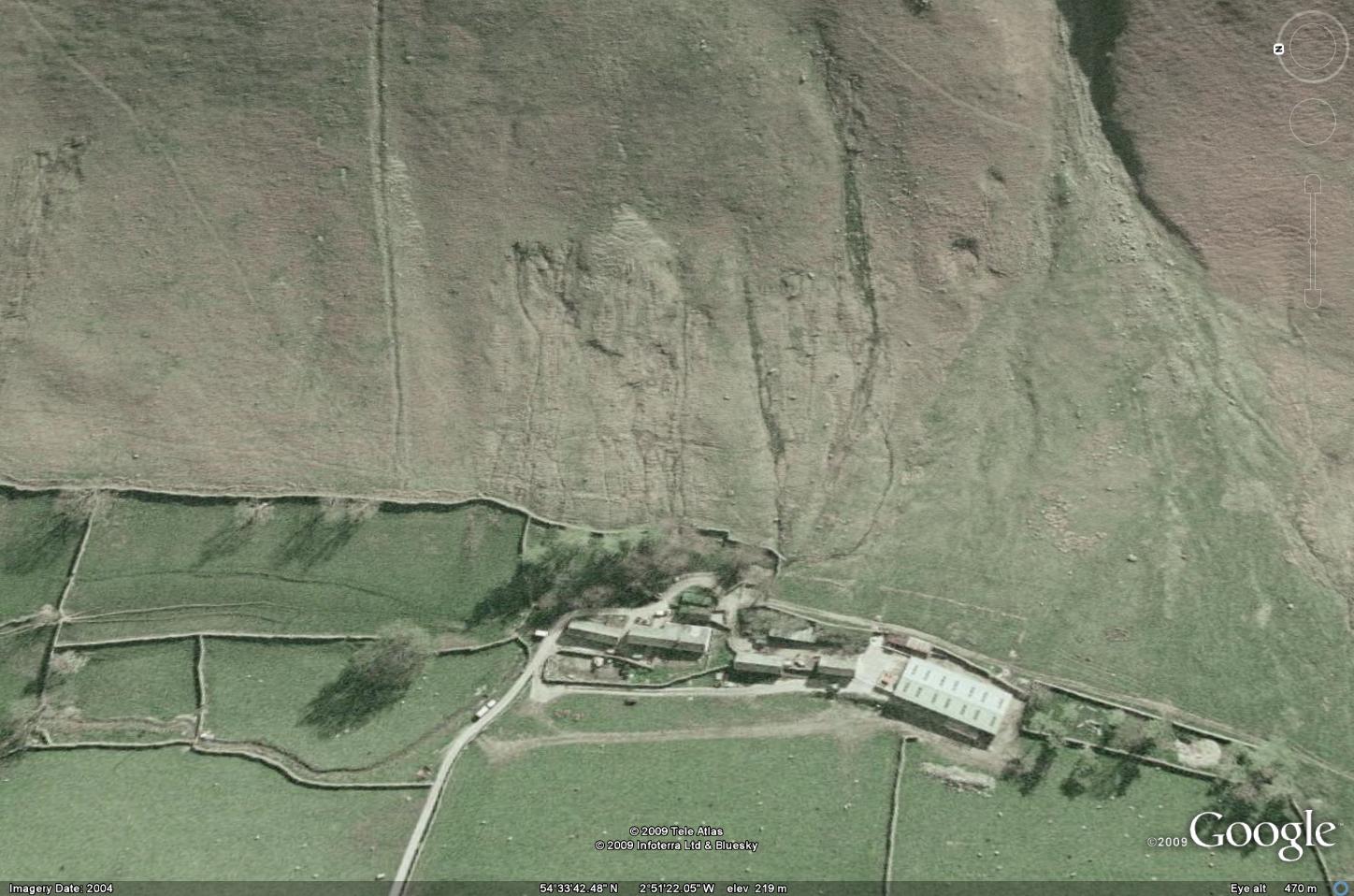
So why did these slides occur at this point at this time? Well, the rainfall that this area received broke the English record for one day and five day precipitation, so it is not surprising that many floods and slides occurred. The Google Earth image of the site of the second slip, taken prior to the landslides, also helps:
 The landslide initiated in the highly disturbed and gullied area on the lower slope. This image suggests to me that the slope was under some distress prior to the failure. In other cases we have found that such gullying and disturbance, which is not seen on the adjacent slopes,
has indicated that for whatever reason, water was flowing into this area underground, maybe through a natural soil pipe network. In the heavy rainfall the flow of water can exceed the capacity of such pipes, causing the local ground to saturate and the the landslide to initiate.
This is an image of the head scarp of the second slide. If the above mechanisms is correct then it might be possible to see pipes in this area, but in the aftermath of the slide they may have become clogged, so some digging around would be needed.


 Dave Petley is the Vice-Chancellor of the University of Hull in the United Kingdom. His blog provides commentary and analysis of landslide events occurring worldwide, including the landslides themselves, latest research, and conferences and meetings.
Is there a certain land type in Cumbria that may make the area landslide succeptible?