
29 October 2009
Typhoon Mirinae (Santi)
Posted by Dave Petley
Click here for the latest update
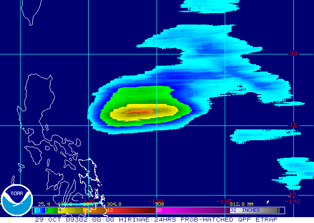
Once again Luzon in the Philippines is staring down the barrel of a powerful tropical cyclone, Typhoon Mirinae (known locally as Typhoon Santi). The storm is currently forecast to track across the southern part of Luzon on Friday evening: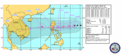 The 24 hour eTRaP precipitation forecast for the storm suggests that it is, as expected, inducing substantial amounts of precipitation along track:
 At the moment the storm is quite fast moving (15 knots) which from a precipitation perspective is probably good news. From a landslide perspective the worry however is that the storm appears likely to induce heavy rainfall in the areas most seriously affected by Typhoons Parma and Ketsana:
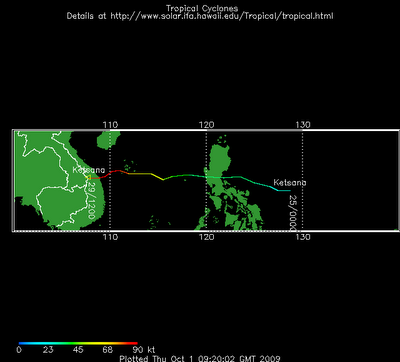
Indeed, the similarity between the track of Typhoon Ketsana and the forecast for Typhoon Mirinae is of some concern. Typhoon Ketsana killed at least 460 people.
 Dave Petley is the Vice-Chancellor of the University of Hull in the United Kingdom. His blog provides commentary and analysis of landslide events occurring worldwide, including the landslides themselves, latest research, and conferences and meetings.