
25 May 2009
Fatal landslide map for 2009 to date
Posted by Dave Petley
I have been a little remiss in posting these maps of late due to other pressures. Below is the distribution of fatal landslides that I have recorded in 2009 to date. Each red dot represents a single landslide that killed at least one person. All types of landslide (including debris flows and rockfalls) are included:
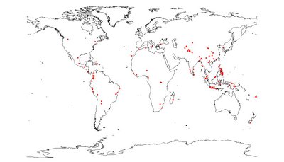
You can click on the map for a better version in a new window. One thing to note is that I have not heard of any fatal landslides from the L’Aquilla earthquake in Italy – but I would be surprised if there were none in reality.
Below I have plotted the same data, but colour coded the dots. In this case, the coding goes dark blue for January moving to lighter blue for February, blue-green for March, and light green for April and dark green for May:
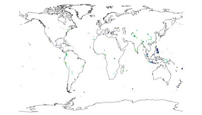 It is reasonably clear that for Asia the blue colours cluster in the Philippines and Indonesia, whilst the greens are in South Asia. This is of course explained by the seasonality of rainfall.
For info, in 2009 to date I have recorded fatal landslides, killing 715 people. This is about par for this time of year, with the main landslide season about to begin.
 Dave Petley is the Vice-Chancellor of the University of Hull in the United Kingdom. His blog provides commentary and analysis of landslide events occurring worldwide, including the landslides themselves, latest research, and conferences and meetings.
Nice blog!Best wishes,Rosana