
10 February 2009
Landslide on the Mahakali River on the Nepal / India border
Posted by Dave Petley
Thanks to both David Hopkins and Ripendra for drawing my attention to a landslide on Friday on the Mahakali River on the border between Nepal and India. Although it has occurred in a remote area, it is interesting because the landslide appears to have partially blocked a fairly large river coming down from the high Himalayas.
The landslide occurred in the Chautuldhar (Chetalkot) area of Rephalikot, close to Tawaghat in Dharchula, right on the border of Nepal (to the east) and India (to the west) (see Google Earth image below – click on the image for a better view).
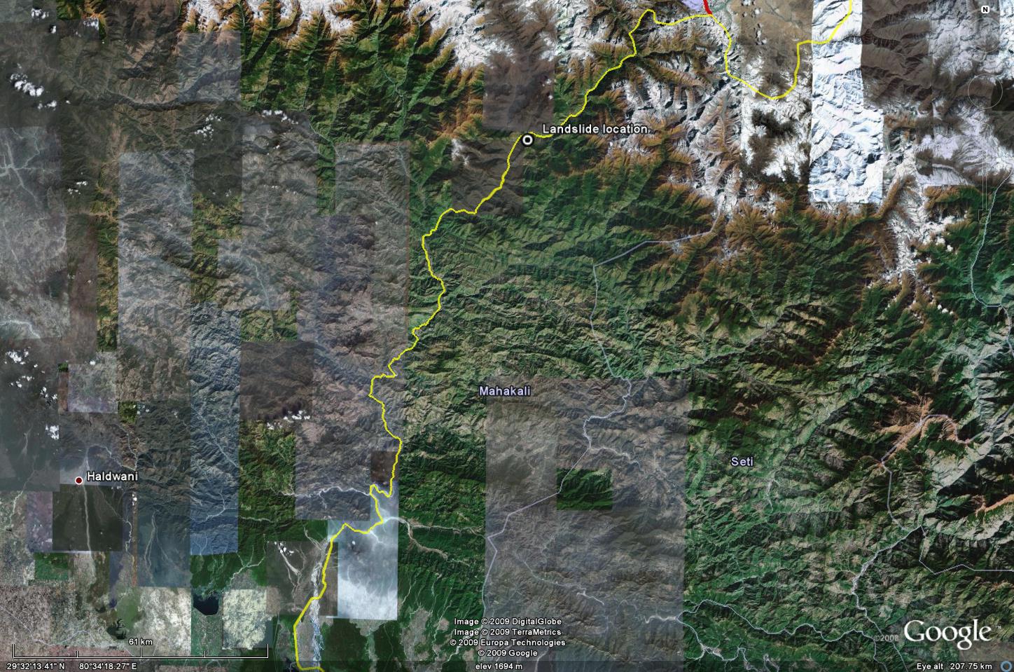 The reports suggest that cracks were first seen on Thursday, which led to a large scale failure on Friday. The location is shown on the Google Earth perspective view below (the actual location of the landslide appears to be in a small area of low resolution imagery):
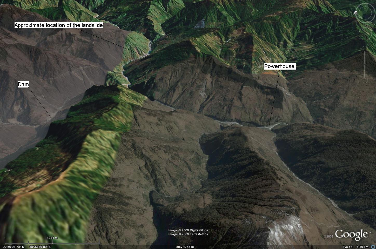
Reports suggest that the river is flowing through a gap of just 2.5 metres, which has created a barrier lake that is threatening a number of villages upstream. The main road is blocked and may take as much as a month to reopen, and there is a threat of further landslides.
An interesting dimension to this is the proximity of the Dhualiganga I hydroelectic scheme. I have annotated the diagram above to show the location of the dam and the power house. This is a run of the river scheme in which the Dhauliganga River has been dammed with a 56 m high concrete faced rock fill dam to create a head of water. The water is then passed through a tunnel beneath the mountain to the powerhouse, where turbines are located. The project was completed in October 2005. Some newspapers are speculating that the landslides may have been associated with the construction of the tunnels as the failure occurred in the dry season with no obvious trigger. However, the tunnel is 6 km from the landslide site, so this is not likely. However, if a large lake were to form at the landslide site, and then was to be released rapidly, then the powerhouse would be threatened. It is not clear to me whether this is a possibility, but given that the river is now reportedly flowing again I suspect the chances at present are low.
As an aside, the dam site itself appears to be quite interesting from a slopes perspective:

 Dave Petley is the Vice-Chancellor of the University of Hull in the United Kingdom. His blog provides commentary and analysis of landslide events occurring worldwide, including the landslides themselves, latest research, and conferences and meetings.
Dear Prof. Dave,The name of river is Mahakali not a Makhali.Regards,Ripendra
Ripendra – corrected, thanks.Dave