9 January 2009
Landslide hazard and the Guatemala rockslide
Posted by Dave Petley
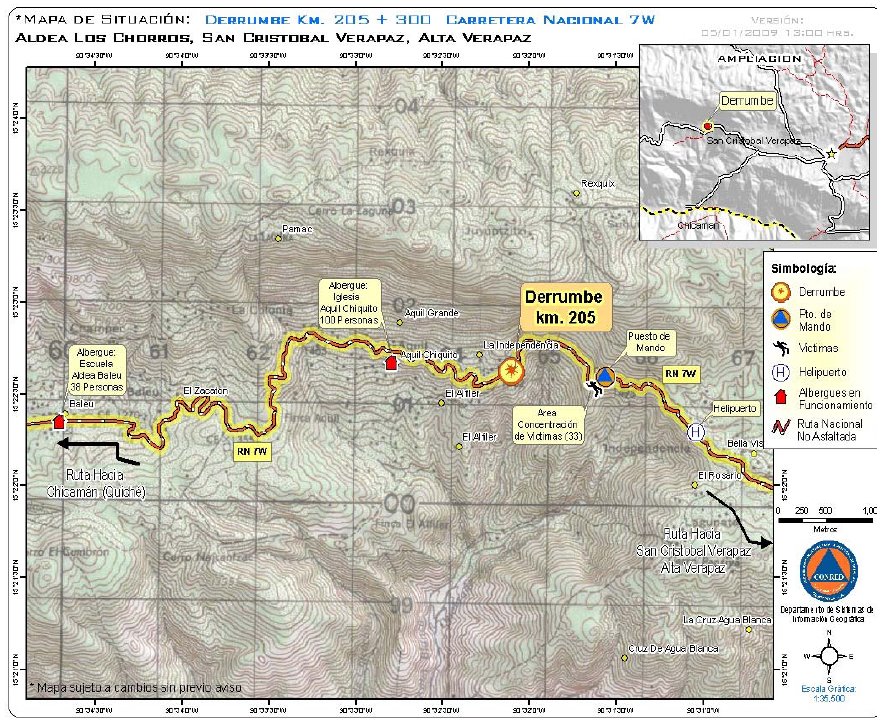
As commenters on my earlier threads have pointed out (thanks to them), the location of the landslide in Guatemala can now be pinpointed using a map produced by CONRED. This map comes from a very useful report, with some good images of the rescue and recovery operation, available here. I have reproduced the map below (click on the map for a better view):
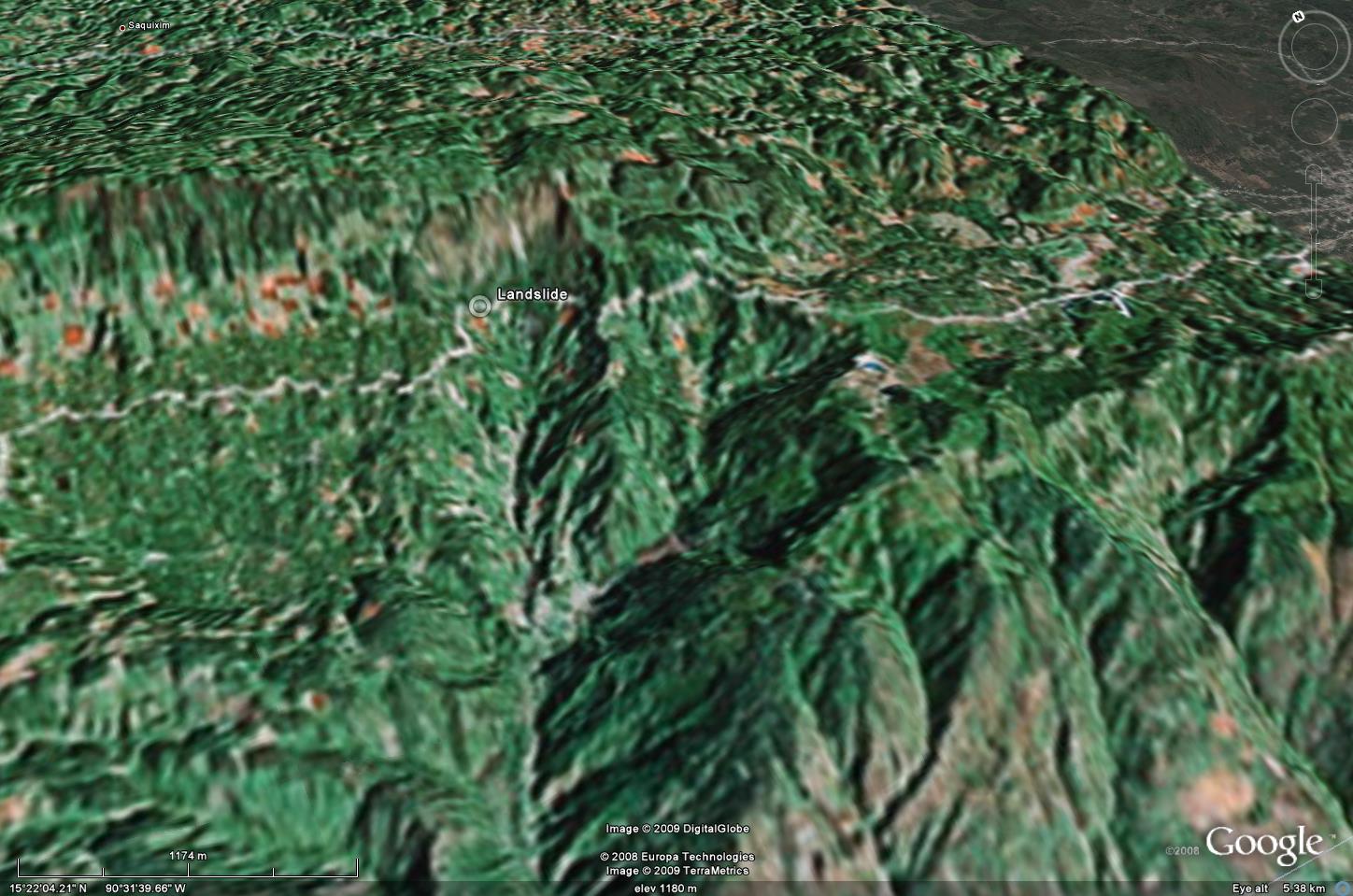
 Helpfully, this allows the location to be pinpointed on Google Earth (unfortunately the high resolution imagery starts just east of the landslide location – click on the image for a decent view):

Satellite imagery can be difficult to interpret until a 3D perspective is available. This is one of the key strengths of Google Earth. The situation becomes so much clearer when a perspective view is taken:
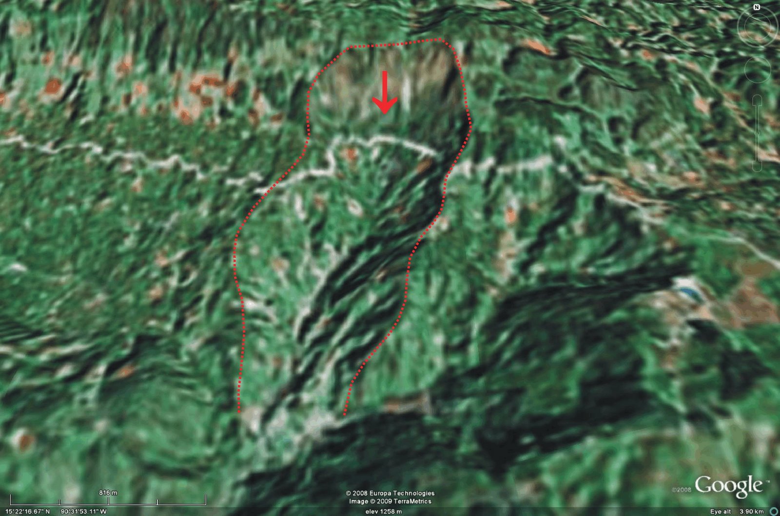
 A magnified and annotated image below shows that the landslide occurred in a very clear bowl shaped feature that would cause any good geomorphologist to be very nervous in terms of slope stability. I have highlighted the boundary of the bowl and the location of the landslide:

Note that there are a number of other locations that look vulnerable to slope instability as well, such as the bowl to the east of the area that failed. Reports suggest that the authorities are being cautious and have arranged evacuations. This is probably prudent, but it is important that a proper hazard assessment is undertaken, and that the risks associated with landslides are then balanced against the (social) risks to the people associated with moving them from their homes and their land.


 Dave Petley is the Vice-Chancellor of the University of Hull in the United Kingdom. His blog provides commentary and analysis of landslide events occurring worldwide, including the landslides themselves, latest research, and conferences and meetings.