
29 October 2008
Magnitude Mw=6.4 earthquake in Pakistan
Posted by Dave Petley
News is coming in this morning of moment magnitude = 6.4 earthquake in Balochistan in Pakistan. According to the USGS, the earthquake occurred at 23:09 UT (04:09 local time) at a depth of about 15 km. The USGS have produced this map of the epicentre:
 Fig. 1: USGS map of the location of the epicentre of the earthquake
 Fig. 2: USGS map of the intensity of shaking associated with this earthquake
This is a rugged and comparatively arid landscape (Fig. 3) with a population density of about 40 people per square kilometre. GDACS estimate that there are about 326,000 people living in a 50 km radius of the epicentre.
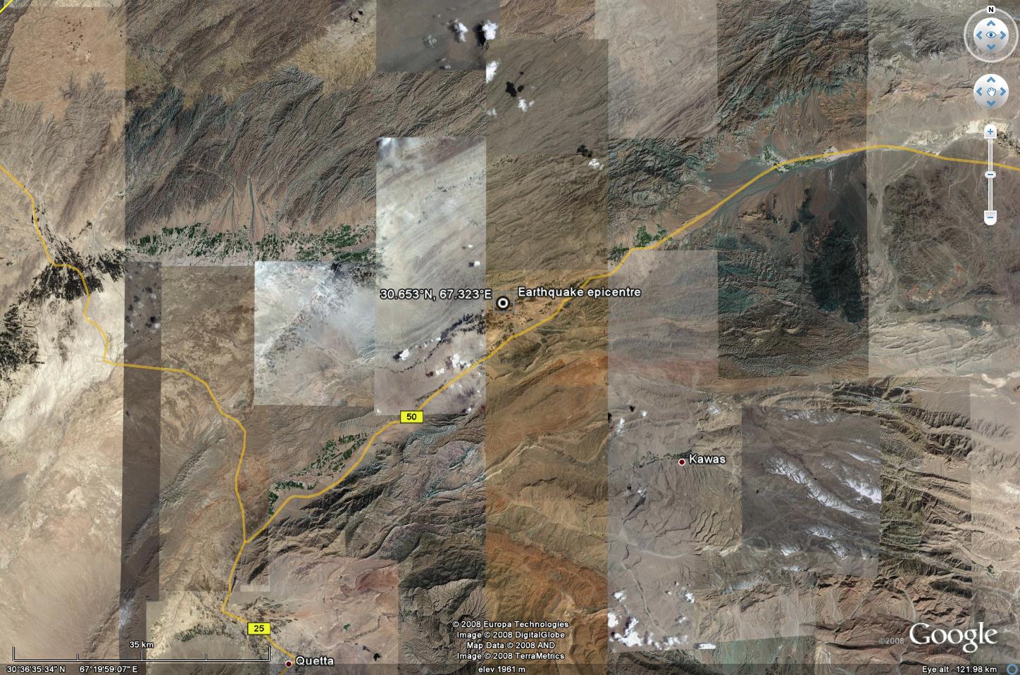 Fig. 3: Google Earth image of the region affected by the earthquake.
Click on the map for a better view in a new window.
In such an environment, landslides are very likely to have been triggered by the earthquake. Already there are one or two reports that landslides have occurred – for example:
- AFP are reporting that “The deaths occurred in and around the hilly town of Ziarat, about 50 kilometres east of Quetta, in gas-rich Baluchistan province, police official Abdul Khaleq told AFP. Ziarat is a historic hill resort famed for its juniper forests. Most of the casualties were from two villages on the outskirts of the town which were built on steep ground and badly damaged in landslides triggered by the quake, which struck at a depth of 10 kilometres, officials said.”
- The Daily Telegraph is reporting that “One village, Wam Killy, was almost completely destroyed while many houses were buried in landslides triggered by the quake.”
- Bloomberg saya that “A landslide in Ziarat, a tourist resort about 100 kilometers east-northeast of Quetta, killed 17 people, said Dilawar Hussain Shah, an official at police control in Quetta. More deaths were reported from Pishin town and its neighboring villages, he said.”
Fig. 4 shows a perspective view of Ziarat, whilst Fig 5 gives an idea of the terrain:
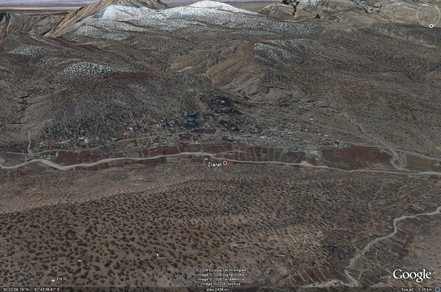
Fig. 4: Google Earth perspective view of Zierat, in which many landslides have been reported.
Click on the map for a better view in a new window.

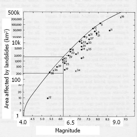
All of the above suggests that landslides are likely to be a serious issue in this earthquake. The diagram of area affected by landsliding derived by Keefer (1984) is helpful here (Fig. 6). The likely affected area is in the range of 200-2000 square kilometres, with a value towards the upper limit being more likely given the shallow focus of the earthquake and the rugged terrain. In my view, it is likely that the effects, although quite localised, could be quite high, with landslides being a major problem both in terms of causing losses and in terms of impeding the flow of assistance.
Reference:
Keefer, D. 1984. Landslides caused by earthquakes. GSA Bulletin, 95, 406-421
 Dave Petley is the Vice-Chancellor of the University of Hull in the United Kingdom. His blog provides commentary and analysis of landslide events occurring worldwide, including the landslides themselves, latest research, and conferences and meetings.