
7 March 2008
February 2008 landslide map
Posted by Dave Petley
The map below shows the distribution of fatal landslides for February 2008.
The statistics are:
Number of fatal landslides: 24
Number of fatalities: 85
Thus February was well below the average for 2003-2007, which is 336 fatalities per annum. Note thiat this figure is skewed somewhat by the impact of the 2006 Leyte landslide. Without this event the average is 113 fatalities, suggesting that 2008 was a below avaerage year. Given the comparatively cold global temperatures (probably associated with La Nina), which implies relatively low levels of atmospheric energy, this is perhaps unsurpising.
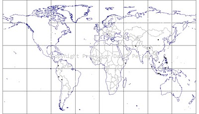 February 2008 fatal landslide locations
The 2008 map to date is as follows:
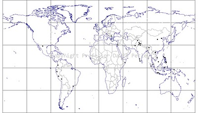 2008 fatal landslide locations for January and February
There are a couple of things to note here:
1. The cluster that occurs along the southern edge of the Himalayas is not evident as yet. January and February are dry and cold [eriods in this region. There is usually a wet phase in March, so this should start to appear next month
2. The clusters in the Philippines and Java are now evident. The philippines is particularly badly affected this year – is this the effect of La Nina?
I would welcome any comments or questions.
 Dave Petley is the Vice-Chancellor of the University of Hull in the United Kingdom. His blog provides commentary and analysis of landslide events occurring worldwide, including the landslides themselves, latest research, and conferences and meetings.