
21 June 2017
Much more detail about the Greenland landslide and tsunami, including images and video
Posted by Dave Petley
Much more detail about the Greenland landslide and tsunami, including images and video
In the last 24 hours much more detail has emerged about the Greenland landslide and tsunami, which severely damaged the settlement of Nuugaatsiaq on Saturday. The Arktisk Kommando, the Joint Arctic Command – have posted a series of images on their Facebook page that have resulted from reconnaissance missions over the site of the landslide. The best overview of the landslide site is this one:-
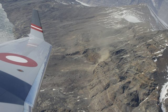
Overview of the Greenland landslide, via the Facebook page of Arktisk Kommando.
.
The landslide appears to consist of a large block failure of the bluff that has then run over the less steep lower slope. In the background of the image is the other section of distressed slope that is causing concern. Above the winglet another large landslide with a clearly defined rear scarp can be seen. The Arktisk Kommando have also posted this image of the landslide scar:-
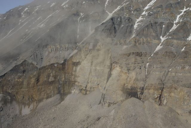
The scar of the Greenland landslide, via Arktisk Kommando
.
Meanwhile, my friends at Strasburg University, Clément Hibert, André Stumpf and Jean-Philippe Malet have kindly obtained two important pieces of information that they have kindly allowed me to share. First, they have downloaded before and after images of the landslide site from the Sentinel-2 satellite:-
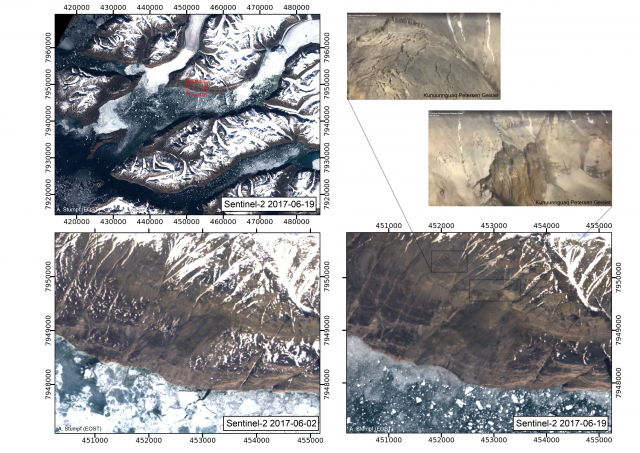
Before and after images of the Greenland landslide. Sentinel-2 data processed by Clement Hibert and colleagues from Strasbourg University.
.
Importantly, this shows that the second landslide was present in the imagery in early June, which reduces the concern of imminent failure (but does not eliminate it by any means of course). The Strasbourg team have noted that the early June image also appears to show the presence of landslide deposits in the area of the main landslide, suggesting that it might have been active before the major failure event.
Second, they have downloaded the data from the local seismic station:
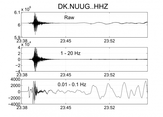
Seismic data from the Greenland landslide, via processed by Clement Hibert and colleagues from Strasbourg University.
.
This data definitively answers the question as to whether the earthquake was the trigger for the landslide, or was the signal from the landslide itself. It was the latter – this signal was generated by the landslide. I am no expert on this data, so I provide the observations by Clément Hibert, who most definitely is an expert:
The high-frequency seismic signal (1-20Hz) exhibits the ‘classical’ features of high-frequency signals generated by landslides (emergent onset, no phases, lots of energy in the high-frequency >1Hz). However the onset of the long-period signal (<0.1 Hz) is peculiar. The first phase, coherent and visible at other stations, is more characteristic of shear faulting. This might suggest a very fast destabilisation of the mass. This is my assumption and I think this should be more thoroughly investigated with inversion and modeling methods for example.
Finally, more information has now emerged about the tsunami that this landslide triggered. In particular, new footage has been posted to Youtube:-
.
This tsunami struck in the middle of the night. It is simply terrifying.
 Dave Petley is the Vice-Chancellor of the University of Hull in the United Kingdom. His blog provides commentary and analysis of landslide events occurring worldwide, including the landslides themselves, latest research, and conferences and meetings.
I wonder how much of a role glacial debuttressing played in this landslide. I know that the glaciers of western Greenland have in some cases seen dramatic retreat, but given how high up the slope this slide occurred I’m not sure how much of an effect a glacier at tidewater would have.