
19 May 2016
The Aranayake landslide in Sri Lanka
Posted by Dave Petley
The Aranayake landslide in Sri Lanka
Aranayake landslide in Sri Lanka is now thought to have killed about 140 people, from which the remains of 19 victims have been recovered to date. The landslide was triggered by exceptional rainfall associated with a slow moving tropical cyclone. Some reports suggest more than 350 mm may have fallen. The best overview image of the landslide that I have seen to date is this one, by AP and posted on the BBC website:
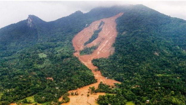
The Aranayake landslide in Sri Lanka via the BBC and AP
.
This is a complex landslide. It appears to have started as a small landslide high on the hillslope – is there a hint of bedrock in that area? I suspect so, which might suggest regolith sliding on a bedrock interface. That then appears to have induced a much more substantial failure on the steeper sections downslope, with three main portions. There is certainly bedrock evident in this area, but the mobile material appears to be deeply weathered soil / regolith. Finally, the displaced material appears to have turned into a highly mobile flow that has channelised. It is this portion of the landslide that is likely to have caused the loss of life. I would also note from this image that the underlying geological structure here might be highly complex – note the different inclinations of the rock surface visible on the ridge to the left compared with the bedrock visible in the slide itself. This suggests that there could be a structural element to this as well, perhaps.
More detail is available about the sliding surface in this image, which was tweeted by the Sri Lanka Red Cross yesterday:
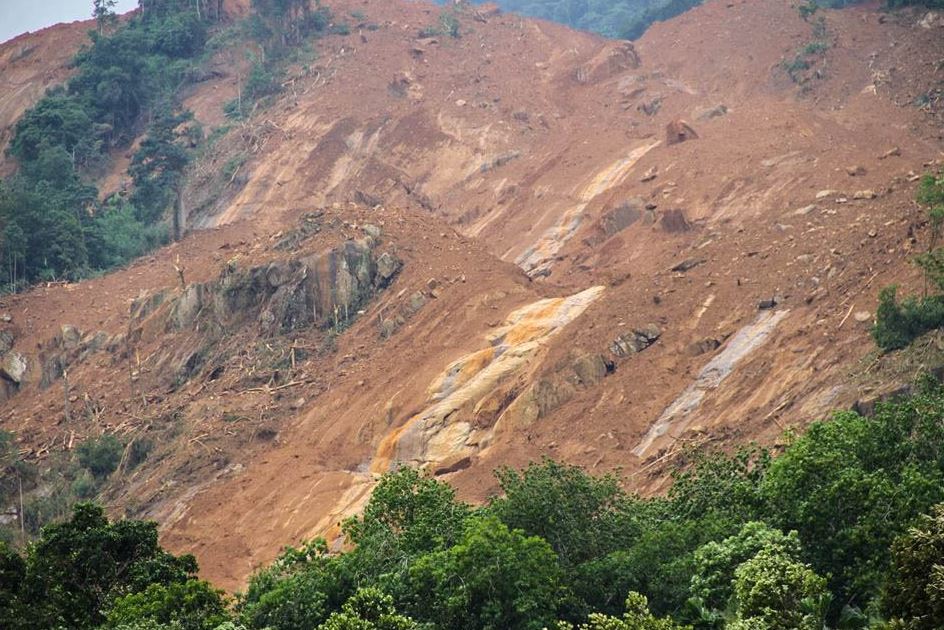
The Sliding surface of the Aranayake landslide, via the Sri Lanka Red Cross
.
In this image it is clear that the main landslide on the steeper slopes consisted of regolith sliding on a bedrock interface. The Sri Lanka Red Cross have also tweeted this helicopter image of the lower portion of the landslide, which illustrates the highly mobile nature of the mass movement:
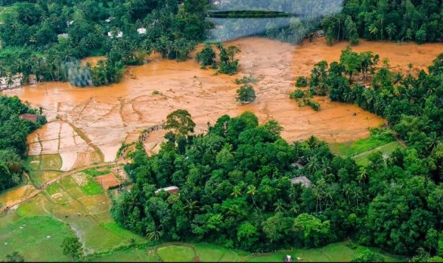
Sri Lanka Red Cross image of the lower portion of the Aranayake landslide
.
Reports today suggest that rescue operations have been suspended today due to further landslide movement associated with heavy rainfall. This will be a very dangerous site until the weather clears up and the ground dries out. The monsoon is not far away.
I believe that this Google Earth image shows the location of the landslide:
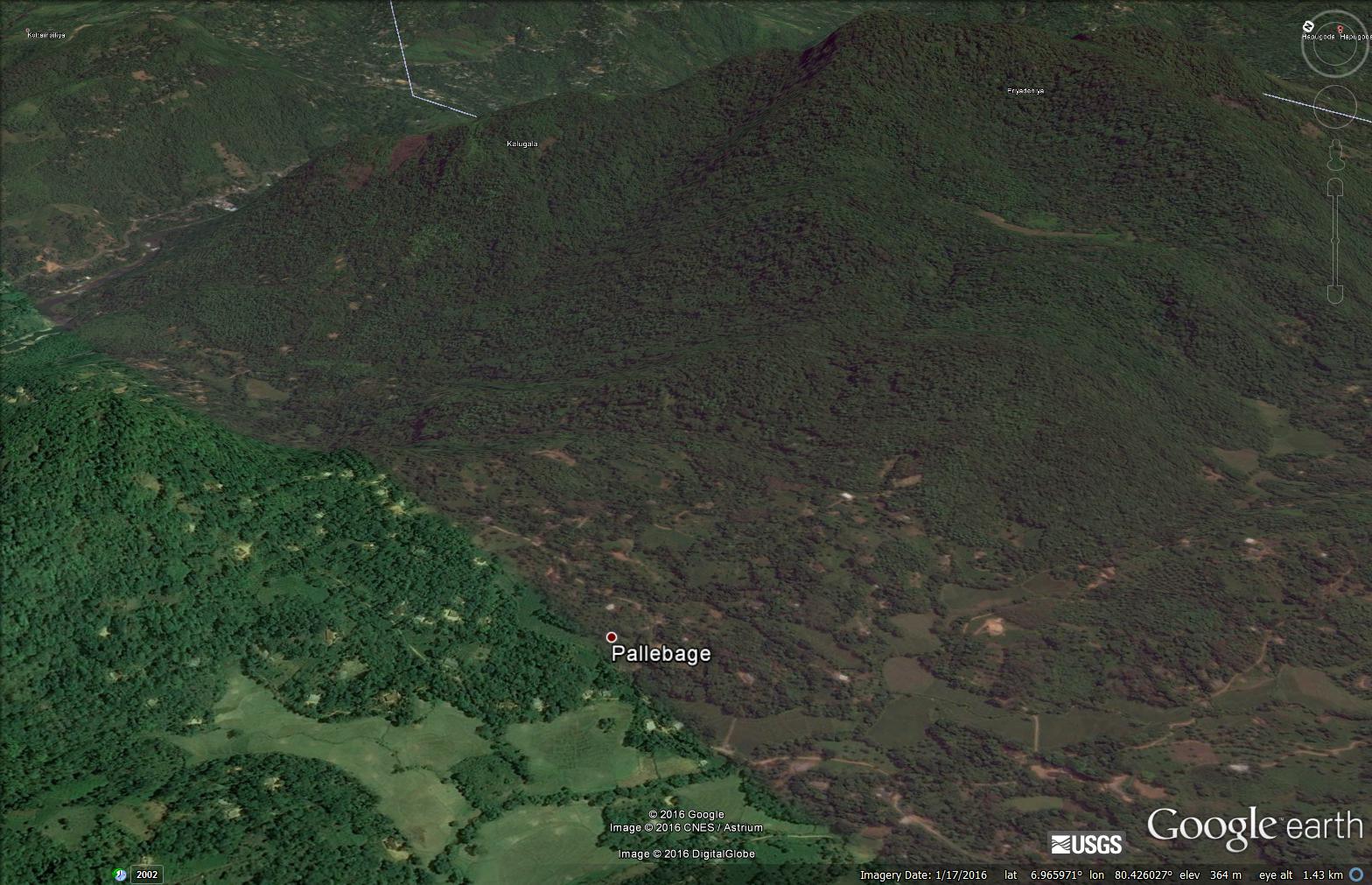
Google Earth image of the Aranayake landslide in Sri Lanka
.
Pallebage (location: 6.9639, 80.4209) is reported to be one of the communities destroyed by the landslide. However, so far I have been unable to pin the location down more precisely. Viewing the Google Earth image from directly above leaves me with a suspicion that this might not have been the first major landslide on this hillside. I have indicated the location of a possible large, much older landslide:
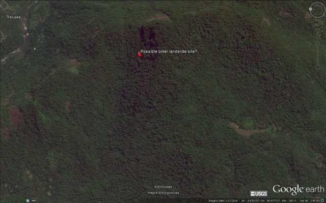
Google Earth image of a possible older landslide site close to the Aranayake landslide location
.
 Dave Petley is the Vice-Chancellor of the University of Hull in the United Kingdom. His blog provides commentary and analysis of landslide events occurring worldwide, including the landslides themselves, latest research, and conferences and meetings.